


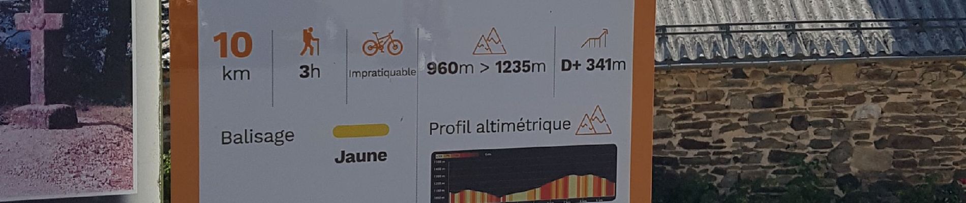
10 km | 14,6 km-effort

Gebruiker


Gratisgps-wandelapplicatie
 SityTrail
IGN / Geografische instituten
SityTrail World
De wereld gaat voor u open
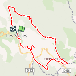
Tocht Stappen van 12 km beschikbaar op Occitanië, Lozère, Les Salces. Deze tocht wordt voorgesteld door Bobzebob.
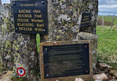
randonnée ombragée "la boucle du loup" référencée 26 par l'office de tourisme Aubrac gorges du tarn.
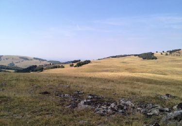
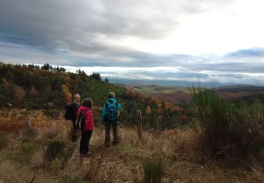
long cheminement dans les bois sur des chemins assez rocailleux.Très beaux points de vue sur le parcours


Noords wandelen
Noords wandelen
Stappen

Stappen
Stappen
Stappen

Noords wandelen

Stappen


sport