![](/images/other/stat-length.png)
![Tocht Mountainbike Pont-Noyelles - Le passage aux loups - Pont-Noyelles - Photo](https://media.geolcdn.com/t/1900/400/ext.pjpeg?maxdim=2&url=https%3A%2F%2Fservices.sitytrail.com%2FGeolivesWS%2FDownloadMedia.ashx%3FTrailID%3D215211%26Media%3D15824_5.jpg)
Le passage aux loups - Pont-Noyelles
tracegps
Gebruiker
![Lengte](/images/other/stat-length.png)
Lengte
13,8 km
![Max. hoogte](https://static1.geolcdn.com/siteimages/upload/files/1508320355ic_sort_altitude_max_24dp.png)
Max. hoogte
96 m
![Positief hoogteverschil](https://static1.geolcdn.com/siteimages/upload/files/1508320355ic_sort_den_pos_24dp.png)
Positief hoogteverschil
143 m
![Km-Effort](/images/other/stat-length.png)
Km-Effort
15,7 km
![Min. hoogte](https://static1.geolcdn.com/siteimages/upload/files/1508320355ic_sort_altitude_min_24dp.png)
Min. hoogte
25 m
![Negatief hoogteverschil](https://static1.geolcdn.com/siteimages/upload/files/1508320355ic_sort_den_neg_24dp.png)
Negatief hoogteverschil
143 m
![Boucle](https://static1.geolcdn.com/siteimages/upload/files/16400158638029165_repeat_loop_refresh_sync_direction_icon.png)
Boucle
Ja
Datum van aanmaak :
2014-12-10 00:00:00.0
Laatste wijziging :
2014-12-10 00:00:00.0
![Mountainbike](https://static1.geolcdn.com/sitytour/trail-icons/202.png)
1h15
Moeilijkheid : Medium
![Scan deze QR-code om de tocht te openen in de SityTrail-applicatie](https://capi.geolives.com/qq0zvz2zws4bq2lad0pu/sitytour/trails/215211/qr.png?size=200)
Gratisgps-wandelapplicatie
Over ons
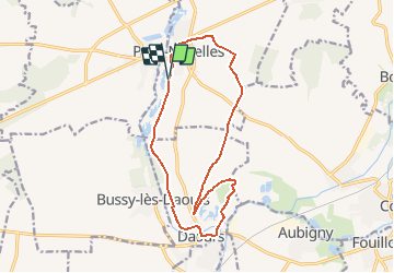
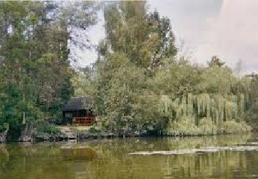
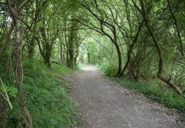
Tocht Mountainbike van 13,8 km beschikbaar op Hauts-de-France, Somme, Pont-Noyelles. Deze tocht wordt voorgesteld door tracegps.
Beschrijving
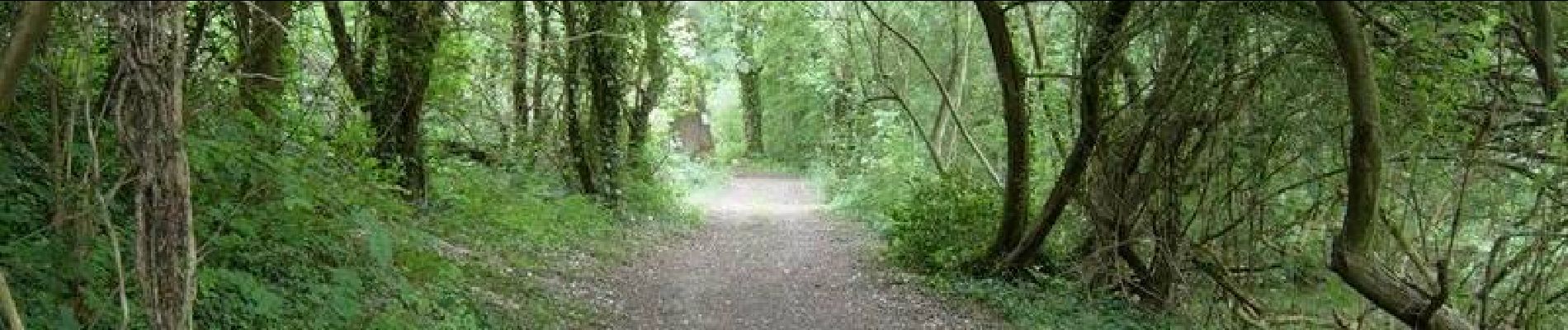
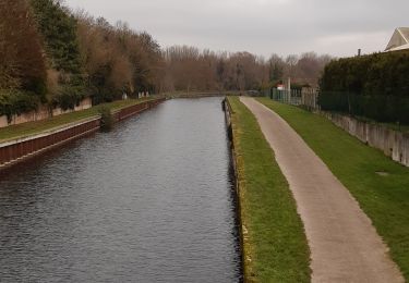
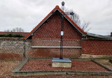
Entre points de vue d’exception, monuments historiques et sites naturels tous vos sens seront mis en éveil lors de cette balade. Départ de la route du camping de Pont-Noyelles. Téléchargez la fiche du circuit.
Plaatsbepaling
Land:
France
Regio :
Hauts-de-France
Departement/Provincie :
Somme
Gemeente :
Pont-Noyelles
Locatie:
Unknown
Vertrek:(Dec)
Vertrek:(UTM)
459660 ; 5531451 (31U) N.
Opmerkingen
Wandeltochten in de omgeving
![Tocht Stappen Corbie - Les rives de Somme de Corbie à Amiens - Photo](https://media.geolcdn.com/t/375/260/b950c723-196c-4705-b4c8-c7caaabdf39d.jpg&format=jpg&maxdim=2)
![Stappen Stappen](https://static1.geolcdn.com/sitytour/trail-icons/101.png)
Les rives de Somme de Corbie à Amiens
Stappen
Medium
Corbie,
Hauts-de-France,
Somme,
France
![](/images/other/stat-length.png)
21 km | 22 km-effort
4h 31min
![](https://static1.geolcdn.com/siteimages/upload/files/16400158638029165_repeat_loop_refresh_sync_direction_icon.png)
Neen
![Tocht Te voet Daours - Le Passage aux Loups - Photo](https://media.geolcdn.com/t/375/260/c0a6c8f5-02d2-4dbd-8744-0550644a54a7.jpeg&format=jpg&maxdim=2)
![Te voet Te voet](https://static1.geolcdn.com/sitytour/trail-icons/100.png)
Le Passage aux Loups
Te voet
Gemakkelijk
Daours,
Hauts-de-France,
Somme,
France
![](/images/other/stat-length.png)
13,9 km | 15,9 km-effort
3h 36min
![](https://static1.geolcdn.com/siteimages/upload/files/16400158638029165_repeat_loop_refresh_sync_direction_icon.png)
Ja
![Tocht Quad Fouilloy - 30 juil. 2019 14:04:21 - Photo](https://media.geolcdn.com/t/375/260/2fe84f10-c8aa-4a4e-9c7d-13d62879c110.jpg&format=jpg&maxdim=2)
![Quad Quad](https://static1.geolcdn.com/sitytour/trail-icons/404.png)
30 juil. 2019 14:04:21
Quad
Medium
(1)
Fouilloy,
Hauts-de-France,
Somme,
France
![](/images/other/stat-length.png)
103 km | 122 km-effort
Onbekend
![](https://static1.geolcdn.com/siteimages/upload/files/16400158638029165_repeat_loop_refresh_sync_direction_icon.png)
Neen
![Tocht Stappen Pont-Noyelles - Le passage aux loups - Pont-Noyelles - Photo](https://media.geolcdn.com/t/375/260/ext.jpg?maxdim=2&url=https%3A%2F%2Fservices.sitytrail.com%2FGeolivesWS%2FDownloadMedia.ashx%3FTrailID%3D215210%26Media%3D15824_5.jpg)
![Stappen Stappen](https://static1.geolcdn.com/sitytour/trail-icons/101.png)
Le passage aux loups - Pont-Noyelles
Stappen
Moeilijk
(1)
Pont-Noyelles,
Hauts-de-France,
Somme,
France
![](/images/other/stat-length.png)
13,8 km | 15,7 km-effort
4h 40min
![](https://static1.geolcdn.com/siteimages/upload/files/16400158638029165_repeat_loop_refresh_sync_direction_icon.png)
Ja
![Tocht Quad Fouilloy - 2022-05-08_16h40m10_SityTrail - 2795546 - rando-fouilloy - Photo](https://media.geolcdn.com/t/375/260/ext.jpg?maxdim=2&url=https%3A%2F%2Fstatic1.geolcdn.com%2Fsiteimages%2Fupload%2Ffiles%2F15247431544x4.jpg)
![Quad Quad](https://static1.geolcdn.com/sitytour/trail-icons/404.png)
2022-05-08_16h40m10_SityTrail - 2795546 - rando-fouilloy
Quad
Gemakkelijk
Fouilloy,
Hauts-de-France,
Somme,
France
![](/images/other/stat-length.png)
73 km | 84 km-effort
Onbekend
![](https://static1.geolcdn.com/siteimages/upload/files/16400158638029165_repeat_loop_refresh_sync_direction_icon.png)
Neen
![Tocht Mountainbike Pont-Noyelles - Le passage aux loups - Pont-Noyelles - Photo](https://media.geolcdn.com/t/375/260/ext.jpg?maxdim=2&url=https%3A%2F%2Fstatic1.geolcdn.com%2Fsiteimages%2Fupload%2Ffiles%2F1524743154velo.jpg)
![Mountainbike Mountainbike](https://static1.geolcdn.com/sitytour/trail-icons/202.png)
Le passage aux loups - Pont-Noyelles
Mountainbike
Medium
Pont-Noyelles,
Hauts-de-France,
Somme,
France
![](/images/other/stat-length.png)
13,8 km | 15,8 km-effort
1h 15min
![](https://static1.geolcdn.com/siteimages/upload/files/16400158638029165_repeat_loop_refresh_sync_direction_icon.png)
Ja
![Tocht Stappen Béhencourt - Le circuit des monts - Photo](https://media.geolcdn.com/t/375/260/ext.jpg?maxdim=2&url=https%3A%2F%2Fstatic1.geolcdn.com%2Fsiteimages%2Fupload%2Ffiles%2F1553511878bg_sport_marche.png)
![Stappen Stappen](https://static1.geolcdn.com/sitytour/trail-icons/101.png)
Le circuit des monts
Stappen
Medium
Béhencourt,
Hauts-de-France,
Somme,
France
![](/images/other/stat-length.png)
16,4 km | 18,6 km-effort
Onbekend
![](https://static1.geolcdn.com/siteimages/upload/files/16400158638029165_repeat_loop_refresh_sync_direction_icon.png)
Ja
![Tocht Stappen Fréchencourt - frechencourt - Photo](https://media.geolcdn.com/t/375/260/ext.jpg?maxdim=2&url=https%3A%2F%2Fstatic1.geolcdn.com%2Fsiteimages%2Fupload%2Ffiles%2F1553511878bg_sport_marche.png)
![Stappen Stappen](https://static1.geolcdn.com/sitytour/trail-icons/101.png)
frechencourt
Stappen
Medium
Fréchencourt,
Hauts-de-France,
Somme,
France
![](/images/other/stat-length.png)
20 km | 24 km-effort
4h 5min
![](https://static1.geolcdn.com/siteimages/upload/files/16400158638029165_repeat_loop_refresh_sync_direction_icon.png)
Ja
![Tocht Paardrijden Pont-Noyelles - Jour 1 equirando - Photo](https://media.geolcdn.com/t/375/260/ext.jpg?maxdim=2&url=https%3A%2F%2Fstatic1.geolcdn.com%2Fsiteimages%2Fupload%2Ffiles%2F1524743154cheval.jpg)
![Paardrijden Paardrijden](https://static1.geolcdn.com/sitytour/trail-icons/301.png)
Jour 1 equirando
Paardrijden
Medium
Pont-Noyelles,
Hauts-de-France,
Somme,
France
![](/images/other/stat-length.png)
26 km | 29 km-effort
5h 29min
![](https://static1.geolcdn.com/siteimages/upload/files/16400158638029165_repeat_loop_refresh_sync_direction_icon.png)
Neen