![](/images/other/stat-length.png)
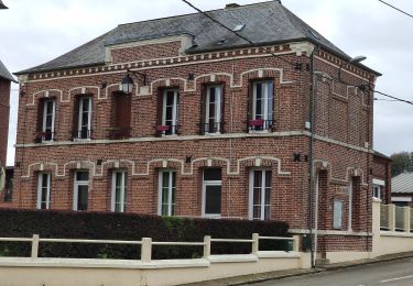
![Tocht Stappen Richemont - La Bienfaisance (N°11) - Richemont - Photo](https://media.geolcdn.com/t/1900/400/ext.pjpeg?maxdim=2&url=https%3A%2F%2Fservices.sitytrail.com%2FGeolivesWS%2FDownloadMedia.ashx%3FTrailID%3D215177%26Media%3D15778_5.jpg)
La Bienfaisance (N°11) - Richemont
tracegps
Gebruiker
![Lengte](/images/other/stat-length.png)
![Max. hoogte](https://static1.geolcdn.com/siteimages/upload/files/1508320355ic_sort_altitude_max_24dp.png)
![Positief hoogteverschil](https://static1.geolcdn.com/siteimages/upload/files/1508320355ic_sort_den_pos_24dp.png)
![Km-Effort](/images/other/stat-length.png)
![Min. hoogte](https://static1.geolcdn.com/siteimages/upload/files/1508320355ic_sort_altitude_min_24dp.png)
![Negatief hoogteverschil](https://static1.geolcdn.com/siteimages/upload/files/1508320355ic_sort_den_neg_24dp.png)
![Boucle](https://static1.geolcdn.com/siteimages/upload/files/16400158638029165_repeat_loop_refresh_sync_direction_icon.png)
![Stappen](https://static1.geolcdn.com/sitytour/trail-icons/101.png)
3h00
Moeilijkheid : Medium
![Scan deze QR-code om de tocht te openen in de SityTrail-applicatie](https://capi.geolives.com/qq0zvz2zws4bq2lad0pu/sitytour/trails/215177/qr.png?size=200)
Gratisgps-wandelapplicatie
Over ons
Tocht Stappen van 12,2 km beschikbaar op Normandië, Seine-Maritime, Richemont. Deze tocht wordt voorgesteld door tracegps.
Beschrijving
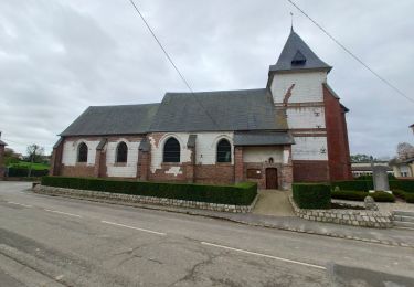
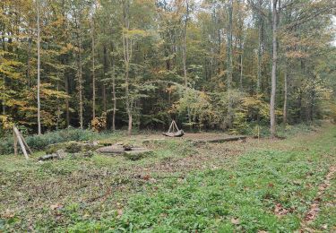
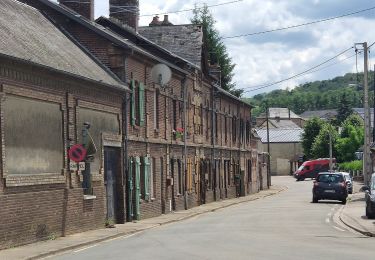
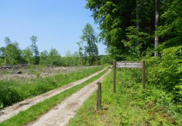
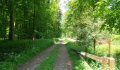
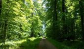
Circuit proposé par l'Office de Tourisme d'Aumale. De l'église prendre la rue principale et tourner à droite dans le rue Marin Vattier. Traverser le Fond de la Berquerie, une fois arrivé à la route, tourner à gauche et continuer tout droit jusqu'à la forêt. Prendre la D7 à droite en longeant le clos de la Ventilette. En tournant ensuite sur votre gauche, vous rattrapez la route forestière des Cateliers que vous prenez sur presque 2 kilomètres. A son extrémité, tourner à gauche sur la D60, puis traverser la plaine d'Aubéguimont, descendre vers le Fond du Cailloutin pour rejoindre une route goudronnée qui ramène au point de départ.
Plaatsbepaling
Opmerkingen
Wandeltochten in de omgeving
![Tocht Te voet Le Caule-Sainte-Beuve - Circuit du Mont Gournoy - Photo](https://media.geolcdn.com/t/375/260/5ed25034-e342-4301-8c95-ce51f3698c88.jpeg&format=jpg&maxdim=2)
![Te voet Te voet](https://static1.geolcdn.com/sitytour/trail-icons/100.png)
Te voet
![](/images/other/stat-length.png)
![](https://static1.geolcdn.com/siteimages/upload/files/16400158638029165_repeat_loop_refresh_sync_direction_icon.png)
![Tocht Te voet Rétonval - Circuit de la Tour Mailly - Photo](https://media.geolcdn.com/t/375/260/195dc9a2-d61b-4306-b16a-fe5b33e2f47e.jpeg&format=jpg&maxdim=2)
![Te voet Te voet](https://static1.geolcdn.com/sitytour/trail-icons/100.png)
Te voet
![](/images/other/stat-length.png)
![](https://static1.geolcdn.com/siteimages/upload/files/16400158638029165_repeat_loop_refresh_sync_direction_icon.png)
![Tocht Te voet Rétonval - Circuit du Prêtre - Photo](https://media.geolcdn.com/t/375/260/195dc9a2-d61b-4306-b16a-fe5b33e2f47e.jpeg&format=jpg&maxdim=2)
![Te voet Te voet](https://static1.geolcdn.com/sitytour/trail-icons/100.png)
Te voet
![](/images/other/stat-length.png)
![](https://static1.geolcdn.com/siteimages/upload/files/16400158638029165_repeat_loop_refresh_sync_direction_icon.png)
![Tocht Te voet Nullemont - Tous Vents - Photo](https://media.geolcdn.com/t/375/260/8e89dbba-2f73-48cc-ac0b-17600b33d530.jpeg&format=jpg&maxdim=2)
![Te voet Te voet](https://static1.geolcdn.com/sitytour/trail-icons/100.png)
Te voet
![](/images/other/stat-length.png)
![](https://static1.geolcdn.com/siteimages/upload/files/16400158638029165_repeat_loop_refresh_sync_direction_icon.png)
![Tocht Te voet Saint-Léger-aux-Bois - La Bienfaisance - Photo](https://media.geolcdn.com/t/375/260/90f86342-6c4d-40e7-bfeb-79662cc331d6.jpeg&format=jpg&maxdim=2)
![Te voet Te voet](https://static1.geolcdn.com/sitytour/trail-icons/100.png)
Te voet
![](/images/other/stat-length.png)
![](https://static1.geolcdn.com/siteimages/upload/files/16400158638029165_repeat_loop_refresh_sync_direction_icon.png)
![Tocht Te voet Marques - La Quesnoye - Photo](https://media.geolcdn.com/t/375/260/56ed5969-ec33-4a0f-9d09-b63db28245dd.jpeg&format=jpg&maxdim=2)
![Te voet Te voet](https://static1.geolcdn.com/sitytour/trail-icons/100.png)
Te voet
![](/images/other/stat-length.png)
![](https://static1.geolcdn.com/siteimages/upload/files/16400158638029165_repeat_loop_refresh_sync_direction_icon.png)
![Tocht Te voet Saint-Martin-au-Bosc - Edruchon - Photo](https://media.geolcdn.com/t/375/260/e9a276ed-e9b3-488b-82ad-608007e72d0d.jpeg&format=jpg&maxdim=2)
![Te voet Te voet](https://static1.geolcdn.com/sitytour/trail-icons/100.png)
Te voet
![](/images/other/stat-length.png)
![](https://static1.geolcdn.com/siteimages/upload/files/16400158638029165_repeat_loop_refresh_sync_direction_icon.png)
![Tocht Paard Richemont - La Bienfaisance (N°11) - Richemont - Photo](https://media.geolcdn.com/t/375/260/ext.jpg?maxdim=2&url=https%3A%2F%2Fservices.sitytrail.com%2FGeolivesWS%2FDownloadMedia.ashx%3FTrailID%3D215179%26Media%3D15778_5.jpg)
![Paard Paard](https://static1.geolcdn.com/sitytour/trail-icons/300.png)
Paard
![](/images/other/stat-length.png)
![](https://static1.geolcdn.com/siteimages/upload/files/16400158638029165_repeat_loop_refresh_sync_direction_icon.png)
![Tocht Mountainbike Richemont - La Bienfaisance (N°11) - Richemont - Photo](https://media.geolcdn.com/t/375/260/ext.jpg?maxdim=2&url=https%3A%2F%2Fservices.sitytrail.com%2FGeolivesWS%2FDownloadMedia.ashx%3FTrailID%3D215178%26Media%3D15778_5.jpg)
![Mountainbike Mountainbike](https://static1.geolcdn.com/sitytour/trail-icons/202.png)
Mountainbike
![](/images/other/stat-length.png)
![](https://static1.geolcdn.com/siteimages/upload/files/16400158638029165_repeat_loop_refresh_sync_direction_icon.png)