![](/images/other/stat-length.png)
![Tocht Stappen Péreyres - Pereyres - Le Ray-Pic 1/6/2019 - Photo](https://media.geolcdn.com/t/1900/400/ext.pjpeg?maxdim=2&url=https%3A%2F%2Fstatic1.geolcdn.com%2Fsiteimages%2Fupload%2Ffiles%2F1553511878bg_sport_marche.png)
Pereyres - Le Ray-Pic 1/6/2019
fredetpascale
Gebruiker GUIDE
![Lengte](/images/other/stat-length.png)
Lengte
9,1 km
![Max. hoogte](https://static1.geolcdn.com/siteimages/upload/files/1508320355ic_sort_altitude_max_24dp.png)
Max. hoogte
1063 m
![Positief hoogteverschil](https://static1.geolcdn.com/siteimages/upload/files/1508320355ic_sort_den_pos_24dp.png)
Positief hoogteverschil
431 m
![Km-Effort](/images/other/stat-length.png)
Km-Effort
14,8 km
![Min. hoogte](https://static1.geolcdn.com/siteimages/upload/files/1508320355ic_sort_altitude_min_24dp.png)
Min. hoogte
790 m
![Negatief hoogteverschil](https://static1.geolcdn.com/siteimages/upload/files/1508320355ic_sort_den_neg_24dp.png)
Negatief hoogteverschil
430 m
![Boucle](https://static1.geolcdn.com/siteimages/upload/files/16400158638029165_repeat_loop_refresh_sync_direction_icon.png)
Boucle
Ja
Datum van aanmaak :
2019-06-01 08:33:42.932
Laatste wijziging :
2019-06-01 14:14:03.978
![Stappen](https://static1.geolcdn.com/sitytour/trail-icons/101.png)
3h24
Moeilijkheid : Gemakkelijk
![Scan deze QR-code om de tocht te openen in de SityTrail-applicatie](https://capi.geolives.com/qq0zvz2zws4bq2lad0pu/sitytour/trails/2101053/qr.png?size=200)
Gratisgps-wandelapplicatie
Over ons
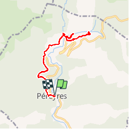
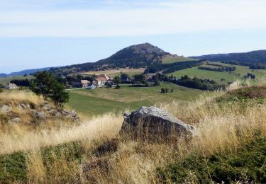
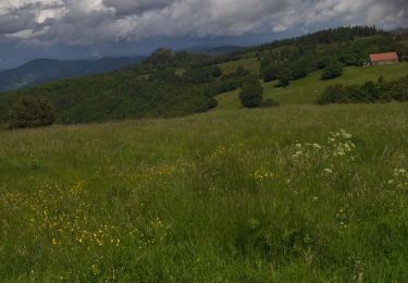
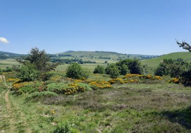
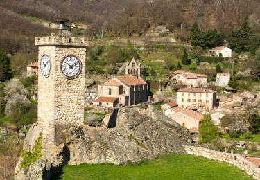
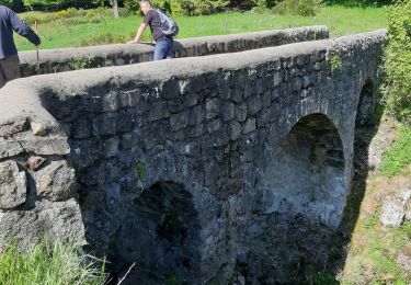
Tocht Stappen van 9,1 km beschikbaar op Auvergne-Rhône-Alpes, Ardèche, Péreyres. Deze tocht wordt voorgesteld door fredetpascale.
Beschrijving
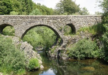
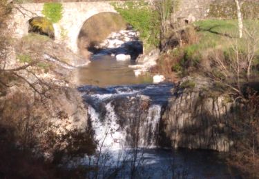
accès cascade interdit mais tout le monde passe. Pas de risque de chute de pierre si on ne fait que les belvédères.
Plaatsbepaling
Land:
France
Regio :
Auvergne-Rhône-Alpes
Departement/Provincie :
Ardèche
Gemeente :
Péreyres
Locatie:
Unknown
Vertrek:(Dec)
Vertrek:(UTM)
599380 ; 4958897 (31T) N.
Opmerkingen
Wandeltochten in de omgeving
![Tocht Stappen Péreyres - Pereyres Lachamp 16km - Photo](https://media.geolcdn.com/t/375/260/cd059db4-0e57-4cdd-b0a7-57f5a9d765a9.jpg&format=jpg&maxdim=2)
![Stappen Stappen](https://static1.geolcdn.com/sitytour/trail-icons/101.png)
Pereyres Lachamp 16km
Stappen
Medium
Péreyres,
Auvergne-Rhône-Alpes,
Ardèche,
France
![](/images/other/stat-length.png)
16,1 km | 24 km-effort
5h 32min
![](https://static1.geolcdn.com/siteimages/upload/files/16400158638029165_repeat_loop_refresh_sync_direction_icon.png)
Ja
![Tocht Stappen Lachamp-Raphaël - 07 lachamp Raphaël orga 10.06.23 - Photo](https://media.geolcdn.com/t/375/260/07456a0b-3bda-48f2-bd40-fb46d8070303.jpg&format=jpg&maxdim=2)
![Stappen Stappen](https://static1.geolcdn.com/sitytour/trail-icons/101.png)
07 lachamp Raphaël orga 10.06.23
Stappen
Medium
Lachamp-Raphaël,
Auvergne-Rhône-Alpes,
Ardèche,
France
![](/images/other/stat-length.png)
18 km | 27 km-effort
5h 39min
![](https://static1.geolcdn.com/siteimages/upload/files/16400158638029165_repeat_loop_refresh_sync_direction_icon.png)
Neen
![Tocht Stappen Sagnes-et-Goudoulet - Les Coux-Sagnes-Tour à Eau 14km - Photo](https://media.geolcdn.com/t/375/260/7bfff9d7-91a3-4852-a6bf-dd6f46240ce8.jpg&format=jpg&maxdim=2)
![Stappen Stappen](https://static1.geolcdn.com/sitytour/trail-icons/101.png)
Les Coux-Sagnes-Tour à Eau 14km
Stappen
Medium
Sagnes-et-Goudoulet,
Auvergne-Rhône-Alpes,
Ardèche,
France
![](/images/other/stat-length.png)
14,1 km | 19,4 km-effort
5h 42min
![](https://static1.geolcdn.com/siteimages/upload/files/16400158638029165_repeat_loop_refresh_sync_direction_icon.png)
Ja
![Tocht Stappen Saint-Andéol-de-Fourchades - Boucle de la ferme de Bourdalier à Sagnes-et-Gourdoulet - Photo](https://media.geolcdn.com/t/375/260/31c1868a-b2a8-47e4-b863-8b44b5da618e.jpg&format=jpg&maxdim=2)
![Stappen Stappen](https://static1.geolcdn.com/sitytour/trail-icons/101.png)
Boucle de la ferme de Bourdalier à Sagnes-et-Gourdoulet
Stappen
Medium
Saint-Andéol-de-Fourchades,
Auvergne-Rhône-Alpes,
Ardèche,
France
![](/images/other/stat-length.png)
11,7 km | 15,8 km-effort
3h 35min
![](https://static1.geolcdn.com/siteimages/upload/files/16400158638029165_repeat_loop_refresh_sync_direction_icon.png)
Ja
![Tocht Stappen Burzet - Burzet (Myrtille) - Photo](https://media.geolcdn.com/t/375/260/b806d2dc-fc2d-46e9-8fd4-c0cb1135c85b.jpg&format=jpg&maxdim=2)
![Stappen Stappen](https://static1.geolcdn.com/sitytour/trail-icons/101.png)
Burzet (Myrtille)
Stappen
Gemakkelijk
Burzet,
Auvergne-Rhône-Alpes,
Ardèche,
France
![](/images/other/stat-length.png)
6,7 km | 10,1 km-effort
2h 8min
![](https://static1.geolcdn.com/siteimages/upload/files/16400158638029165_repeat_loop_refresh_sync_direction_icon.png)
Ja
![Tocht Stappen Burzet - Burzet - Peyreyres a/r - Photo](https://media.geolcdn.com/t/375/260/23473f45-0263-4dae-8985-6a6cd9c5506f.jpg&format=jpg&maxdim=2)
![Stappen Stappen](https://static1.geolcdn.com/sitytour/trail-icons/101.png)
Burzet - Peyreyres a/r
Stappen
Zeer moeilijk
Burzet,
Auvergne-Rhône-Alpes,
Ardèche,
France
![](/images/other/stat-length.png)
12,8 km | 19,4 km-effort
4h 23min
![](https://static1.geolcdn.com/siteimages/upload/files/16400158638029165_repeat_loop_refresh_sync_direction_icon.png)
Ja
![Tocht Stappen Sagnes-et-Goudoulet - Les Coux - Sagne et Goudoulet - La Tour à Eau 14km - Photo](https://media.geolcdn.com/t/375/260/e50b9160-d833-4b37-8588-2eb7f9e44f6b.jpg&format=jpg&maxdim=2)
![Stappen Stappen](https://static1.geolcdn.com/sitytour/trail-icons/101.png)
Les Coux - Sagne et Goudoulet - La Tour à Eau 14km
Stappen
Moeilijk
Sagnes-et-Goudoulet,
Auvergne-Rhône-Alpes,
Ardèche,
France
![](/images/other/stat-length.png)
14,2 km | 19,6 km-effort
5h 36min
![](https://static1.geolcdn.com/siteimages/upload/files/16400158638029165_repeat_loop_refresh_sync_direction_icon.png)
Ja
![Tocht Stappen Burzet - Burzet Péreyres 17km(1) - Photo](https://media.geolcdn.com/t/375/260/ce9bedc1-acaa-4ec8-8551-b33be3b18c1c.jpg&format=jpg&maxdim=2)
![Stappen Stappen](https://static1.geolcdn.com/sitytour/trail-icons/101.png)
Burzet Péreyres 17km(1)
Stappen
Moeilijk
Burzet,
Auvergne-Rhône-Alpes,
Ardèche,
France
![](/images/other/stat-length.png)
16,9 km | 28 km-effort
6h 24min
![](https://static1.geolcdn.com/siteimages/upload/files/16400158638029165_repeat_loop_refresh_sync_direction_icon.png)
Ja
![Tocht Stappen Lachamp-Raphaël - Lachamp-Raphaël : les sucs - Photo](https://media.geolcdn.com/t/375/260/efd94835-0c85-498e-997c-3f10de9c1e49.jpg&format=jpg&maxdim=2)
![Stappen Stappen](https://static1.geolcdn.com/sitytour/trail-icons/101.png)
Lachamp-Raphaël : les sucs
Stappen
Medium
Lachamp-Raphaël,
Auvergne-Rhône-Alpes,
Ardèche,
France
![](/images/other/stat-length.png)
23 km | 31 km-effort
5h 18min
![](https://static1.geolcdn.com/siteimages/upload/files/16400158638029165_repeat_loop_refresh_sync_direction_icon.png)
Ja