![](/images/other/stat-length.png)
![Tocht Stappen Sète - 34 Sète Mont Saint-Clair Chemins des Pierres Blanches - Photo](https://media.geolcdn.com/t/1900/400/ext.pjpeg?maxdim=2&url=https%3A%2F%2Fstatic1.geolcdn.com%2Fsiteimages%2Fupload%2Ffiles%2F1553511878bg_sport_marche.png)
34 Sète Mont Saint-Clair Chemins des Pierres Blanches
Maryma
Gebruiker
![Lengte](/images/other/stat-length.png)
Lengte
8,7 km
![Max. hoogte](https://static1.geolcdn.com/siteimages/upload/files/1508320355ic_sort_altitude_max_24dp.png)
Max. hoogte
176 m
![Positief hoogteverschil](https://static1.geolcdn.com/siteimages/upload/files/1508320355ic_sort_den_pos_24dp.png)
Positief hoogteverschil
325 m
![Km-Effort](/images/other/stat-length.png)
Km-Effort
13 km
![Min. hoogte](https://static1.geolcdn.com/siteimages/upload/files/1508320355ic_sort_altitude_min_24dp.png)
Min. hoogte
4 m
![Negatief hoogteverschil](https://static1.geolcdn.com/siteimages/upload/files/1508320355ic_sort_den_neg_24dp.png)
Negatief hoogteverschil
325 m
![Boucle](https://static1.geolcdn.com/siteimages/upload/files/16400158638029165_repeat_loop_refresh_sync_direction_icon.png)
Boucle
Ja
Datum van aanmaak :
2019-05-31 06:57:45.669
Laatste wijziging :
2024-06-19 12:42:10.335
![Stappen](https://static1.geolcdn.com/sitytour/trail-icons/101.png)
2h57
Moeilijkheid : Moeilijk
![Noords wandelen](https://static1.geolcdn.com/sitytour/trail-icons/102.png)
2h24
Moeilijkheid : Gemakkelijk
![Scan deze QR-code om de tocht te openen in de SityTrail-applicatie](https://capi.geolives.com/qq0zvz2zws4bq2lad0pu/sitytour/trails/2099630/qr.png?size=200)
Gratisgps-wandelapplicatie
Over ons
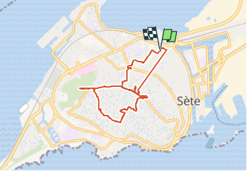
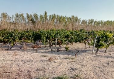
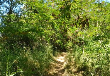
Tocht Stappen van 8,7 km beschikbaar op Occitanië, Hérault, Sète. Deze tocht wordt voorgesteld door Maryma.
Beschrijving
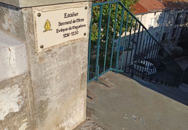
des escaliers à monter et à descendre. De magnifiques points de vue. Parcours uniquement sur goudron. De petits passages entre les maisons très sympas. C'est le tracer bleu sur le plan de la ville de l' OT
Plaatsbepaling
Land:
France
Regio :
Occitanië
Departement/Provincie :
Hérault
Gemeente :
Sète
Locatie:
Unknown
Vertrek:(Dec)
Vertrek:(UTM)
555761 ; 4806634 (31T) N.
Opmerkingen
Wandeltochten in de omgeving
![Tocht Stappen Bouzigues - Bouzigues 15.12.23 - Photo](https://media.geolcdn.com/t/375/260/eb546321-21cb-4aa2-b8af-8ac18af028b5.jpg&format=jpg&maxdim=2)
![Stappen Stappen](https://static1.geolcdn.com/sitytour/trail-icons/101.png)
Bouzigues 15.12.23
Stappen
Gemakkelijk
(1)
Bouzigues,
Occitanië,
Hérault,
France
![](/images/other/stat-length.png)
8,1 km | 8,9 km-effort
2h 0min
![](https://static1.geolcdn.com/siteimages/upload/files/16400158638029165_repeat_loop_refresh_sync_direction_icon.png)
Neen
![Tocht Fiets Loupian - loupian balaruc - Photo](https://media.geolcdn.com/t/375/260/ext.jpg?maxdim=2&url=https%3A%2F%2Fservices.sitytrail.com%2FGeolivesWS%2FDownloadMedia.ashx%3FTrailID%3D190323%26Media%3D20130509154005.jpg)
![Fiets Fiets](https://static1.geolcdn.com/sitytour/trail-icons/200.png)
loupian balaruc
Fiets
Heel gemakkelijk
(1)
Loupian,
Occitanië,
Hérault,
France
![](/images/other/stat-length.png)
13,6 km | 15,1 km-effort
1h 22min
![](https://static1.geolcdn.com/siteimages/upload/files/16400158638029165_repeat_loop_refresh_sync_direction_icon.png)
Ja
![Tocht Stappen Frontignan - rocher de rasclegirascle - Photo](https://media.geolcdn.com/t/375/260/ext.jpg?maxdim=2&url=https%3A%2F%2Fstatic1.geolcdn.com%2Fsiteimages%2Fupload%2Ffiles%2F1553511878bg_sport_marche.png)
![Stappen Stappen](https://static1.geolcdn.com/sitytour/trail-icons/101.png)
rocher de rasclegirascle
Stappen
Gemakkelijk
(1)
Frontignan,
Occitanië,
Hérault,
France
![](/images/other/stat-length.png)
6 km | 8,1 km-effort
1h 47min
![](https://static1.geolcdn.com/siteimages/upload/files/16400158638029165_repeat_loop_refresh_sync_direction_icon.png)
Ja
![Tocht Stappen Sète - Jolie balade à Sète - Photo](https://media.geolcdn.com/t/375/260/2901ad28-9840-4293-b72b-03831aa6126d.jpg&format=jpg&maxdim=2)
![Stappen Stappen](https://static1.geolcdn.com/sitytour/trail-icons/101.png)
Jolie balade à Sète
Stappen
Gemakkelijk
Sète,
Occitanië,
Hérault,
France
![](/images/other/stat-length.png)
12,8 km | 14,6 km-effort
7h 8min
![](https://static1.geolcdn.com/siteimages/upload/files/16400158638029165_repeat_loop_refresh_sync_direction_icon.png)
Ja
![Tocht Wegfiets Sète - vélo sete balaruc pinet - Photo](https://media.geolcdn.com/t/375/260/7879f4d8-d04c-4b53-9739-207a531fd449.jpg&format=jpg&maxdim=2)
![Wegfiets Wegfiets](https://static1.geolcdn.com/sitytour/trail-icons/201.png)
vélo sete balaruc pinet
Wegfiets
Medium
Sète,
Occitanië,
Hérault,
France
![](/images/other/stat-length.png)
67 km | 73 km-effort
6h 20min
![](https://static1.geolcdn.com/siteimages/upload/files/16400158638029165_repeat_loop_refresh_sync_direction_icon.png)
Ja
![Tocht Stappen Balaruc-les-Bains - autour de balaruc le vieux - Photo](https://media.geolcdn.com/t/375/260/3445ceb0-84a9-40f3-a7c3-5cb2a109f301.jpg&format=jpg&maxdim=2)
![Stappen Stappen](https://static1.geolcdn.com/sitytour/trail-icons/101.png)
autour de balaruc le vieux
Stappen
Gemakkelijk
(1)
Balaruc-les-Bains,
Occitanië,
Hérault,
France
![](/images/other/stat-length.png)
6,2 km | 7,1 km-effort
1h 20min
![](https://static1.geolcdn.com/siteimages/upload/files/16400158638029165_repeat_loop_refresh_sync_direction_icon.png)
Ja
![Tocht Te voet Bouzigues - Bouzuigue le Lac de - Photo](https://media.geolcdn.com/t/375/260/ext.jpg?maxdim=2&url=https%3A%2F%2Fstatic1.geolcdn.com%2Fsiteimages%2Fupload%2Ffiles%2F1545311037marcheuse_200dpi.jpg)
![Te voet Te voet](https://static1.geolcdn.com/sitytour/trail-icons/100.png)
Bouzuigue le Lac de
Te voet
Gemakkelijk
(1)
Bouzigues,
Occitanië,
Hérault,
France
![](/images/other/stat-length.png)
9,3 km | 11,3 km-effort
Onbekend
![](https://static1.geolcdn.com/siteimages/upload/files/16400158638029165_repeat_loop_refresh_sync_direction_icon.png)
Ja
![Tocht Mountainbike Sète - listel - Photo](https://media.geolcdn.com/t/375/260/412805d1-94d4-411b-b3a6-2827e8c0f61d.jpg&format=jpg&maxdim=2)
![Mountainbike Mountainbike](https://static1.geolcdn.com/sitytour/trail-icons/202.png)
listel
Mountainbike
Heel gemakkelijk
Sète,
Occitanië,
Hérault,
France
![](/images/other/stat-length.png)
8,7 km | 9,1 km-effort
54min
![](https://static1.geolcdn.com/siteimages/upload/files/16400158638029165_repeat_loop_refresh_sync_direction_icon.png)
Neen
![Tocht Fietstoerisme Sète - Sète -Narbonne - Photo](https://media.geolcdn.com/t/375/260/68bcbb9a-3276-48d7-8f16-700aafadf642.jpg&format=jpg&maxdim=2)
![Fietstoerisme Fietstoerisme](https://static1.geolcdn.com/sitytour/trail-icons/204.png)
Sète -Narbonne
Fietstoerisme
Moeilijk
Sète,
Occitanië,
Hérault,
France
![](/images/other/stat-length.png)
76 km | 82 km-effort
5h 3min
![](https://static1.geolcdn.com/siteimages/upload/files/16400158638029165_repeat_loop_refresh_sync_direction_icon.png)
Neen