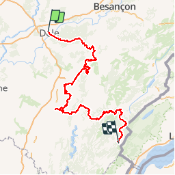
![](/images/other/stat-length.png)
![Tocht Stappen Dole - L’Echappée Jurassienne - Photo](https://media.geolcdn.com/t/1900/400/ext.pjpeg?maxdim=2&url=https%3A%2F%2Fstatic1.geolcdn.com%2Fsiteimages%2Fupload%2Ffiles%2F1553511878bg_sport_marche.png)
L’Echappée Jurassienne
Jura_Tourism
Gebruiker
![Lengte](/images/other/stat-length.png)
![Max. hoogte](https://static1.geolcdn.com/siteimages/upload/files/1508320355ic_sort_altitude_max_24dp.png)
![Positief hoogteverschil](https://static1.geolcdn.com/siteimages/upload/files/1508320355ic_sort_den_pos_24dp.png)
![Km-Effort](/images/other/stat-length.png)
![Min. hoogte](https://static1.geolcdn.com/siteimages/upload/files/1508320355ic_sort_altitude_min_24dp.png)
![Negatief hoogteverschil](https://static1.geolcdn.com/siteimages/upload/files/1508320355ic_sort_den_neg_24dp.png)
![Boucle](https://static1.geolcdn.com/siteimages/upload/files/16400158638029165_repeat_loop_refresh_sync_direction_icon.png)
![Stappen](https://static1.geolcdn.com/sitytour/trail-icons/101.png)
70h25
Moeilijkheid : Medium
![Scan deze QR-code om de tocht te openen in de SityTrail-applicatie](https://capi.geolives.com/qq0zvz2zws4bq2lad0pu/sitytour/trails/207179/qr.png?size=200)
Gratisgps-wandelapplicatie
Over ons
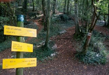
Tocht Stappen van 257 km beschikbaar op Bourgondië-Franche-Comté, Jura, Dole. Deze tocht wordt voorgesteld door Jura_Tourism.
Beschrijving
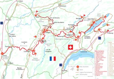
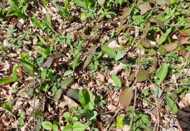
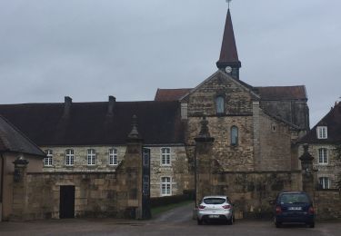
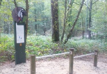
Le temps d’une Échappée Jurassienne, de 2 à 13 jours, au choix, laissez-vous conquérir par les richesses et mystères de ce territoire aux reliefs vivifiants. Ses paysages spectaculaires et extrêmement variés vous promettent des découvertes réjouissantes ! Cet « itinéraire des Grands Sites du Jura » relie la plaine aux hauteurs du massif. Ses 260 km de sentiers pédestres balisés et homologués permettent de découvrir la richesse de ce territoire et ses trésors inattendus : forêts majestueuses, Grande Saline et Saline Royale classées au patrimoine mondial de l’UNESCO, reculées emblématiques, vignoble insoupçonné aux 6 AOC vins, lacs et cascades rafraîchissants, paysages spectaculaires façonnés par une géologie particulière,… Des haltes bienvenues offrent l’occasion de déguster les spécialités locales, entre vins de caractère et plats du terroir, aux saveurs inédites. L’expérience se vit à la carte, à votre rythme : composez l’itinéraire qui vous ressemble, du Nord au Sud ou inversement. Les plus audacieux peuvent opter pour la traversée entre Dole et Les Rousses, en 13 jours !
Plus d’informations sur www.echappee-jurassienne.fr
Plaatsbepaling
Opmerkingen
Wandeltochten in de omgeving
![Tocht Stappen Jouhe - Mont Roland 11.7km 20161215 - Photo](https://media.geolcdn.com/t/375/260/ext.jpg?maxdim=2&url=https%3A%2F%2Fstatic1.geolcdn.com%2Fsiteimages%2Fupload%2Ffiles%2F1553511878bg_sport_marche.png)
![Stappen Stappen](https://static1.geolcdn.com/sitytour/trail-icons/101.png)
Stappen
![](/images/other/stat-length.png)
![](https://static1.geolcdn.com/siteimages/upload/files/16400158638029165_repeat_loop_refresh_sync_direction_icon.png)
![Tocht Stappen Dole - Dole ville - Photo](https://media.geolcdn.com/t/375/260/e28aad6a-c7e5-401c-94fb-452df6c86b47.jpg&format=jpg&maxdim=2)
![Stappen Stappen](https://static1.geolcdn.com/sitytour/trail-icons/101.png)
![Tocht Stappen Dole - Via Cluny: de Dole (Jura) à Cluny - Photo](https://media.geolcdn.com/t/375/260/1092a6f8-d0c7-4e5e-a178-164a2812cb66.jpg&format=jpg&maxdim=2)
![Stappen Stappen](https://static1.geolcdn.com/sitytour/trail-icons/101.png)
Stappen
![](/images/other/stat-length.png)
![](https://static1.geolcdn.com/siteimages/upload/files/16400158638029165_repeat_loop_refresh_sync_direction_icon.png)
![Tocht Wegfiets Dole - mn05 - Photo](https://media.geolcdn.com/t/375/260/5ece753a-d519-46d1-b96a-31a274298d2e.jpg&format=jpg&maxdim=2)
![Wegfiets Wegfiets](https://static1.geolcdn.com/sitytour/trail-icons/201.png)
Wegfiets
![](/images/other/stat-length.png)
![](https://static1.geolcdn.com/siteimages/upload/files/16400158638029165_repeat_loop_refresh_sync_direction_icon.png)
![Tocht Stappen Dole - muguet confinement - Photo](https://media.geolcdn.com/t/375/260/574ce2bd-ddb7-4098-9610-087d7bd33043.jpg&format=jpg&maxdim=2)
![Stappen Stappen](https://static1.geolcdn.com/sitytour/trail-icons/101.png)
Stappen
![](/images/other/stat-length.png)
![](https://static1.geolcdn.com/siteimages/upload/files/16400158638029165_repeat_loop_refresh_sync_direction_icon.png)
![Tocht Stappen Jouhe - g)Etapa 7 - Photo](https://media.geolcdn.com/t/375/260/ext.jpg?maxdim=2&url=https%3A%2F%2Fservices.sitytrail.com%2FGeolivesWS%2FDownloadMedia.ashx%3FTrailID%3D711082%26Media%3D20170306151955.jpg)
![Stappen Stappen](https://static1.geolcdn.com/sitytour/trail-icons/101.png)
Stappen
![](/images/other/stat-length.png)
![](https://static1.geolcdn.com/siteimages/upload/files/16400158638029165_repeat_loop_refresh_sync_direction_icon.png)
![Tocht Stappen Dole - Sentier des chênes rouges - Photo](https://media.geolcdn.com/t/375/260/ext.jpg?maxdim=2&url=https%3A%2F%2Fservices.sitytrail.com%2FGeolivesWS%2FDownloadMedia.ashx%3FTrailID%3D476404%26Media%3Dfix__20150927175830.jpg)
![Stappen Stappen](https://static1.geolcdn.com/sitytour/trail-icons/101.png)
Stappen
![](/images/other/stat-length.png)
![](https://static1.geolcdn.com/siteimages/upload/files/16400158638029165_repeat_loop_refresh_sync_direction_icon.png)
![Tocht Fiets Dole - Bletterans - Photo](https://media.geolcdn.com/t/375/260/ext.jpg?maxdim=2&url=https%3A%2F%2Fservices.sitytrail.com%2FGeolivesWS%2FDownloadMedia.ashx%3FTrailID%3D466291%26Media%3Dfix__20150828142451.jpg)
![Fiets Fiets](https://static1.geolcdn.com/sitytour/trail-icons/200.png)
Fiets
![](/images/other/stat-length.png)
![](https://static1.geolcdn.com/siteimages/upload/files/16400158638029165_repeat_loop_refresh_sync_direction_icon.png)
![Tocht Noords wandelen Jouhe - Circuit Mont-Roland - Photo](https://media.geolcdn.com/t/375/260/ext.jpg?maxdim=2&url=https%3A%2F%2Fservices.sitytrail.com%2FGeolivesWS%2FDownloadMedia.ashx%3FTrailID%3D344188%26Media%3Dfix__20140911154422.jpg)
![Noords wandelen Noords wandelen](https://static1.geolcdn.com/sitytour/trail-icons/102.png)
Noords wandelen
![](/images/other/stat-length.png)
![](https://static1.geolcdn.com/siteimages/upload/files/16400158638029165_repeat_loop_refresh_sync_direction_icon.png)