39 km | 43 km-effort
Bois Renard - Blois et retour.
pffrench
Gebruiker
Lengte
54 km
Max. hoogte
105 m
Positief hoogteverschil
376 m
Km-Effort
59 km
Min. hoogte
64 m
Negatief hoogteverschil
376 m
Boucle
Ja
Datum van aanmaak :
2019-03-25 08:06:59.279
Laatste wijziging :
2019-04-07 21:50:49.052
6h51
Moeilijkheid : Medium
Gratisgps-wandelapplicatie
Over ons
Tocht Fietstoerisme van 54 km beschikbaar op Centre-Val de Loire, Loir-et-Cher, Saint-Laurent-Nouan. Deze tocht wordt voorgesteld door pffrench.
Beschrijving
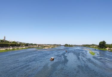
aller sur la rive gauche, retour sur la rive droite.
Plaatsbepaling
Land:
France
Regio :
Centre-Val de Loire
Departement/Provincie :
Loir-et-Cher
Gemeente :
Saint-Laurent-Nouan
Locatie:
Unknown
Vertrek:(Dec)
Vertrek:(UTM)
393217 ; 5280360 (31T) N.
Opmerkingen
Wandeltochten in de omgeving
Itinéraire 12 - Au fil de Loire
Wegfiets
Zeer moeilijk
(1)
Muides-sur-Loire,
Centre-Val de Loire,
Loir-et-Cher,
France
2h 36min
Ja
Parc de Chambord et ses postes d'observation
Stappen
Gemakkelijk
(1)
Chambord,
Centre-Val de Loire,
Loir-et-Cher,
France
20 km | 22 km-effort
5h 3min
Ja
Muides Blois Chambord
Hybride fiets
Medium
Muides-sur-Loire,
Centre-Val de Loire,
Loir-et-Cher,
France
51 km | 57 km-effort
4h 41min
Neen
Thoury 2019
Stappen
Heel gemakkelijk
(1)
Thoury,
Centre-Val de Loire,
Loir-et-Cher,
France
14,5 km | 16,2 km-effort
2h 42min
Ja
Bords de Loire - Chambord
Wegfiets
Gemakkelijk
Saint-Laurent-Nouan,
Centre-Val de Loire,
Loir-et-Cher,
France
32 km | 35 km-effort
3h 55min
Ja
Thoury 10-12-23
Stappen
Moeilijk
Thoury,
Centre-Val de Loire,
Loir-et-Cher,
France
14,9 km | 16,7 km-effort
2h 48min
Ja
Thury -Cheverny
Wegfiets
Moeilijk
Thoury,
Centre-Val de Loire,
Loir-et-Cher,
France
29 km | 32 km-effort
2h 12min
Neen
crouy sur cosson
Stappen
Gemakkelijk
Crouy-sur-Cosson,
Centre-Val de Loire,
Loir-et-Cher,
France
13,9 km | 15,3 km-effort
2h 58min
Ja
beaugeny
Mountainbike
Moeilijk
Muides-sur-Loire,
Centre-Val de Loire,
Loir-et-Cher,
France
32 km | 34 km-effort
1h 39min
Ja