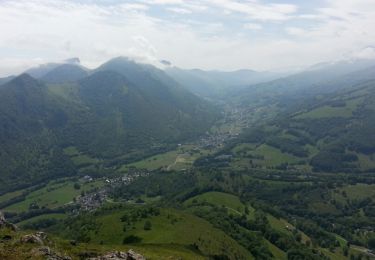
18,2 km | 30 km-effort
Bagnères de Bigorre
Delieuxc
Gebruiker
Lengte
7,3 km
Max. hoogte
862 m
Positief hoogteverschil
327 m
Km-Effort
11,6 km
Min. hoogte
559 m
Negatief hoogteverschil
328 m
Boucle
Ja
Datum van aanmaak :
2019-03-27 13:20:36.907
Laatste wijziging :
2019-03-27 15:32:10.748
2h10
Moeilijkheid : Heel gemakkelijk
Gratisgps-wandelapplicatie
Over ons
Tocht Stappen van 7,3 km beschikbaar op Occitanië, Hautes-Pyrénées, Bagnères-de-Bigorre. Deze tocht wordt voorgesteld door Delieuxc.
Plaatsbepaling
Land:
France
Regio :
Occitanië
Departement/Provincie :
Hautes-Pyrénées
Gemeente :
Bagnères-de-Bigorre
Locatie:
Unknown
Vertrek:(Dec)
Vertrek:(UTM)
267708 ; 4771664 (31T) N.
Opmerkingen
Wandeltochten in de omgeving
FEU 2015 - Etape 5
Stappen
Gemakkelijk
(1)
Bagnères-de-Bigorre,
Occitanië,
Hautes-Pyrénées,
France
6h 29min
Neen
Gerde
Stappen
Gemakkelijk
Bagnères-de-Bigorre,
Occitanië,
Hautes-Pyrénées,
France
9,7 km | 12,2 km-effort
2h 49min
Ja
Camp César Pouzac
Stappen
Medium
Pouzac,
Occitanië,
Hautes-Pyrénées,
France
6,6 km | 9,8 km-effort
1h 46min
Ja
Casque du Lheris
Stappen
Medium
Gerde,
Occitanië,
Hautes-Pyrénées,
France
16,8 km | 28 km-effort
6h 25min
Ja
hourquette
Wegfiets
Zeer moeilijk
(1)
Beaudéan,
Occitanië,
Hautes-Pyrénées,
France
50 km | 65 km-effort
2h 54min
Ja
Randonnée 1 mai haut de Bagneres
Mountainbike
Zeer moeilijk
Bagnères-de-Bigorre,
Occitanië,
Hautes-Pyrénées,
France
28 km | 38 km-effort
3h 18min
Ja
tour du castelmouly
Stappen
Gemakkelijk
(2)
Bagnères-de-Bigorre,
Occitanië,
Hautes-Pyrénées,
France
12,7 km | 20 km-effort
4h 3min
Ja
Le Tour de la Bouche - Campan
Stappen
Moeilijk
Campan,
Occitanië,
Hautes-Pyrénées,
France
15,2 km | 28 km-effort
7h 0min
Ja
Casque du Lhéris - Gerde
Stappen
Medium
Gerde,
Occitanië,
Hautes-Pyrénées,
France
14,1 km | 24 km-effort
5h 0min
Ja