![](/images/other/stat-length.png)
![Tocht Stappen Opzullik - Promenade du Maquis de Saint-Marcoult - Photo](https://media.geolcdn.com/t/1900/400/ext.pjpeg?maxdim=2&url=https%3A%2F%2Fservices.sitytrail.com%2FGeolivesWS%2FDownloadMedia.ashx%3FTrailID%3D202848%26Media%3D616a2a38-6fc7-4a40-8b59-c370b519e94a.jpg)
Promenade du Maquis de Saint-Marcoult
Rando Famili
Randonnées de RandoFamili
![Lengte](/images/other/stat-length.png)
![Max. hoogte](https://static1.geolcdn.com/siteimages/upload/files/1508320355ic_sort_altitude_max_24dp.png)
![Positief hoogteverschil](https://static1.geolcdn.com/siteimages/upload/files/1508320355ic_sort_den_pos_24dp.png)
![Km-Effort](/images/other/stat-length.png)
![Min. hoogte](https://static1.geolcdn.com/siteimages/upload/files/1508320355ic_sort_altitude_min_24dp.png)
![Negatief hoogteverschil](https://static1.geolcdn.com/siteimages/upload/files/1508320355ic_sort_den_neg_24dp.png)
![Boucle](https://static1.geolcdn.com/siteimages/upload/files/16400158638029165_repeat_loop_refresh_sync_direction_icon.png)
![Stappen](https://static1.geolcdn.com/sitytour/trail-icons/101.png)
--
Moeilijkheid : Onbekend
![Scan deze QR-code om de tocht te openen in de SityTrail-applicatie](https://capi.geolives.com/qq0zvz2zws4bq2lad0pu/sitytour/trails/202848/qr.png?size=200)
Gratisgps-wandelapplicatie
Over ons
Tocht Stappen van 5,4 km beschikbaar op Wallonië, Henegouwen, Opzullik. Deze tocht wordt voorgesteld door Rando Famili.
Beschrijving
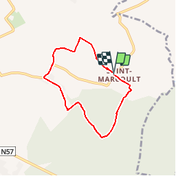
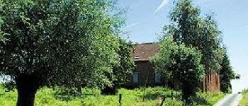
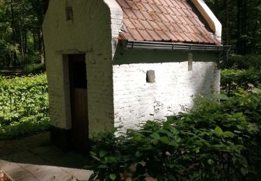
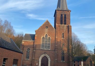
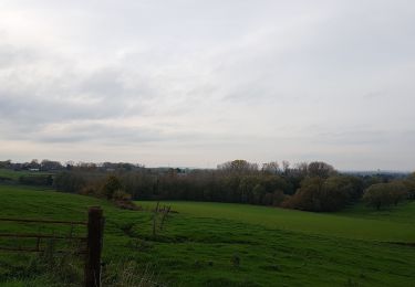
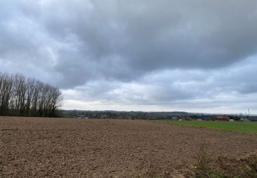
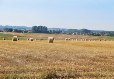
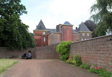
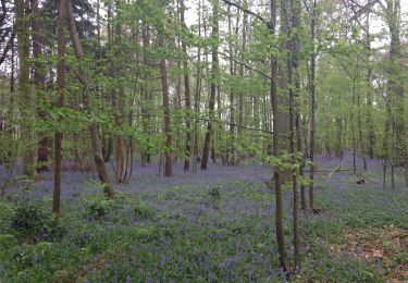
<p> A Saint-Marcoult, vous entrez dans un haut lieu de la Résistance de la seconde guerre mondiale. Mais ne craignez rien, aujourd’hui, ce village est devenu un hameau paisible. La promenade vous mènera à travers la forêt domaniale de Silly, à la découverte de magnifiques paysages, de châteaux, et de la Sille, le cours d’eau de la commune. Profitez des aires de pique-nique déguster un casse-croute à base des produits locaux slow food ! </p>
Plaatsbepaling
Opmerkingen
Wandeltochten in de omgeving
![Tocht Stappen Opzullik - HT-06_complet - Photo](https://media.geolcdn.com/t/375/260/f966d4d2-0dc0-4cd6-bca7-03c18785f611.jpg&format=jpg&maxdim=2)
![Stappen Stappen](https://static1.geolcdn.com/sitytour/trail-icons/101.png)
Stappen
![](/images/other/stat-length.png)
![](https://static1.geolcdn.com/siteimages/upload/files/16400158638029165_repeat_loop_refresh_sync_direction_icon.png)
![Tocht Stappen Opzullik - Graty - bois d’Enghien - Graty - Photo](https://media.geolcdn.com/t/375/260/7271ef7d-a5b1-459f-b9eb-91dd19972deb.jpg&format=jpg&maxdim=2)
![Stappen Stappen](https://static1.geolcdn.com/sitytour/trail-icons/101.png)
Stappen
![](/images/other/stat-length.png)
![](https://static1.geolcdn.com/siteimages/upload/files/16400158638029165_repeat_loop_refresh_sync_direction_icon.png)
![Tocht Stappen Opzullik - Wapi 3.02 - La promenade des Princes - Silly - Photo](https://media.geolcdn.com/t/375/260/98872b19-6c1a-4965-9bd7-5d3e9b88372a.jpg&format=jpg&maxdim=2)
![Stappen Stappen](https://static1.geolcdn.com/sitytour/trail-icons/101.png)
Stappen
![](/images/other/stat-length.png)
![](https://static1.geolcdn.com/siteimages/upload/files/16400158638029165_repeat_loop_refresh_sync_direction_icon.png)
![Tocht Stappen Opzullik - RB-Ha-03 - Raccourci - Du pays des carrières au parc naturel des Collines - Photo](https://media.geolcdn.com/t/375/260/ext.jpg?maxdim=2&url=https%3A%2F%2Fservices.sitytrail.com%2FGeolivesWS%2FDownloadMedia.ashx%3FTrailID%3D217835%26Media%3Dd7099cfa-d7c9-4bf3-bdfa-78aa37eb10bb.jpg)
![Stappen Stappen](https://static1.geolcdn.com/sitytour/trail-icons/101.png)
Stappen
![](/images/other/stat-length.png)
![](https://static1.geolcdn.com/siteimages/upload/files/16400158638029165_repeat_loop_refresh_sync_direction_icon.png)
![Tocht Stappen Aat - Dimanche 20/12/2020 - Photo](https://media.geolcdn.com/t/375/260/e7853499-b082-4f1a-bcac-5b446950aa41.jpg&format=jpg&maxdim=2)
![Stappen Stappen](https://static1.geolcdn.com/sitytour/trail-icons/101.png)
Stappen
![](/images/other/stat-length.png)
![](https://static1.geolcdn.com/siteimages/upload/files/16400158638029165_repeat_loop_refresh_sync_direction_icon.png)
![Tocht Te voet Opzullik - Gehuchten en hoogtepunten van Zullik-Hellebeek - Photo](https://media.geolcdn.com/t/375/260/ext.jpg?maxdim=2&url=https%3A%2F%2Fpivotmedia.tourismewallonie.be%2FANX-02-04K1-001F%2FANX-02-04K1-001F.JPG)
![Te voet Te voet](https://static1.geolcdn.com/sitytour/trail-icons/100.png)
Te voet
![](/images/other/stat-length.png)
![](https://static1.geolcdn.com/siteimages/upload/files/16400158638029165_repeat_loop_refresh_sync_direction_icon.png)
![Tocht Te voet Opzullik - Wandeling langs de kastelen en Bos van la Provision - Photo](https://media.geolcdn.com/t/375/260/ext.jpg?maxdim=2&url=https%3A%2F%2Fpivotmedia.tourismewallonie.be%2FANX-02-04OE-001F%2FANX-02-04OE-001F.JPG)
![Te voet Te voet](https://static1.geolcdn.com/sitytour/trail-icons/100.png)
Te voet
![](/images/other/stat-length.png)
![](https://static1.geolcdn.com/siteimages/upload/files/16400158638029165_repeat_loop_refresh_sync_direction_icon.png)
![Tocht Te voet Opzullik - Wandeling van het Maquis de Saint-Marcoult - Photo](https://media.geolcdn.com/t/375/260/ext.jpg?maxdim=2&url=https%3A%2F%2Fpivotmedia.tourismewallonie.be%2FANX-02-04OQ-005G%2FANX-02-04OQ-005G.JPG)
![Te voet Te voet](https://static1.geolcdn.com/sitytour/trail-icons/100.png)
Te voet
![](/images/other/stat-length.png)
![](https://static1.geolcdn.com/siteimages/upload/files/16400158638029165_repeat_loop_refresh_sync_direction_icon.png)
![Tocht Te voet Opzullik - Prinsen-wandeling - Photo](https://media.geolcdn.com/t/375/260/ext.jpg?maxdim=2&url=https%3A%2F%2Fpivotmedia.tourismewallonie.be%2FANX-02-04OT-001F%2FANX-02-04OT-001F.JPG)
![Te voet Te voet](https://static1.geolcdn.com/sitytour/trail-icons/100.png)
Te voet
![](/images/other/stat-length.png)
![](https://static1.geolcdn.com/siteimages/upload/files/16400158638029165_repeat_loop_refresh_sync_direction_icon.png)