

Leimbach - Chalet Zuber

patrickbeyrath
Gebruiker

Lengte
8,5 km

Max. hoogte
647 m

Positief hoogteverschil
341 m

Km-Effort
13 km

Min. hoogte
357 m

Negatief hoogteverschil
337 m
Boucle
Ja
Datum van aanmaak :
2018-12-07 08:21:02.977
Laatste wijziging :
2018-12-07 08:27:56.896
2h42
Moeilijkheid : Medium

Gratisgps-wandelapplicatie
Over ons
Tocht Stappen van 8,5 km beschikbaar op Grand Est, Haut-Rhin, Leimbach. Deze tocht wordt voorgesteld door patrickbeyrath.
Beschrijving
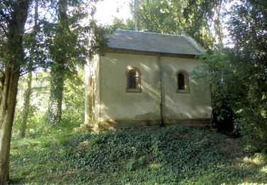
Parking mairie Leimbach - Les Trois Chênes ) Tempel - Muhlberg - Col du Teufelsgrund - Chalet Zuber - descente rond rouge puis prendre à gauche Riegelsbourg et retour parking
Plaatsbepaling
Land:
France
Regio :
Grand Est
Departement/Provincie :
Haut-Rhin
Gemeente :
Leimbach
Locatie:
Unknown
Vertrek:(Dec)
Vertrek:(UTM)
357786 ; 5295059 (32T) N.
Opmerkingen
Wandeltochten in de omgeving
Sentheim Rossberg


Stappen
Medium
(1)
Sentheim,
Grand Est,
Haut-Rhin,
France

27 km | 40 km-effort
6h 11min
Ja
lac du ballon


Andere activiteiten
Heel gemakkelijk
(1)
Steinbach,
Grand Est,
Haut-Rhin,
France

33 km | 64 km-effort
5h 1min
Neen
Cascade de Erzenbach


Stappen
Medium
Steinbach,
Grand Est,
Haut-Rhin,
France

6 km | 8,8 km-effort
1h 32min
Ja
2024-01-12_14h17m14_239006910


Stappen
Moeilijk
Bourbach-le-Haut,
Grand Est,
Haut-Rhin,
France

11,4 km | 18,5 km-effort
4h 12min
Ja
Sentier géologique du Wolfloch


Te voet
Gemakkelijk
Sentheim,
Grand Est,
Haut-Rhin,
France

3,8 km | 4,8 km-effort
1h 5min
Neen

Sentheim - Bergwald - Eichwald - Guevenheim - Sentheim


Te voet
Gemakkelijk
(1)
Sentheim,
Grand Est,
Haut-Rhin,
France

13,4 km | 16,6 km-effort
Onbekend
Ja

SityTrail - 2489713 - thann-roche--albert--grumbachkopf


Stappen
Medium
(1)
Thann,
Grand Est,
Haut-Rhin,
France

7,6 km | 12 km-effort
2h 28min
Ja

Bitschwiller les Thann - Rehbrunnel - Abri du Becherkopf - Roche Albert


Te voet
Medium
(1)
Bitschwiller-lès-Thann,
Grand Est,
Haut-Rhin,
France

10,3 km | 16,4 km-effort
Onbekend
Ja

68 Col du Hundsrück - FA Gsang - retour ThannerHubel


Stappen
Medium
(1)
Bitschwiller-lès-Thann,
Grand Est,
Haut-Rhin,
France

11,2 km | 18,4 km-effort
3h 48min
Ja


 SityTrail


