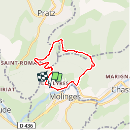
![](/images/other/stat-length.png)
![Tocht Trail Chassal-Molinges - Move - Photo](https://media.geolcdn.com/t/1900/400/ext.pjpeg?maxdim=2&url=https%3A%2F%2Fstatic1.geolcdn.com%2Fsiteimages%2Fupload%2Ffiles%2F1524743154running.jpg)
Move
phd04
Gebruiker
![Lengte](/images/other/stat-length.png)
![Max. hoogte](https://static1.geolcdn.com/siteimages/upload/files/1508320355ic_sort_altitude_max_24dp.png)
![Positief hoogteverschil](https://static1.geolcdn.com/siteimages/upload/files/1508320355ic_sort_den_pos_24dp.png)
![Km-Effort](/images/other/stat-length.png)
![Min. hoogte](https://static1.geolcdn.com/siteimages/upload/files/1508320355ic_sort_altitude_min_24dp.png)
![Negatief hoogteverschil](https://static1.geolcdn.com/siteimages/upload/files/1508320355ic_sort_den_neg_24dp.png)
![Boucle](https://static1.geolcdn.com/siteimages/upload/files/16400158638029165_repeat_loop_refresh_sync_direction_icon.png)
![Trail](https://static1.geolcdn.com/sitytour/trail-icons/104.png)
1h47
Moeilijkheid : Medium
![Scan deze QR-code om de tocht te openen in de SityTrail-applicatie](https://capi.geolives.com/qq0zvz2zws4bq2lad0pu/sitytour/trails/2005586/qr.png?size=200)
Gratisgps-wandelapplicatie
Over ons
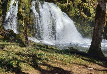
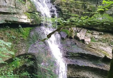
Tocht Trail van 5,9 km beschikbaar op Bourgondië-Franche-Comté, Jura, Chassal-Molinges. Deze tocht wordt voorgesteld door phd04.
Beschrijving
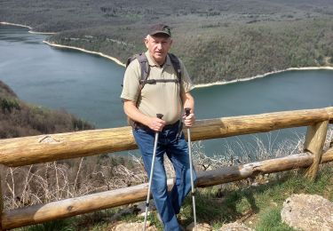
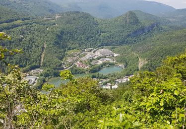
La montée au Pas de l'Ane se fait à l'ombre des arbres.
Attention !!! A partir du Pas de l'Ane vous traversez une zone de pâturage de moutons avec un risque de rencontre avec des chiens de troupeaux (patous, berger d'Anatolie...)
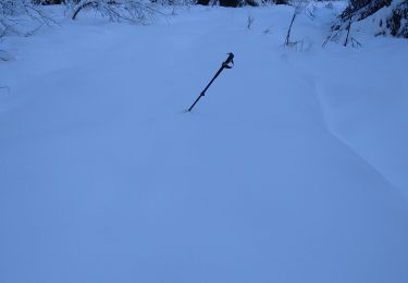
Le descente du retour se fait sur un sentier en lacet très technique
Plaatsbepaling
Opmerkingen
Wandeltochten in de omgeving
![Tocht Stappen Martigna - rando a martgna dans le jura - Photo](https://media.geolcdn.com/t/375/260/6b33a252-c3e7-4c5b-8119-3accb2705ee1.jpg&format=jpg&maxdim=2)
![Stappen Stappen](https://static1.geolcdn.com/sitytour/trail-icons/101.png)
Stappen
![](/images/other/stat-length.png)
![](https://static1.geolcdn.com/siteimages/upload/files/16400158638029165_repeat_loop_refresh_sync_direction_icon.png)
![Tocht Stappen Chassal-Molinges - molinges st romain - Photo](https://media.geolcdn.com/t/375/260/96f2d699-28ed-4327-bbb8-d1650dc3e795.jpg&format=jpg&maxdim=2)
![Stappen Stappen](https://static1.geolcdn.com/sitytour/trail-icons/101.png)
Stappen
![](/images/other/stat-length.png)
![](https://static1.geolcdn.com/siteimages/upload/files/16400158638029165_repeat_loop_refresh_sync_direction_icon.png)
![Tocht Stappen Viry - Siege - Photo](https://media.geolcdn.com/t/375/260/77dd9ca0-0f8d-47ce-a347-2eb0ba0a304b.jpg&format=jpg&maxdim=2)
![Stappen Stappen](https://static1.geolcdn.com/sitytour/trail-icons/101.png)
Stappen
![](/images/other/stat-length.png)
![](https://static1.geolcdn.com/siteimages/upload/files/16400158638029165_repeat_loop_refresh_sync_direction_icon.png)
![Tocht Stappen Jeurre - partis de jeurre ensuite la chapelle Saint Romain et la cascade de l enragé - Photo](https://media.geolcdn.com/t/375/260/5447c741-aafe-4dc1-a194-dd1b06220f91.jpg&format=jpg&maxdim=2)
![Stappen Stappen](https://static1.geolcdn.com/sitytour/trail-icons/101.png)
Stappen
![](/images/other/stat-length.png)
![](https://static1.geolcdn.com/siteimages/upload/files/16400158638029165_repeat_loop_refresh_sync_direction_icon.png)
![Tocht Stappen Coteaux du Lizon - gorges du Lison . départ de Saint lupicin - Photo](https://media.geolcdn.com/t/375/260/286e2e3c-117d-4fdc-a219-2e81e971f03b.jpg&format=jpg&maxdim=2)
![Stappen Stappen](https://static1.geolcdn.com/sitytour/trail-icons/101.png)
Stappen
![](/images/other/stat-length.png)
![](https://static1.geolcdn.com/siteimages/upload/files/16400158638029165_repeat_loop_refresh_sync_direction_icon.png)
![Tocht Stappen Coteaux du Lizon - les gorges du lison - Photo](https://media.geolcdn.com/t/375/260/798c7521-49f8-4b6e-a2da-2384fe5e7302.jpg&format=jpg&maxdim=2)
![Stappen Stappen](https://static1.geolcdn.com/sitytour/trail-icons/101.png)
Stappen
![](/images/other/stat-length.png)
![](https://static1.geolcdn.com/siteimages/upload/files/16400158638029165_repeat_loop_refresh_sync_direction_icon.png)
![Tocht Stappen Chassal-Molinges - molinges-st-romain - Photo](https://media.geolcdn.com/t/375/260/ext.jpg?maxdim=2&url=https%3A%2F%2Fstatic1.geolcdn.com%2Fsiteimages%2Fupload%2Ffiles%2F1553511878bg_sport_marche.png)
![Stappen Stappen](https://static1.geolcdn.com/sitytour/trail-icons/101.png)
Stappen
![](/images/other/stat-length.png)
![](https://static1.geolcdn.com/siteimages/upload/files/16400158638029165_repeat_loop_refresh_sync_direction_icon.png)
![Tocht Stappen Lavans-lès-Saint-Claude - Vers la chapelle Saint-Romain et retour par le village... - Photo](https://media.geolcdn.com/t/375/260/ee107560-80c8-430a-b82c-3e07b072ea63.jpg&format=jpg&maxdim=2)
![Stappen Stappen](https://static1.geolcdn.com/sitytour/trail-icons/101.png)
Stappen
![](/images/other/stat-length.png)
![](https://static1.geolcdn.com/siteimages/upload/files/16400158638029165_repeat_loop_refresh_sync_direction_icon.png)
![Tocht Stappen Lavans-lès-Saint-Claude - Lison Avignon Ponthoux - Photo](https://media.geolcdn.com/t/375/260/124383a0-1bfe-4558-b4f8-920c3bbcd932.jpg&format=jpg&maxdim=2)
![Stappen Stappen](https://static1.geolcdn.com/sitytour/trail-icons/101.png)
Stappen
![](/images/other/stat-length.png)
![](https://static1.geolcdn.com/siteimages/upload/files/16400158638029165_repeat_loop_refresh_sync_direction_icon.png)