![](/images/other/stat-length.png)
![Tocht Stappen Charbonnières-les-Varennes - Beaunit_Narse_JG_02 - Photo](https://media.geolcdn.com/t/1900/400/2347cc26-eafa-4011-be79-b7d07d478152.jpg&format=pjpeg&maxdim=2)
Beaunit_Narse_JG_02
jagarnier
Gebruiker GUIDE
![Lengte](/images/other/stat-length.png)
![Max. hoogte](https://static1.geolcdn.com/siteimages/upload/files/1508320355ic_sort_altitude_max_24dp.png)
![Positief hoogteverschil](https://static1.geolcdn.com/siteimages/upload/files/1508320355ic_sort_den_pos_24dp.png)
![Km-Effort](/images/other/stat-length.png)
![Min. hoogte](https://static1.geolcdn.com/siteimages/upload/files/1508320355ic_sort_altitude_min_24dp.png)
![Negatief hoogteverschil](https://static1.geolcdn.com/siteimages/upload/files/1508320355ic_sort_den_neg_24dp.png)
![Boucle](https://static1.geolcdn.com/siteimages/upload/files/16400158638029165_repeat_loop_refresh_sync_direction_icon.png)
![Stappen](https://static1.geolcdn.com/sitytour/trail-icons/101.png)
2h30
Moeilijkheid : Gemakkelijk
![Scan deze QR-code om de tocht te openen in de SityTrail-applicatie](https://capi.geolives.com/qq0zvz2zws4bq2lad0pu/sitytour/trails/2001944/qr.png?size=200)
Gratisgps-wandelapplicatie
Over ons
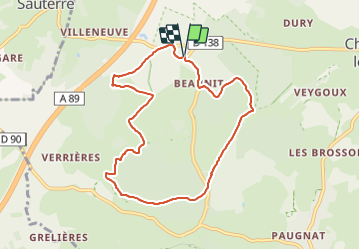
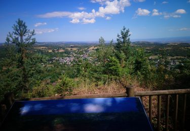
Tocht Stappen van 8,2 km beschikbaar op Auvergne-Rhône-Alpes, Puy-de-Dôme, Charbonnières-les-Varennes. Deze tocht wordt voorgesteld door jagarnier.
Beschrijving
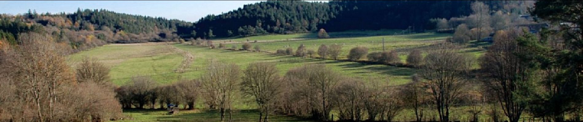
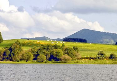
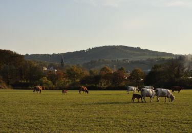
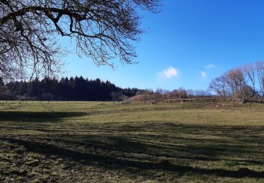
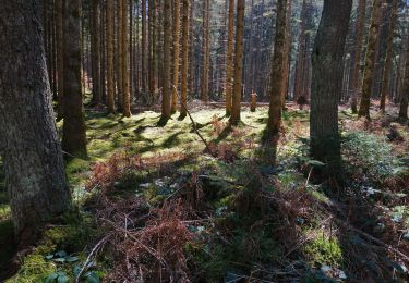
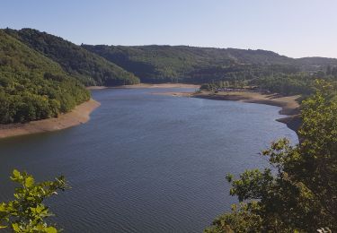
Une agréable balade près de l'ancien maar de Beaunit occupé par une narse (zone humide) et traversé par l'Ambène. Vous bénéficierez de belles vues sur les puys de Paugnat, de la Nugère, de Jumes, Louchadière, Tressous, des Bannières et la carrière de Tunisset.
Plaatsbepaling
Opmerkingen
Wandeltochten in de omgeving
![Tocht Stappen Pulvérières - Pulverieres_Etang_Grand - Photo](https://media.geolcdn.com/t/375/260/422b13e9-38d7-4e06-b1aa-c671b113145c.jpg&format=jpg&maxdim=2)
![Stappen Stappen](https://static1.geolcdn.com/sitytour/trail-icons/101.png)
Stappen
![](/images/other/stat-length.png)
![](https://static1.geolcdn.com/siteimages/upload/files/16400158638029165_repeat_loop_refresh_sync_direction_icon.png)
![Tocht Te voet Manzat - Aux Sources de la Morge - Photo](https://media.geolcdn.com/t/375/260/5410179d-bc75-4fce-aa40-6165831bf324.jpeg&format=jpg&maxdim=2)
![Te voet Te voet](https://static1.geolcdn.com/sitytour/trail-icons/100.png)
Te voet
![](/images/other/stat-length.png)
![](https://static1.geolcdn.com/siteimages/upload/files/16400158638029165_repeat_loop_refresh_sync_direction_icon.png)
![Tocht Mountainbike Loubeyrat - camping GCU loubeyrat, gour de tazenat - Photo](https://media.geolcdn.com/t/375/260/c16b9fbd-4727-4221-a9c8-7acae4d3d0c3.jpg&format=jpg&maxdim=2)
![Mountainbike Mountainbike](https://static1.geolcdn.com/sitytour/trail-icons/202.png)
Mountainbike
![](/images/other/stat-length.png)
![](https://static1.geolcdn.com/siteimages/upload/files/16400158638029165_repeat_loop_refresh_sync_direction_icon.png)
![Tocht Te voet Manzat - La Roche de Sauterre - Photo](https://media.geolcdn.com/t/375/260/8dba4542-9ef0-4bdf-8b1f-a5675463ca16.jpeg&format=jpg&maxdim=2)
![Te voet Te voet](https://static1.geolcdn.com/sitytour/trail-icons/100.png)
Te voet
![](/images/other/stat-length.png)
![](https://static1.geolcdn.com/siteimages/upload/files/16400158638029165_repeat_loop_refresh_sync_direction_icon.png)
![Tocht Stappen Charbonnières-les-Varennes - Le Puy de Paugnat - Photo](https://media.geolcdn.com/t/375/260/b631891c-a86d-4ad8-811c-e5b56ec82195.jpg&format=jpg&maxdim=2)
![Stappen Stappen](https://static1.geolcdn.com/sitytour/trail-icons/101.png)
Stappen
![](/images/other/stat-length.png)
![](https://static1.geolcdn.com/siteimages/upload/files/16400158638029165_repeat_loop_refresh_sync_direction_icon.png)
![Tocht Stappen Volvic - La grande Hêtraie et le Puy de Paugnat. - Photo](https://media.geolcdn.com/t/375/260/4c01e6e3-a8bd-4a83-9075-1c0f2c9aafb4.jpg&format=jpg&maxdim=2)
![Stappen Stappen](https://static1.geolcdn.com/sitytour/trail-icons/101.png)
Stappen
![](/images/other/stat-length.png)
![](https://static1.geolcdn.com/siteimages/upload/files/16400158638029165_repeat_loop_refresh_sync_direction_icon.png)
![Tocht Stappen Charbonnières-les-Varennes - Charbonnieres_Manoir - Photo](https://media.geolcdn.com/t/375/260/cfb40e0d-7db6-4903-ba3b-6861e6d3cd75.jpg&format=jpg&maxdim=2)
![Stappen Stappen](https://static1.geolcdn.com/sitytour/trail-icons/101.png)
Stappen
![](/images/other/stat-length.png)
![](https://static1.geolcdn.com/siteimages/upload/files/16400158638029165_repeat_loop_refresh_sync_direction_icon.png)
![Tocht Lopen Loubeyrat - jour 11 CAP Jeanot - Photo](https://media.geolcdn.com/t/375/260/ebbe0f7f-e642-4e04-8c2f-02adf97172ae.jpg&format=jpg&maxdim=2)
![Lopen Lopen](https://static1.geolcdn.com/sitytour/trail-icons/103.png)
Lopen
![](/images/other/stat-length.png)
![](https://static1.geolcdn.com/siteimages/upload/files/16400158638029165_repeat_loop_refresh_sync_direction_icon.png)
![Tocht Noords wandelen Volvic - Le tour du Puy de Paugnat - Photo](https://media.geolcdn.com/t/375/260/a63ccebb-0154-469a-b4e3-715c7c47c054.jpg&format=jpg&maxdim=2)
![Noords wandelen Noords wandelen](https://static1.geolcdn.com/sitytour/trail-icons/102.png)
Noords wandelen
![](/images/other/stat-length.png)
![](https://static1.geolcdn.com/siteimages/upload/files/16400158638029165_repeat_loop_refresh_sync_direction_icon.png)