![](/images/other/stat-length.png)
![Tocht Stappen Palasca - Agriates Ouest - Photo](https://media.geolcdn.com/t/1900/400/ext.pjpeg?maxdim=2&url=https%3A%2F%2Fstatic1.geolcdn.com%2Fsiteimages%2Fupload%2Ffiles%2F1553511878bg_sport_marche.png)
Agriates Ouest
jmheydorff
Gebruiker
![Lengte](/images/other/stat-length.png)
![Max. hoogte](https://static1.geolcdn.com/siteimages/upload/files/1508320355ic_sort_altitude_max_24dp.png)
![Positief hoogteverschil](https://static1.geolcdn.com/siteimages/upload/files/1508320355ic_sort_den_pos_24dp.png)
![Km-Effort](/images/other/stat-length.png)
![Min. hoogte](https://static1.geolcdn.com/siteimages/upload/files/1508320355ic_sort_altitude_min_24dp.png)
![Negatief hoogteverschil](https://static1.geolcdn.com/siteimages/upload/files/1508320355ic_sort_den_neg_24dp.png)
![Boucle](https://static1.geolcdn.com/siteimages/upload/files/16400158638029165_repeat_loop_refresh_sync_direction_icon.png)
![Stappen](https://static1.geolcdn.com/sitytour/trail-icons/101.png)
5h36
Moeilijkheid : Gemakkelijk
![Scan deze QR-code om de tocht te openen in de SityTrail-applicatie](https://capi.geolives.com/qq0zvz2zws4bq2lad0pu/sitytour/trails/194536/qr.png?size=200)
Gratisgps-wandelapplicatie
Over ons
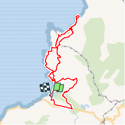
Tocht Stappen van 18,2 km beschikbaar op Corsica, Haute-Corse, Palasca. Deze tocht wordt voorgesteld door jmheydorff.
Beschrijving
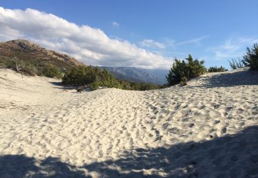
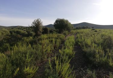
Départ dans le virage de l''ancienne route N197, au-dessus de la plage de l''ostriconi.
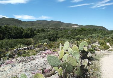
ATTENTION: on peut avoir à traverser la rivière de l''Ostriconi par gros débit, avec de 20 à 80 cms d''eau; passer alors par le camping.
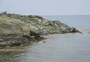
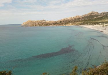
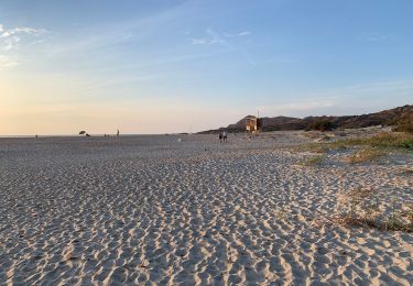
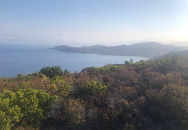
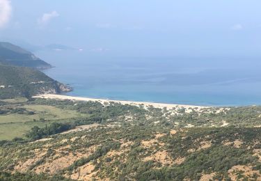
Suivre le bord de mer jusqu''à la plage au nord de Punta di Corbu.
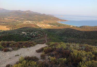
Revenir par le même sentier, ou par l''intérieur (plus de dénivelé)
Plaatsbepaling
Opmerkingen
Wandeltochten in de omgeving
![Stappen Stappen](https://static1.geolcdn.com/sitytour/trail-icons/101.png)
Stappen
![](/images/other/stat-length.png)
![](https://static1.geolcdn.com/siteimages/upload/files/16400158638029165_repeat_loop_refresh_sync_direction_icon.png)
![Tocht Stappen Palasca - corse - Photo](https://media.geolcdn.com/t/375/260/075625bc-44ce-445d-a25f-ff50bc31fa15.jpg&format=jpg&maxdim=2)
![Stappen Stappen](https://static1.geolcdn.com/sitytour/trail-icons/101.png)
![Tocht Te voet Palasca - Haute-Corse - Photo](https://media.geolcdn.com/t/375/260/4062cc29-1b28-48a6-bd8f-55e4eae013b8.jpeg&format=jpg&maxdim=2)
![Te voet Te voet](https://static1.geolcdn.com/sitytour/trail-icons/100.png)
Te voet
![](/images/other/stat-length.png)
![](https://static1.geolcdn.com/siteimages/upload/files/16400158638029165_repeat_loop_refresh_sync_direction_icon.png)
![Tocht Stappen Palasca - Agriates - Photo](https://media.geolcdn.com/t/375/260/6dc5bd43-02b9-46b0-8155-5b9d1c4421ca.jpg&format=jpg&maxdim=2)
![Stappen Stappen](https://static1.geolcdn.com/sitytour/trail-icons/101.png)
Stappen
![](/images/other/stat-length.png)
![](https://static1.geolcdn.com/siteimages/upload/files/16400158638029165_repeat_loop_refresh_sync_direction_icon.png)
![Tocht Stappen Belgodère - Boucle Lozari - plage ostreconi : désert dès agriates - Photo](https://media.geolcdn.com/t/375/260/985625cc-0eb6-48e8-8431-636baea10d40.jpg&format=jpg&maxdim=2)
![Stappen Stappen](https://static1.geolcdn.com/sitytour/trail-icons/101.png)
Stappen
![](/images/other/stat-length.png)
![](https://static1.geolcdn.com/siteimages/upload/files/16400158638029165_repeat_loop_refresh_sync_direction_icon.png)
![Tocht Trail Belgodère - Boucle Punto arco - Spar Lozari - Photo](https://media.geolcdn.com/t/375/260/25e82146-8d26-44ab-b341-543e5b96beea.jpg&format=jpg&maxdim=2)
![Trail Trail](https://static1.geolcdn.com/sitytour/trail-icons/104.png)
Trail
![](/images/other/stat-length.png)
![](https://static1.geolcdn.com/siteimages/upload/files/16400158638029165_repeat_loop_refresh_sync_direction_icon.png)
![Tocht Stappen Palasca - Randonnée « le Désert des Agriates » Corse - Photo](https://media.geolcdn.com/t/375/260/5d5baaa3-10e6-4da6-8d1f-53cd2ea673ec.jpg&format=jpg&maxdim=2)
![Stappen Stappen](https://static1.geolcdn.com/sitytour/trail-icons/101.png)
Stappen
![](/images/other/stat-length.png)
![](https://static1.geolcdn.com/siteimages/upload/files/16400158638029165_repeat_loop_refresh_sync_direction_icon.png)
![Tocht Stappen Belgodère - les hauteurs de lozari (départ plage de Lozari) - Photo](https://media.geolcdn.com/t/375/260/e3a97c50-c05c-4391-98c9-fb436a47e1d2.jpg&format=jpg&maxdim=2)
![Stappen Stappen](https://static1.geolcdn.com/sitytour/trail-icons/101.png)
Stappen
![](/images/other/stat-length.png)
![](https://static1.geolcdn.com/siteimages/upload/files/16400158638029165_repeat_loop_refresh_sync_direction_icon.png)
![Tocht Stappen Palasca - Les Agriates - Photo](https://media.geolcdn.com/t/375/260/fcc91d53-ad90-410e-b592-9a1cf1fe9e71.jpg&format=jpg&maxdim=2)
![Stappen Stappen](https://static1.geolcdn.com/sitytour/trail-icons/101.png)
Stappen
![](/images/other/stat-length.png)
![](https://static1.geolcdn.com/siteimages/upload/files/16400158638029165_repeat_loop_refresh_sync_direction_icon.png)