![](/images/other/stat-length.png)
![Tocht Stappen Moëlan-sur-Mer - Balade de l'Allée Couverte et de la Fontaine de Sainte Thumette - Kersaux - Photo](https://media.geolcdn.com/t/1900/400/ext.pjpeg?maxdim=2&url=https%3A%2F%2Fservices.sitytrail.com%2FGeolivesWS%2FDownloadMedia.ashx%3FTrailID%3D191631%26Media%3D15274_3.jpg)
Balade de l'Allée Couverte et de la Fontaine de Sainte Thumette - Kersaux
tracegps
Gebruiker
![Lengte](/images/other/stat-length.png)
![Max. hoogte](https://static1.geolcdn.com/siteimages/upload/files/1508320355ic_sort_altitude_max_24dp.png)
![Positief hoogteverschil](https://static1.geolcdn.com/siteimages/upload/files/1508320355ic_sort_den_pos_24dp.png)
![Km-Effort](/images/other/stat-length.png)
![Min. hoogte](https://static1.geolcdn.com/siteimages/upload/files/1508320355ic_sort_altitude_min_24dp.png)
![Negatief hoogteverschil](https://static1.geolcdn.com/siteimages/upload/files/1508320355ic_sort_den_neg_24dp.png)
![Boucle](https://static1.geolcdn.com/siteimages/upload/files/16400158638029165_repeat_loop_refresh_sync_direction_icon.png)
![Stappen](https://static1.geolcdn.com/sitytour/trail-icons/101.png)
2h00
Moeilijkheid : Medium
![Scan deze QR-code om de tocht te openen in de SityTrail-applicatie](https://capi.geolives.com/qq0zvz2zws4bq2lad0pu/sitytour/trails/191631/qr.png?size=200)
Gratisgps-wandelapplicatie
Over ons
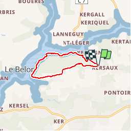
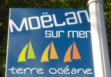
Tocht Stappen van 4,4 km beschikbaar op Bretagne, Finistère, Moëlan-sur-Mer. Deze tocht wordt voorgesteld door tracegps.
Beschrijving
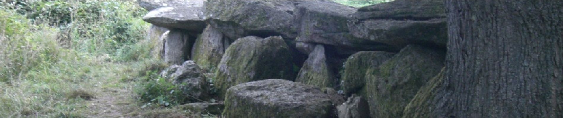
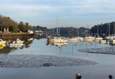
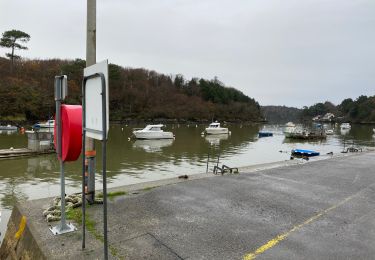
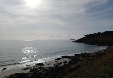
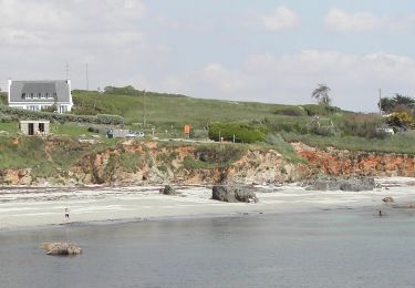
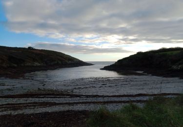
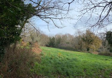
Jolie petite balade au départ de Kersaux (Kersauz) en passant par la fontaine et les sous bois le long de la rivière de Belon. Observez l'autre rive avec une superbe petite chapelle et une ostréiculture. A la sortie du bois, vous découvrirez une allée couverte remarquable pour traverser un petit village et rentrer à Kersaux par un sentier boisé.
Plaatsbepaling
Opmerkingen
Wandeltochten in de omgeving
![Tocht Stappen Moëlan-sur-Mer - Belon 16 km - Photo](https://media.geolcdn.com/t/375/260/8216e2e0-afdb-49ef-bc45-06fb5d915a7a.jpg&format=jpg&maxdim=2)
![Stappen Stappen](https://static1.geolcdn.com/sitytour/trail-icons/101.png)
Stappen
![](/images/other/stat-length.png)
![](https://static1.geolcdn.com/siteimages/upload/files/16400158638029165_repeat_loop_refresh_sync_direction_icon.png)
![Tocht Stappen Moëlan-sur-Mer - Merrien Doelan cote 11,5 km - Photo](https://media.geolcdn.com/t/375/260/599544b5-7665-42c5-9bba-b91c68249624.jpg&format=jpg&maxdim=2)
![Stappen Stappen](https://static1.geolcdn.com/sitytour/trail-icons/101.png)
Stappen
![](/images/other/stat-length.png)
![](https://static1.geolcdn.com/siteimages/upload/files/16400158638029165_repeat_loop_refresh_sync_direction_icon.png)
![Tocht Stappen Névez - NEVEZ - Photo](https://media.geolcdn.com/t/375/260/f96a5c93-27bb-45a4-9758-032ea0ee3857.jpg&format=jpg&maxdim=2)
![Stappen Stappen](https://static1.geolcdn.com/sitytour/trail-icons/101.png)
![Tocht Stappen Moëlan-sur-Mer - routoirs à lin de Pouldouran - Photo](https://media.geolcdn.com/t/375/260/3361eba2-e966-4e2b-bed4-315e6af4295a.jpg&format=jpg&maxdim=2)
![Stappen Stappen](https://static1.geolcdn.com/sitytour/trail-icons/101.png)
Stappen
![](/images/other/stat-length.png)
![](https://static1.geolcdn.com/siteimages/upload/files/16400158638029165_repeat_loop_refresh_sync_direction_icon.png)
![Tocht Te voet Moëlan-sur-Mer - FR-5 - Photo](https://media.geolcdn.com/t/375/260/7377c7e2-944d-4023-9c3d-895707207e3a.jpeg&format=jpg&maxdim=2)
![Te voet Te voet](https://static1.geolcdn.com/sitytour/trail-icons/100.png)
Te voet
![](/images/other/stat-length.png)
![](https://static1.geolcdn.com/siteimages/upload/files/16400158638029165_repeat_loop_refresh_sync_direction_icon.png)
![Tocht Stappen Moëlan-sur-Mer - MOELAN Sur MER - Photo](https://media.geolcdn.com/t/375/260/9f5d6a9f-89a4-4a35-9d4e-86b22f763fe6.jpg&format=jpg&maxdim=2)
![Stappen Stappen](https://static1.geolcdn.com/sitytour/trail-icons/101.png)
Stappen
![](/images/other/stat-length.png)
![](https://static1.geolcdn.com/siteimages/upload/files/16400158638029165_repeat_loop_refresh_sync_direction_icon.png)
![Tocht Stappen Moëlan-sur-Mer - MOËLAN sur MER - Photo](https://media.geolcdn.com/t/375/260/50c1b4de-5d6a-4ed2-b104-4b49e23459a5.jpg&format=jpg&maxdim=2)
![Stappen Stappen](https://static1.geolcdn.com/sitytour/trail-icons/101.png)
Stappen
![](/images/other/stat-length.png)
![](https://static1.geolcdn.com/siteimages/upload/files/16400158638029165_repeat_loop_refresh_sync_direction_icon.png)
![Tocht Stappen Moëlan-sur-Mer - Belon 5,6 km - Photo](https://media.geolcdn.com/t/375/260/8ab5e063-1a65-4f04-9262-32fd932aab57.jpg&format=jpg&maxdim=2)
![Stappen Stappen](https://static1.geolcdn.com/sitytour/trail-icons/101.png)
![Tocht Stappen Névez - Port Menech 16 juin 19 - Photo](https://media.geolcdn.com/t/375/260/729938cc-6031-4199-8e1b-5827b94df26a.jpg&format=jpg&maxdim=2)
![Stappen Stappen](https://static1.geolcdn.com/sitytour/trail-icons/101.png)
Stappen
![](/images/other/stat-length.png)
![](https://static1.geolcdn.com/siteimages/upload/files/16400158638029165_repeat_loop_refresh_sync_direction_icon.png)
plus port de belon