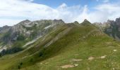

Signal de Barca - Bielle

tracegps
Gebruiker

Lengte
12,8 km

Max. hoogte
1780 m

Positief hoogteverschil
971 m

Km-Effort
26 km

Min. hoogte
844 m

Negatief hoogteverschil
971 m
Boucle
Ja
Datum van aanmaak :
2014-12-10 00:00:00.0
Laatste wijziging :
2014-12-10 00:00:00.0
5h00
Moeilijkheid : Moeilijk

Gratisgps-wandelapplicatie
Over ons
Tocht Stappen van 12,8 km beschikbaar op Nieuw-Aquitanië, Pyrénées-Atlantiques, Bielle. Deze tocht wordt voorgesteld door tracegps.
Beschrijving
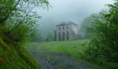
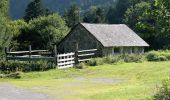
Circuit au départ du parking de la cabane de Bourdiou d'Aspeigt. Vous partez pour une montée de 1000 m environ. La montée par des chemins facile vous conduit au sommet du pic de Bareilles à 1802 m. Retour par le même chemin.
Plaatsbepaling
Land:
France
Regio :
Nieuw-Aquitanië
Departement/Provincie :
Pyrénées-Atlantiques
Gemeente :
Bielle
Locatie:
Unknown
Vertrek:(Dec)
Vertrek:(UTM)
706250 ; 4767431 (30T) N.
Opmerkingen
Wandeltochten in de omgeving
Behost


Stappen
Gemakkelijk
(1)
Béost,
Nieuw-Aquitanië,
Pyrénées-Atlantiques,
France

6 km | 9,9 km-effort
2h 59min
Ja
Pics de Cambeilh et petit Gerbe


Stappen
Gemakkelijk
(1)
Bielle,
Nieuw-Aquitanië,
Pyrénées-Atlantiques,
France

13,7 km | 27 km-effort
5h 24min
Ja
BIELLE l arriu Mage reco 3443541


Stappen
Moeilijk
Bielle,
Nieuw-Aquitanië,
Pyrénées-Atlantiques,
France

8,7 km | 14,7 km-effort
2h 47min
Ja
L'eau


Te voet
Gemakkelijk
Laruns,
Nieuw-Aquitanië,
Pyrénées-Atlantiques,
France

4,8 km | 5,9 km-effort
1h 20min
Ja
Les carrières


Te voet
Gemakkelijk
Louvie-Soubiron,
Nieuw-Aquitanië,
Pyrénées-Atlantiques,
France

3,4 km | 7 km-effort
1h 35min
Ja
La promenade des trois villages


Te voet
Gemakkelijk
Béost,
Nieuw-Aquitanië,
Pyrénées-Atlantiques,
France

5,1 km | 8,6 km-effort
1h 56min
Ja
La fontaine d'Esteret


Te voet
Gemakkelijk
Gère-Bélesten,
Nieuw-Aquitanië,
Pyrénées-Atlantiques,
France

3,7 km | 7,6 km-effort
1h 43min
Ja
L'Arriu-Mage


Te voet
Gemakkelijk
Bielle,
Nieuw-Aquitanië,
Pyrénées-Atlantiques,
France

8 km | 14 km-effort
3h 10min
Ja
Les cercles de pierre (Bilhères)


Te voet
Gemakkelijk
Bilhères,
Nieuw-Aquitanië,
Pyrénées-Atlantiques,
France

7,2 km | 11,6 km-effort
2h 37min
Ja


 SityTrail


