![](/images/other/stat-length.png)
![Tocht Stappen Saint-Jean-du-Gard - Autour du Col de St Pierre - St Jean-du-Gard - Photo](https://media.geolcdn.com/t/1900/400/ext.pjpeg?maxdim=2&url=https%3A%2F%2Fservices.sitytrail.com%2FGeolivesWS%2FDownloadMedia.ashx%3FTrailID%3D191506%26Media%3D15101_5.jpg)
Autour du Col de St Pierre - St Jean-du-Gard
tracegps
Gebruiker
![Lengte](/images/other/stat-length.png)
![Max. hoogte](https://static1.geolcdn.com/siteimages/upload/files/1508320355ic_sort_altitude_max_24dp.png)
![Positief hoogteverschil](https://static1.geolcdn.com/siteimages/upload/files/1508320355ic_sort_den_pos_24dp.png)
![Km-Effort](/images/other/stat-length.png)
![Min. hoogte](https://static1.geolcdn.com/siteimages/upload/files/1508320355ic_sort_altitude_min_24dp.png)
![Negatief hoogteverschil](https://static1.geolcdn.com/siteimages/upload/files/1508320355ic_sort_den_neg_24dp.png)
![Boucle](https://static1.geolcdn.com/siteimages/upload/files/16400158638029165_repeat_loop_refresh_sync_direction_icon.png)
![Stappen](https://static1.geolcdn.com/sitytour/trail-icons/101.png)
5h00
Moeilijkheid : Moeilijk
![Scan deze QR-code om de tocht te openen in de SityTrail-applicatie](https://capi.geolives.com/qq0zvz2zws4bq2lad0pu/sitytour/trails/191506/qr.png?size=200)
Gratisgps-wandelapplicatie
Over ons
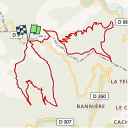
Tocht Stappen van 16,5 km beschikbaar op Occitanië, Gard, Saint-Jean-du-Gard. Deze tocht wordt voorgesteld door tracegps.
Beschrijving
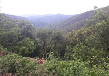
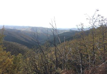
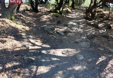
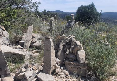
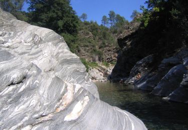
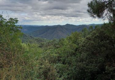
Départ au col St Pierre sur la corniche des Cévennes. 2 boucles sur le versant ouest puis sur le versant est (vallée française) à enchaîner (16km - 1000m deniv) ou à faire séparément. Balisage jaune (boucle 1), partiel jaune (boucle 2). Descendre du coté ouest sur la crête en direction du Mas du Puech puis dans la vallée de la Rancassette et remonter vers l'Affenadou et le col de St Pierre. Suivre la corniche vers l'est et prendre à gauche vers le Resses. Passer un col, quitter le goudron par la droite pour une trace qui devient sentier dans les châtaigners. Aller jusqu'à la ruine de l'Argentière puis la crête. Gagner le Cap de Lapio et descendre hors sentier pour retrouver un chemin que l'on prend à gauche. Aller au gîte de La Taillade, monter les lacets pour rejoindre le sentier de départ. Bonne randonnée !!
Plaatsbepaling
Opmerkingen
Wandeltochten in de omgeving
![Tocht Stappen Saint-Jean-du-Gard - rocher des chèvres - Photo](https://media.geolcdn.com/t/375/260/f651fafb-b1d1-4725-b624-a9394b90fcdc.jpg&format=jpg&maxdim=2)
![Stappen Stappen](https://static1.geolcdn.com/sitytour/trail-icons/101.png)
Stappen
![](/images/other/stat-length.png)
![](https://static1.geolcdn.com/siteimages/upload/files/16400158638029165_repeat_loop_refresh_sync_direction_icon.png)
![Tocht Stappen Saint-Jean-du-Gard - Signal Saint Pierre - Photo](https://media.geolcdn.com/t/375/260/c97a240b-eff8-49fc-8022-a55a2f6c33fc.jpg&format=jpg&maxdim=2)
![Stappen Stappen](https://static1.geolcdn.com/sitytour/trail-icons/101.png)
Stappen
![](/images/other/stat-length.png)
![](https://static1.geolcdn.com/siteimages/upload/files/16400158638029165_repeat_loop_refresh_sync_direction_icon.png)
![Tocht Stappen Peyrolles - la Diligence - Photo](https://media.geolcdn.com/t/375/260/586b4281-ee2f-4585-9155-506814e7d72d.jpg&format=jpg&maxdim=2)
![Stappen Stappen](https://static1.geolcdn.com/sitytour/trail-icons/101.png)
![Tocht Stappen L'Estréchure - sentier du soult - - Photo](https://media.geolcdn.com/t/375/260/a964cc92-5537-4fc7-831f-28f7bdbf37f2.jpg&format=jpg&maxdim=2)
![Stappen Stappen](https://static1.geolcdn.com/sitytour/trail-icons/101.png)
Stappen
![](/images/other/stat-length.png)
![](https://static1.geolcdn.com/siteimages/upload/files/16400158638029165_repeat_loop_refresh_sync_direction_icon.png)
![Tocht Stappen Saint-Jean-du-Gard - visite st jean du gard et de son train en attendant le bus pour Ales 1.50 - Photo](https://media.geolcdn.com/t/375/260/2380748b-87d2-4535-be2e-274dea353d02.jpg&format=jpg&maxdim=2)
![Stappen Stappen](https://static1.geolcdn.com/sitytour/trail-icons/101.png)
Stappen
![](/images/other/stat-length.png)
![](https://static1.geolcdn.com/siteimages/upload/files/16400158638029165_repeat_loop_refresh_sync_direction_icon.png)
![Tocht Stappen Saint-Étienne-Vallée-Française - Etape 10 St Étienne vallée française/St Jean du gard - Photo](https://media.geolcdn.com/t/375/260/7b929c7d-a56a-42ce-9789-2a4c4a74d1e4.jpg&format=jpg&maxdim=2)
![Stappen Stappen](https://static1.geolcdn.com/sitytour/trail-icons/101.png)
Stappen
![](/images/other/stat-length.png)
![](https://static1.geolcdn.com/siteimages/upload/files/16400158638029165_repeat_loop_refresh_sync_direction_icon.png)
![Tocht Stappen Saint-Jean-du-Gard - 17-05-2023 E12 Saint Jean du Gard - Ales - Photo](https://media.geolcdn.com/t/375/260/1d8b4717-c204-41b3-a27c-5a1aef561e2f.jpg&format=jpg&maxdim=2)
![Stappen Stappen](https://static1.geolcdn.com/sitytour/trail-icons/101.png)
Stappen
![](/images/other/stat-length.png)
![](https://static1.geolcdn.com/siteimages/upload/files/16400158638029165_repeat_loop_refresh_sync_direction_icon.png)
![Tocht Te voet Saint-Étienne-Vallée-Française - Sentier d'Auriol - Photo](https://media.geolcdn.com/t/375/260/1861d0f8-7177-4442-a4d3-a6ac51cd9385.jpeg&format=jpg&maxdim=2)
![Te voet Te voet](https://static1.geolcdn.com/sitytour/trail-icons/100.png)
Te voet
![](/images/other/stat-length.png)
![](https://static1.geolcdn.com/siteimages/upload/files/16400158638029165_repeat_loop_refresh_sync_direction_icon.png)
![Tocht Stappen Saint-Jean-du-Gard - Col St Pierre, sentier d 'Auriol - Photo](https://media.geolcdn.com/t/375/260/09e6b908-e9c5-46fb-ad14-2e4b4e0e9d95.jpg&format=jpg&maxdim=2)
![Stappen Stappen](https://static1.geolcdn.com/sitytour/trail-icons/101.png)
Stappen
![](/images/other/stat-length.png)
![](https://static1.geolcdn.com/siteimages/upload/files/16400158638029165_repeat_loop_refresh_sync_direction_icon.png)