![](/images/other/stat-length.png)
![Tocht Stappen Hoste - Randonnée de Hoste à Barst - Photo](https://media.geolcdn.com/t/1900/400/ext.pjpeg?maxdim=2&url=https%3A%2F%2Fservices.sitytrail.com%2FGeolivesWS%2FDownloadMedia.ashx%3FTrailID%3D191455%26Media%3D15048_1.jpg)
Randonnée de Hoste à Barst
tracegps
Gebruiker
![Lengte](/images/other/stat-length.png)
Lengte
13,7 km
![Max. hoogte](https://static1.geolcdn.com/siteimages/upload/files/1508320355ic_sort_altitude_max_24dp.png)
Max. hoogte
302 m
![Positief hoogteverschil](https://static1.geolcdn.com/siteimages/upload/files/1508320355ic_sort_den_pos_24dp.png)
Positief hoogteverschil
181 m
![Km-Effort](/images/other/stat-length.png)
Km-Effort
16,1 km
![Min. hoogte](https://static1.geolcdn.com/siteimages/upload/files/1508320355ic_sort_altitude_min_24dp.png)
Min. hoogte
228 m
![Negatief hoogteverschil](https://static1.geolcdn.com/siteimages/upload/files/1508320355ic_sort_den_neg_24dp.png)
Negatief hoogteverschil
181 m
![Boucle](https://static1.geolcdn.com/siteimages/upload/files/16400158638029165_repeat_loop_refresh_sync_direction_icon.png)
Boucle
Ja
Datum van aanmaak :
2014-12-10 00:00:00.0
Laatste wijziging :
2014-12-10 00:00:00.0
![Stappen](https://static1.geolcdn.com/sitytour/trail-icons/101.png)
3h00
Moeilijkheid : Medium
![Scan deze QR-code om de tocht te openen in de SityTrail-applicatie](https://capi.geolives.com/qq0zvz2zws4bq2lad0pu/sitytour/trails/191455/qr.png?size=200)
Gratisgps-wandelapplicatie
Over ons
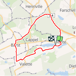
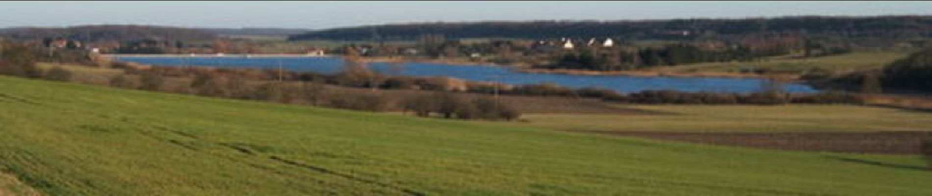
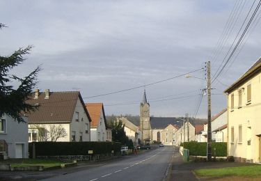
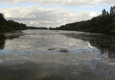
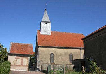
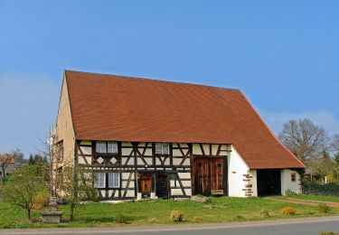
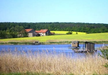
Tocht Stappen van 13,7 km beschikbaar op Grand Est, Moselle, Hoste. Deze tocht wordt voorgesteld door tracegps.
Beschrijving
Départ du parking de la salle des fêtes de Hoste. Selon la saison et les cultures, entre Barst et Cappel, il vaudra mieux emprunter la petite route de campagne, 500m plus loin plutôt que le "hors piste" du tracé GPS.
Plaatsbepaling
Land:
France
Regio :
Grand Est
Departement/Provincie :
Moselle
Gemeente :
Hoste
Locatie:
Unknown
Vertrek:(Dec)
Vertrek:(UTM)
345026 ; 5437092 (32U) N.
Opmerkingen
Wandeltochten in de omgeving
![Tocht Te voet Hoste - Circuit de Guten Brunnen - Photo](https://media.geolcdn.com/t/375/260/7a25f4ff-22c1-4802-8200-db89b7c4b482.jpeg&format=jpg&maxdim=2)
![Te voet Te voet](https://static1.geolcdn.com/sitytour/trail-icons/100.png)
Circuit de Guten Brunnen
Te voet
Gemakkelijk
Hoste,
Grand Est,
Moselle,
France
![](/images/other/stat-length.png)
11,5 km | 14 km-effort
3h 11min
![](https://static1.geolcdn.com/siteimages/upload/files/16400158638029165_repeat_loop_refresh_sync_direction_icon.png)
Ja
![Tocht Stappen Loupershouse - Autour de Metzing - Guebenhouse - Photo](https://media.geolcdn.com/t/375/260/ext.jpg?maxdim=2&url=https%3A%2F%2Fstatic1.geolcdn.com%2Fsiteimages%2Fupload%2Ffiles%2F1553511878bg_sport_marche.png)
![Stappen Stappen](https://static1.geolcdn.com/sitytour/trail-icons/101.png)
Autour de Metzing - Guebenhouse
Stappen
Gemakkelijk
(1)
Loupershouse,
Grand Est,
Moselle,
France
![](/images/other/stat-length.png)
12,3 km | 15,6 km-effort
3h 19min
![](https://static1.geolcdn.com/siteimages/upload/files/16400158638029165_repeat_loop_refresh_sync_direction_icon.png)
Ja
![Tocht Te voet Hoste - Circuit de la ligne Maginot Aquatique - Photo](https://media.geolcdn.com/t/375/260/7a25f4ff-22c1-4802-8200-db89b7c4b482.jpeg&format=jpg&maxdim=2)
![Te voet Te voet](https://static1.geolcdn.com/sitytour/trail-icons/100.png)
Circuit de la ligne Maginot Aquatique
Te voet
Gemakkelijk
Hoste,
Grand Est,
Moselle,
France
![](/images/other/stat-length.png)
4,7 km | 5,6 km-effort
1h 16min
![](https://static1.geolcdn.com/siteimages/upload/files/16400158638029165_repeat_loop_refresh_sync_direction_icon.png)
Neen
![Tocht Stappen Saint-Jean-Rohrbach - lac diefenbach - Photo](https://media.geolcdn.com/t/375/260/ext.jpg?maxdim=2&url=https%3A%2F%2Fservices.sitytrail.com%2FGeolivesWS%2FDownloadMedia.ashx%3FTrailID%3D359422%26Media%3Dfix__20140817174802.jpg)
![Stappen Stappen](https://static1.geolcdn.com/sitytour/trail-icons/101.png)
lac diefenbach
Stappen
Gemakkelijk
Saint-Jean-Rohrbach,
Grand Est,
Moselle,
France
![](/images/other/stat-length.png)
4,4 km | 5,5 km-effort
1h 14min
![](https://static1.geolcdn.com/siteimages/upload/files/16400158638029165_repeat_loop_refresh_sync_direction_icon.png)
Ja
![Tocht Stappen Barst - Boucle au départ de Barst - Photo](https://media.geolcdn.com/t/375/260/ext.jpg?maxdim=2&url=https%3A%2F%2Fservices.sitytrail.com%2FGeolivesWS%2FDownloadMedia.ashx%3FTrailID%3D317539%26Media%3D16785_6.jpg)
![Stappen Stappen](https://static1.geolcdn.com/sitytour/trail-icons/101.png)
Boucle au départ de Barst
Stappen
Medium
Barst,
Grand Est,
Moselle,
France
![](/images/other/stat-length.png)
14,5 km | 17,1 km-effort
3h 0min
![](https://static1.geolcdn.com/siteimages/upload/files/16400158638029165_repeat_loop_refresh_sync_direction_icon.png)
Ja
![Tocht Te voet Guenviller - Circuit de la Nied Allemande - Photo](https://media.geolcdn.com/t/375/260/dfd79c84-9a3f-4086-992f-c32e115ae46c.jpeg&format=jpg&maxdim=2)
![Te voet Te voet](https://static1.geolcdn.com/sitytour/trail-icons/100.png)
Circuit de la Nied Allemande
Te voet
Gemakkelijk
Guenviller,
Grand Est,
Moselle,
France
![](/images/other/stat-length.png)
9,7 km | 11,4 km-effort
2h 34min
![](https://static1.geolcdn.com/siteimages/upload/files/16400158638029165_repeat_loop_refresh_sync_direction_icon.png)
Neen
![Tocht Mountainbike Puttelange-aux-Lacs - Randonnée au Pays des Lacs - Puttelange aux Lacs - Photo](https://media.geolcdn.com/t/375/260/ext.jpg?maxdim=2&url=https%3A%2F%2Fservices.sitytrail.com%2FGeolivesWS%2FDownloadMedia.ashx%3FTrailID%3D103623%26Media%3D6013_2.jpg)
![Mountainbike Mountainbike](https://static1.geolcdn.com/sitytour/trail-icons/202.png)
Randonnée au Pays des Lacs - Puttelange aux Lacs
Mountainbike
Moeilijk
(1)
Puttelange-aux-Lacs,
Grand Est,
Moselle,
France
![](/images/other/stat-length.png)
56 km | 69 km-effort
4h 0min
![](https://static1.geolcdn.com/siteimages/upload/files/16400158638029165_repeat_loop_refresh_sync_direction_icon.png)
Ja
![Tocht Stappen Farschviller - cappel - Photo](https://media.geolcdn.com/t/375/260/ext.jpg?maxdim=2&url=https%3A%2F%2Fstatic1.geolcdn.com%2Fsiteimages%2Fupload%2Ffiles%2F1553511878bg_sport_marche.png)
![Stappen Stappen](https://static1.geolcdn.com/sitytour/trail-icons/101.png)
cappel
Stappen
Gemakkelijk
Farschviller,
Grand Est,
Moselle,
France
![](/images/other/stat-length.png)
4,9 km | 5,6 km-effort
3h 40min
![](https://static1.geolcdn.com/siteimages/upload/files/16400158638029165_repeat_loop_refresh_sync_direction_icon.png)
Ja
![Tocht Stappen Farschviller - cappel - Photo](https://media.geolcdn.com/t/375/260/ext.jpg?maxdim=2&url=https%3A%2F%2Fstatic1.geolcdn.com%2Fsiteimages%2Fupload%2Ffiles%2F1553511878bg_sport_marche.png)
![Stappen Stappen](https://static1.geolcdn.com/sitytour/trail-icons/101.png)