![](/images/other/stat-length.png)
![Tocht Stappen Saint-Louis-lès-Bitche - Voie ferrée militaire de Saint-Louis à Simserhof - Ligne Maginot - Photo](https://media.geolcdn.com/t/1900/400/ext.pjpeg?maxdim=2&url=https%3A%2F%2Fservices.sitytrail.com%2FGeolivesWS%2FDownloadMedia.ashx%3FTrailID%3D191348%26Media%3D14912_6.jpg)
Voie ferrée militaire de Saint-Louis à Simserhof - Ligne Maginot
tracegps
Gebruiker
![Lengte](/images/other/stat-length.png)
![Max. hoogte](https://static1.geolcdn.com/siteimages/upload/files/1508320355ic_sort_altitude_max_24dp.png)
![Positief hoogteverschil](https://static1.geolcdn.com/siteimages/upload/files/1508320355ic_sort_den_pos_24dp.png)
![Km-Effort](/images/other/stat-length.png)
![Min. hoogte](https://static1.geolcdn.com/siteimages/upload/files/1508320355ic_sort_altitude_min_24dp.png)
![Negatief hoogteverschil](https://static1.geolcdn.com/siteimages/upload/files/1508320355ic_sort_den_neg_24dp.png)
![Boucle](https://static1.geolcdn.com/siteimages/upload/files/16400158638029165_repeat_loop_refresh_sync_direction_icon.png)
![Stappen](https://static1.geolcdn.com/sitytour/trail-icons/101.png)
6h00
Moeilijkheid : Moeilijk
![Scan deze QR-code om de tocht te openen in de SityTrail-applicatie](https://capi.geolives.com/qq0zvz2zws4bq2lad0pu/sitytour/trails/191348/qr.png?size=200)
Gratisgps-wandelapplicatie
Over ons
Tocht Stappen van 27 km beschikbaar op Grand Est, Moselle, Saint-Louis-lès-Bitche. Deze tocht wordt voorgesteld door tracegps.
Beschrijving
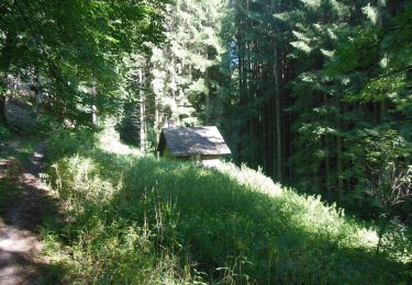
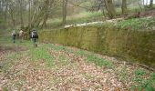
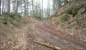
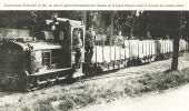
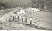
Le parcours débute à la gare d'échange de Saint-Louis-lès-Bitche où arrivaient les trains de munitions en provenance de Wingen-sur-Moder. Les munitions étaient déchargées des wagons à écartement normal (1,435m) sur des wagonnets à écartement 60cm. A la gare militaire de Saint-Louis étaient entretenus les locomotives et les wagons dans des ateliers dont il subsiste encore les soubassements et le château d'eau. De nombreux fossés, aqueducs, ponceaux, murs de soutènement sont encore visibles sur le parcours transformé en chemin forestier avec le ballast. Des parties de voie en tranchée ou en remblai laissent deviner l'existence d'une voie ferrée. Deux parties de voie en heutoir permettaient de rebrousser pour franchir la colline du Légeret. Devant l'entrée des munitions du Simserhof stationnent des wagonnets témoins de cette ligne qui ne demande qu'à être valorisée par un balisage pédestre pour en permettre plus facilement la randonnée. Téléchargez la carte du trajet .
Plaatsbepaling
Opmerkingen
Wandeltochten in de omgeving
![Tocht Stappen Saint-Louis-lès-Bitche - Saint-Louis-Lès-Bitche et le pays du verre et du cristal - Photo](https://media.geolcdn.com/t/375/260/ext.jpg?maxdim=2&url=https%3A%2F%2Fservices.sitytrail.com%2FGeolivesWS%2FDownloadMedia.ashx%3FTrailID%3D317570%26Media%3D16827_6.jpg)
![Stappen Stappen](https://static1.geolcdn.com/sitytour/trail-icons/101.png)
Stappen
![](/images/other/stat-length.png)
![](https://static1.geolcdn.com/siteimages/upload/files/16400158638029165_repeat_loop_refresh_sync_direction_icon.png)
![Tocht Paardrijden Lemberg - suuntoapp-HorsebackRiding-2024-11-11T08-51-25Z - Photo](https://media.geolcdn.com/t/375/260/ea9311dd-1d9e-48ba-a2e2-24731aca39a9.jpg&format=jpg&maxdim=2)
![Paardrijden Paardrijden](https://static1.geolcdn.com/sitytour/trail-icons/301.png)
Paardrijden
![](/images/other/stat-length.png)
![](https://static1.geolcdn.com/siteimages/upload/files/16400158638029165_repeat_loop_refresh_sync_direction_icon.png)
![Tocht Paardrijden Soucht - suuntoapp-HorsebackRiding-2024-11-10T08-15-44Z - Photo](https://media.geolcdn.com/t/375/260/d294c360-1d28-4f9f-ab80-3f1d986cc1d0.jpg&format=jpg&maxdim=2)
![Paardrijden Paardrijden](https://static1.geolcdn.com/sitytour/trail-icons/301.png)
Paardrijden
![](/images/other/stat-length.png)
![](https://static1.geolcdn.com/siteimages/upload/files/16400158638029165_repeat_loop_refresh_sync_direction_icon.png)
![Tocht Paardrijden Soucht - suuntoapp-HorsebackRiding-2024-11-09T08-23-34Z - Photo](https://media.geolcdn.com/t/375/260/0bfc4fa4-827c-4487-84af-819b72092ea6.jpg&format=jpg&maxdim=2)
![Paardrijden Paardrijden](https://static1.geolcdn.com/sitytour/trail-icons/301.png)
Paardrijden
![](/images/other/stat-length.png)
![](https://static1.geolcdn.com/siteimages/upload/files/16400158638029165_repeat_loop_refresh_sync_direction_icon.png)
![Tocht Te voet Montbronn - Circuit des calvaires n°4 - Photo](https://media.geolcdn.com/t/375/260/a7b9a56e-05f0-4134-ac47-01c83168e22f.jpeg&format=jpg&maxdim=2)
![Te voet Te voet](https://static1.geolcdn.com/sitytour/trail-icons/100.png)
Te voet
![](/images/other/stat-length.png)
![](https://static1.geolcdn.com/siteimages/upload/files/16400158638029165_repeat_loop_refresh_sync_direction_icon.png)
![Tocht Te voet Butten - Anneau bleu - Photo](https://media.geolcdn.com/t/375/260/81231655-9cac-4d3c-8b6a-5b23a7072ecc.jpeg&format=jpg&maxdim=2)
![Te voet Te voet](https://static1.geolcdn.com/sitytour/trail-icons/100.png)
Te voet
![](/images/other/stat-length.png)
![](https://static1.geolcdn.com/siteimages/upload/files/16400158638029165_repeat_loop_refresh_sync_direction_icon.png)
![Tocht Te voet Butten - Anneau rouge - Photo](https://media.geolcdn.com/t/375/260/81231655-9cac-4d3c-8b6a-5b23a7072ecc.jpeg&format=jpg&maxdim=2)
![Te voet Te voet](https://static1.geolcdn.com/sitytour/trail-icons/100.png)
Te voet
![](/images/other/stat-length.png)
![](https://static1.geolcdn.com/siteimages/upload/files/16400158638029165_repeat_loop_refresh_sync_direction_icon.png)
![Tocht Te voet Volksberg - Anneau vert - Photo](https://media.geolcdn.com/t/375/260/e2590e39-af6c-4003-9899-64cc7064b496.jpeg&format=jpg&maxdim=2)
![Te voet Te voet](https://static1.geolcdn.com/sitytour/trail-icons/100.png)
Te voet
![](/images/other/stat-length.png)
![](https://static1.geolcdn.com/siteimages/upload/files/16400158638029165_repeat_loop_refresh_sync_direction_icon.png)
![Tocht Te voet Meisenthal - Sur les traces des Verriers et des Sabotiers - circuit 2 - Photo](https://media.geolcdn.com/t/375/260/6caab5bb-203b-4360-b4ea-26455e163371.jpeg&format=jpg&maxdim=2)
![Te voet Te voet](https://static1.geolcdn.com/sitytour/trail-icons/100.png)
Te voet
![](/images/other/stat-length.png)
![](https://static1.geolcdn.com/siteimages/upload/files/16400158638029165_repeat_loop_refresh_sync_direction_icon.png)