


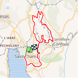

14,4 km | 18 km-effort


Gebruiker


Gratisgps-wandelapplicatie
 SityTrail
IGN / Geografische instituten
SityTrail World
De wereld gaat voor u open
Tocht Mountainbike van 19,4 km beschikbaar op Provence-Alpes-Côte d'Azur, Bouches-du-Rhône, Saint-Chamas. Deze tocht wordt voorgesteld door gloeren.
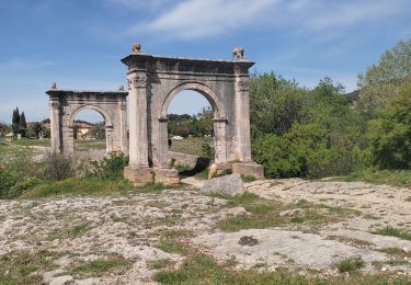
départ de st Chamas, passage par le pont Flavien,direction vers la Moria, remonter la Touloubre vers le nord, passage près du pont de Rhaud, puis vers le Mas de Guerin, puis retour St Chamas par la route.
Stappen
Stappen

Stappen
Stappen

Mountainbike

Stappen

Stappen
Stappen
Stappen