![](/images/other/stat-length.png)
![Tocht Stappen Vernosc-lès-Annonay - N_VERNOSC 07430 Vert-Balais-pn - Photo](https://media.geolcdn.com/t/1900/400/ext.pjpeg?maxdim=2&url=https%3A%2F%2Fstatic1.geolcdn.com%2Fsiteimages%2Fupload%2Ffiles%2F1553511878bg_sport_marche.png)
N_VERNOSC 07430 Vert-Balais-pn
ANDREJAC
Gebruiker
![Lengte](/images/other/stat-length.png)
Lengte
12,6 km
![Max. hoogte](https://static1.geolcdn.com/siteimages/upload/files/1508320355ic_sort_altitude_max_24dp.png)
Max. hoogte
379 m
![Positief hoogteverschil](https://static1.geolcdn.com/siteimages/upload/files/1508320355ic_sort_den_pos_24dp.png)
Positief hoogteverschil
304 m
![Km-Effort](/images/other/stat-length.png)
Km-Effort
16,6 km
![Min. hoogte](https://static1.geolcdn.com/siteimages/upload/files/1508320355ic_sort_altitude_min_24dp.png)
Min. hoogte
170 m
![Negatief hoogteverschil](https://static1.geolcdn.com/siteimages/upload/files/1508320355ic_sort_den_neg_24dp.png)
Negatief hoogteverschil
305 m
![Boucle](https://static1.geolcdn.com/siteimages/upload/files/16400158638029165_repeat_loop_refresh_sync_direction_icon.png)
Boucle
Ja
Datum van aanmaak :
2016-10-26 00:00:00.0
Laatste wijziging :
2016-10-26 00:00:00.0
![Stappen](https://static1.geolcdn.com/sitytour/trail-icons/101.png)
5h00
Moeilijkheid : Medium
![Scan deze QR-code om de tocht te openen in de SityTrail-applicatie](https://capi.geolives.com/qq0zvz2zws4bq2lad0pu/sitytour/trails/188913/qr.png?size=200)
Gratisgps-wandelapplicatie
Over ons
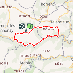
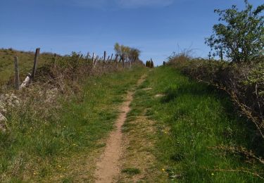
Tocht Stappen van 12,6 km beschikbaar op Auvergne-Rhône-Alpes, Ardèche, Vernosc-lès-Annonay. Deze tocht wordt voorgesteld door ANDREJAC.
Beschrijving
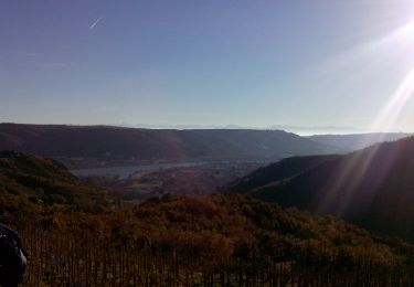
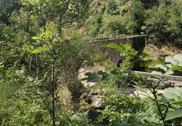
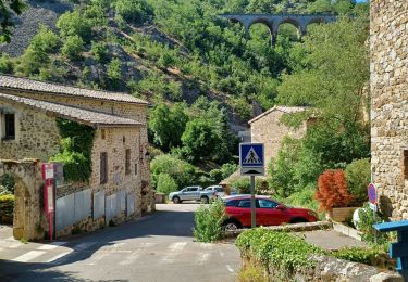
Départ de Tourtel (Vallée de la Cance). Montée vers Vert,Balais,descente le long du ravin des Singles, remontée de la vallée de la Cance jusqu''à Tourtel
Plaatsbepaling
Land:
France
Regio :
Auvergne-Rhône-Alpes
Departement/Provincie :
Ardèche
Gemeente :
Vernosc-lès-Annonay
Locatie:
Unknown
Vertrek:(Dec)
Vertrek:(UTM)
636483 ; 5007998 (31T) N.
Opmerkingen
Wandeltochten in de omgeving
![Tocht Stappen Sarras - F07 Sarras Ardoix 2013 12 - Photo](https://media.geolcdn.com/t/375/260/ext.jpg?maxdim=2&url=https%3A%2F%2Fservices.sitytrail.com%2FGeolivesWS%2FDownloadMedia.ashx%3FTrailID%3D237787%26Media%3Dfix__20131217101813.jpg)
![Stappen Stappen](https://static1.geolcdn.com/sitytour/trail-icons/101.png)
F07 Sarras Ardoix 2013 12
Stappen
Gemakkelijk
(3)
Sarras,
Auvergne-Rhône-Alpes,
Ardèche,
France
![](/images/other/stat-length.png)
15 km | 21 km-effort
4h 59min
![](https://static1.geolcdn.com/siteimages/upload/files/16400158638029165_repeat_loop_refresh_sync_direction_icon.png)
Ja
![Tocht Stappen Andance - 07 andance - Photo](https://media.geolcdn.com/t/375/260/3704a4bb-279a-42ef-a199-e4d061ea849a.jpg&format=jpg&maxdim=2)
![Stappen Stappen](https://static1.geolcdn.com/sitytour/trail-icons/101.png)
07 andance
Stappen
Medium
Andance,
Auvergne-Rhône-Alpes,
Ardèche,
France
![](/images/other/stat-length.png)
16,3 km | 25 km-effort
6h 4min
![](https://static1.geolcdn.com/siteimages/upload/files/16400158638029165_repeat_loop_refresh_sync_direction_icon.png)
Neen
![Tocht Mountainbike Sarras - sarras eclassan ardoix sarras - Photo](https://media.geolcdn.com/t/375/260/ext.jpg?maxdim=2&url=https%3A%2F%2Fstatic1.geolcdn.com%2Fsiteimages%2Fupload%2Ffiles%2F1524743154velo.jpg)
![Mountainbike Mountainbike](https://static1.geolcdn.com/sitytour/trail-icons/202.png)
sarras eclassan ardoix sarras
Mountainbike
Gemakkelijk
(2)
Sarras,
Auvergne-Rhône-Alpes,
Ardèche,
France
![](/images/other/stat-length.png)
31 km | 42 km-effort
2h 40min
![](https://static1.geolcdn.com/siteimages/upload/files/16400158638029165_repeat_loop_refresh_sync_direction_icon.png)
Ja
![Tocht sport Vernosc-lès-Annonay - Les passerelles de la Cance Vernosc - Photo](https://media.geolcdn.com/t/375/260/ae3ac81d-f44c-4292-b688-0cdbe25cdc15.jpg&format=jpg&maxdim=2)
Les passerelles de la Cance Vernosc
sport
Heel gemakkelijk
Vernosc-lès-Annonay,
Auvergne-Rhône-Alpes,
Ardèche,
France
![](/images/other/stat-length.png)
10,5 km | 15,2 km-effort
Onbekend
![](https://static1.geolcdn.com/siteimages/upload/files/16400158638029165_repeat_loop_refresh_sync_direction_icon.png)
Ja
![Tocht sport Thorrenc - Thorrenc - Photo](https://media.geolcdn.com/t/375/260/71e25f74-b06f-4000-bbd5-468315489073.jpg&format=jpg&maxdim=2)
Thorrenc
sport
Heel gemakkelijk
Thorrenc,
Auvergne-Rhône-Alpes,
Ardèche,
France
![](/images/other/stat-length.png)
14,5 km | 18,8 km-effort
Onbekend
![](https://static1.geolcdn.com/siteimages/upload/files/16400158638029165_repeat_loop_refresh_sync_direction_icon.png)
Ja
![Tocht Lopen Quintenas - roche Péréandre, pont suspendu circuit - Photo](https://media.geolcdn.com/t/375/260/1ca2ef30-37ec-41a5-8885-fe3e88c20bbf.jpg&format=jpg&maxdim=2)
![Lopen Lopen](https://static1.geolcdn.com/sitytour/trail-icons/103.png)
roche Péréandre, pont suspendu circuit
Lopen
Medium
Quintenas,
Auvergne-Rhône-Alpes,
Ardèche,
France
![](/images/other/stat-length.png)
11,6 km | 16,1 km-effort
1h 35min
![](https://static1.geolcdn.com/siteimages/upload/files/16400158638029165_repeat_loop_refresh_sync_direction_icon.png)
Ja
![Tocht Stappen Andance - 07 andance zel 01.12.2022 - Photo](https://media.geolcdn.com/t/375/260/f0f78084-bdfc-4a38-9061-d2f2a3c14a59.jpg&format=jpg&maxdim=2)
![Stappen Stappen](https://static1.geolcdn.com/sitytour/trail-icons/101.png)
07 andance zel 01.12.2022
Stappen
Medium
Andance,
Auvergne-Rhône-Alpes,
Ardèche,
France
![](/images/other/stat-length.png)
17,3 km | 27 km-effort
6h 54min
![](https://static1.geolcdn.com/siteimages/upload/files/16400158638029165_repeat_loop_refresh_sync_direction_icon.png)
Ja
![Tocht Stappen Thorrenc - Le lac de vert - Photo](https://media.geolcdn.com/t/375/260/e2b7581b-e010-43b2-8a77-00836feaf2e3.jpg&format=jpg&maxdim=2)
![Stappen Stappen](https://static1.geolcdn.com/sitytour/trail-icons/101.png)
Le lac de vert
Stappen
Zeer moeilijk
(1)
Thorrenc,
Auvergne-Rhône-Alpes,
Ardèche,
France
![](/images/other/stat-length.png)
14,9 km | 19,3 km-effort
6h 48min
![](https://static1.geolcdn.com/siteimages/upload/files/16400158638029165_repeat_loop_refresh_sync_direction_icon.png)
Ja
![Tocht Stappen Talencieux - 07 talencieux oraganise - Photo](https://media.geolcdn.com/t/375/260/4eebbb77-72fe-4fbd-8999-0884f3320d5e.jpg&format=jpg&maxdim=2)
![Stappen Stappen](https://static1.geolcdn.com/sitytour/trail-icons/101.png)
07 talencieux oraganise
Stappen
Gemakkelijk
Talencieux,
Auvergne-Rhône-Alpes,
Ardèche,
France
![](/images/other/stat-length.png)
14 km | 17,7 km-effort
3h 5min
![](https://static1.geolcdn.com/siteimages/upload/files/16400158638029165_repeat_loop_refresh_sync_direction_icon.png)
Neen