![](/images/other/stat-length.png)
![Tocht Stappen Evolène - YHH003 Les Haudères - Grimentz (1er jour) - Photo](https://media.geolcdn.com/t/1900/400/ext.pjpeg?maxdim=2&url=https%3A%2F%2Fstatic1.geolcdn.com%2Fsiteimages%2Fupload%2Ffiles%2F1553511878bg_sport_marche.png)
YHH003 Les Haudères - Grimentz (1er jour)
yveshumbert
Gebruiker
![Lengte](/images/other/stat-length.png)
![Max. hoogte](https://static1.geolcdn.com/siteimages/upload/files/1508320355ic_sort_altitude_max_24dp.png)
![Positief hoogteverschil](https://static1.geolcdn.com/siteimages/upload/files/1508320355ic_sort_den_pos_24dp.png)
![Km-Effort](/images/other/stat-length.png)
![Min. hoogte](https://static1.geolcdn.com/siteimages/upload/files/1508320355ic_sort_altitude_min_24dp.png)
![Negatief hoogteverschil](https://static1.geolcdn.com/siteimages/upload/files/1508320355ic_sort_den_neg_24dp.png)
![Boucle](https://static1.geolcdn.com/siteimages/upload/files/16400158638029165_repeat_loop_refresh_sync_direction_icon.png)
![Stappen](https://static1.geolcdn.com/sitytour/trail-icons/101.png)
5h55
Moeilijkheid : Zeer moeilijk
![Scan deze QR-code om de tocht te openen in de SityTrail-applicatie](https://capi.geolives.com/qq0zvz2zws4bq2lad0pu/sitytour/trails/18364/qr.png?size=200)
Gratisgps-wandelapplicatie
Over ons
Tocht Stappen van 9,3 km beschikbaar op Valais/Wallis, Hérens, Evolène. Deze tocht wordt voorgesteld door yveshumbert.
Beschrijving
"Pour faire cette ballade nous avons profité des transports en commun.
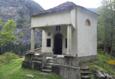
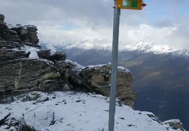
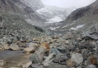
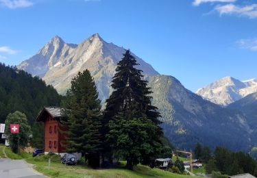
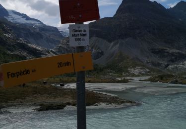
Nous avons laissé notre voiture à la gare de Sion pour prendre le bus jusqu’au Haudères. De là nous avons pris un deuxième bus pour la Forclaz. Cette partie peut aussi se faire à pied, cela vous rallongera votre ballade d’une heure. De La Forclaz nous avons commencé notre marche. Le sentier au début est assez large et permet à un 4X4 de monter. A partir du hameau de Motau (1924 m), le sentier n’est plus carrossable. On continue à monter jusqu’à Le Tsaté, où vous pourrez voir de joli chalet typique de la région. Le chemin continue a bien monté jusqu’au Remointse du Tsaté. De là, la pente est moins rude, puis le chemin commence a bien remonter pour arriver au col de Tsaté (2868 m). La descente sur le lac (2349 m) se fait par un chemin agréable. Le chemin recommence ensuite à monter jusqu’à la cabane Moiry. A la cabane les matelas sont serrés, mais en contre partie la nourriture était excellente
"
Plaatsbepaling
Opmerkingen
Wandeltochten in de omgeving
![Tocht Te voet Evolène - Tour pédestre du Val d'Hérens - Photo](https://media.geolcdn.com/t/375/260/d60cf38c-77bf-4129-9294-d60e6b1dffc9.jpeg&format=jpg&maxdim=2)
![Te voet Te voet](https://static1.geolcdn.com/sitytour/trail-icons/100.png)
Te voet
![](/images/other/stat-length.png)
![](https://static1.geolcdn.com/siteimages/upload/files/16400158638029165_repeat_loop_refresh_sync_direction_icon.png)
![Tocht Stappen Anniviers - Grimentz, Cabane de Moiry - Photo](https://media.geolcdn.com/t/375/260/ext.jpg?maxdim=2&url=https%3A%2F%2Fstatic1.geolcdn.com%2Fsiteimages%2Fupload%2Ffiles%2F1553511878bg_sport_marche.png)
![Stappen Stappen](https://static1.geolcdn.com/sitytour/trail-icons/101.png)
Stappen
![](/images/other/stat-length.png)
![](https://static1.geolcdn.com/siteimages/upload/files/16400158638029165_repeat_loop_refresh_sync_direction_icon.png)
![Tocht Te voet Evolène - Volvovron - L'A Vieille - Photo](https://media.geolcdn.com/t/375/260/5c03b540-8f8c-485d-804b-53ff835b3e8f.jpeg&format=jpg&maxdim=2)
![Te voet Te voet](https://static1.geolcdn.com/sitytour/trail-icons/100.png)
Te voet
![](/images/other/stat-length.png)
![](https://static1.geolcdn.com/siteimages/upload/files/16400158638029165_repeat_loop_refresh_sync_direction_icon.png)
![Tocht Te voet Evolène - Cotter - Volvovron - Photo](https://media.geolcdn.com/t/375/260/36ba09c3-e79b-4a55-a676-8e981d39bb91.jpeg&format=jpg&maxdim=2)
![Te voet Te voet](https://static1.geolcdn.com/sitytour/trail-icons/100.png)
Te voet
![](/images/other/stat-length.png)
![](https://static1.geolcdn.com/siteimages/upload/files/16400158638029165_repeat_loop_refresh_sync_direction_icon.png)
![Tocht Stappen Evolène - CHX ZRMT Étape 7 de La Sage à Zinal - Photo](https://media.geolcdn.com/t/375/260/ext.jpg?maxdim=2&url=https%3A%2F%2Fservices.sitytrail.com%2FGeolivesWS%2FDownloadMedia.ashx%3FTrailID%3D635935%26Media%3Dfix__20160919103137.jpg)
![Stappen Stappen](https://static1.geolcdn.com/sitytour/trail-icons/101.png)
Stappen
![](/images/other/stat-length.png)
![](https://static1.geolcdn.com/siteimages/upload/files/16400158638029165_repeat_loop_refresh_sync_direction_icon.png)
![Tocht Stappen Evolène - glacier mont miné - Photo](https://media.geolcdn.com/t/375/260/849256b3-79a0-4e3d-a14f-3b9ab44c6963.jpg&format=jpg&maxdim=2)
![Stappen Stappen](https://static1.geolcdn.com/sitytour/trail-icons/101.png)
Stappen
![](/images/other/stat-length.png)
![](https://static1.geolcdn.com/siteimages/upload/files/16400158638029165_repeat_loop_refresh_sync_direction_icon.png)
![Tocht Stappen Evolène - La Haute Route : J6 - Photo](https://media.geolcdn.com/t/375/260/6da9f12a-c8f6-41a8-be78-ed229f95d453.jpg&format=jpg&maxdim=2)
![Stappen Stappen](https://static1.geolcdn.com/sitytour/trail-icons/101.png)
Stappen
![](/images/other/stat-length.png)
![](https://static1.geolcdn.com/siteimages/upload/files/16400158638029165_repeat_loop_refresh_sync_direction_icon.png)
![Tocht Noords wandelen Evolène - glacier Miné - Photo](https://media.geolcdn.com/t/375/260/8aaa6fb9-4c35-4013-acf1-a4e5b7d6886c.jpg&format=jpg&maxdim=2)
![Noords wandelen Noords wandelen](https://static1.geolcdn.com/sitytour/trail-icons/102.png)
Noords wandelen
![](/images/other/stat-length.png)
![](https://static1.geolcdn.com/siteimages/upload/files/16400158638029165_repeat_loop_refresh_sync_direction_icon.png)
![Tocht Stappen Evolène - vs_hike674d - Photo](https://media.geolcdn.com/t/375/260/ext.jpg?maxdim=2&url=https%3A%2F%2Fstatic1.geolcdn.com%2Fsiteimages%2Fupload%2Ffiles%2F1553511878bg_sport_marche.png)
![Stappen Stappen](https://static1.geolcdn.com/sitytour/trail-icons/101.png)
Stappen
![](/images/other/stat-length.png)
![](https://static1.geolcdn.com/siteimages/upload/files/16400158638029165_repeat_loop_refresh_sync_direction_icon.png)