![](/images/other/stat-length.png)
![Tocht Stappen Pinel-Hauterive - Rando ASPTT du 2013/04/04 _ Saint-Pierre de Caubel (47380) - Photo](https://media.geolcdn.com/t/1900/400/ext.pjpeg?maxdim=2&url=https%3A%2F%2Fstatic1.geolcdn.com%2Fsiteimages%2Fupload%2Ffiles%2F1553511878bg_sport_marche.png)
Rando ASPTT du 2013/04/04 _ Saint-Pierre de Caubel (47380)
Elbe
Gebruiker
![Lengte](/images/other/stat-length.png)
Lengte
12,3 km
![Max. hoogte](https://static1.geolcdn.com/siteimages/upload/files/1508320355ic_sort_altitude_max_24dp.png)
Max. hoogte
208 m
![Positief hoogteverschil](https://static1.geolcdn.com/siteimages/upload/files/1508320355ic_sort_den_pos_24dp.png)
Positief hoogteverschil
252 m
![Km-Effort](/images/other/stat-length.png)
Km-Effort
15,7 km
![Min. hoogte](https://static1.geolcdn.com/siteimages/upload/files/1508320355ic_sort_altitude_min_24dp.png)
Min. hoogte
77 m
![Negatief hoogteverschil](https://static1.geolcdn.com/siteimages/upload/files/1508320355ic_sort_den_neg_24dp.png)
Negatief hoogteverschil
253 m
![Boucle](https://static1.geolcdn.com/siteimages/upload/files/16400158638029165_repeat_loop_refresh_sync_direction_icon.png)
Boucle
Ja
Datum van aanmaak :
2014-12-10 00:00:00.0
Laatste wijziging :
2014-12-10 00:00:00.0
![Stappen](https://static1.geolcdn.com/sitytour/trail-icons/101.png)
3h22
Moeilijkheid : Medium
![Scan deze QR-code om de tocht te openen in de SityTrail-applicatie](https://capi.geolives.com/qq0zvz2zws4bq2lad0pu/sitytour/trails/183189/qr.png?size=200)
Gratisgps-wandelapplicatie
Over ons
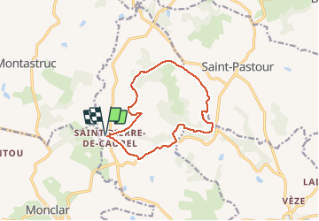
Tocht Stappen van 12,3 km beschikbaar op Nieuw-Aquitanië, Lot-et-Garonne, Pinel-Hauterive. Deze tocht wordt voorgesteld door Elbe.
Beschrijving
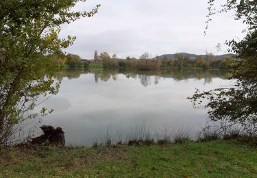
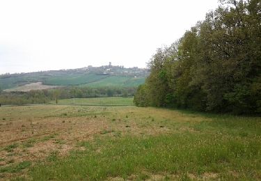
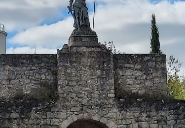
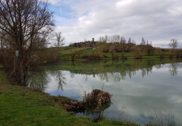
Départ du parking de l'église de Saint-Pierre de Caubel vers Caussade, Roche Haut, Auzac, Latapie, puis retour à l'église.
Plaatsbepaling
Land:
France
Regio :
Nieuw-Aquitanië
Departement/Provincie :
Lot-et-Garonne
Gemeente :
Pinel-Hauterive
Locatie:
Unknown
Vertrek:(Dec)
Vertrek:(UTM)
305026 ; 4926806 (31T) N.
Opmerkingen
Wandeltochten in de omgeving
![Tocht Noords wandelen Monclar - Monclar M N 17 11 2019 - Photo](https://media.geolcdn.com/t/375/260/351c62c9-93c3-4c20-b365-630ba1325c1b.jpg&format=jpg&maxdim=2)
![Noords wandelen Noords wandelen](https://static1.geolcdn.com/sitytour/trail-icons/102.png)
Monclar M N 17 11 2019
Noords wandelen
Gemakkelijk
Monclar,
Nieuw-Aquitanië,
Lot-et-Garonne,
France
![](/images/other/stat-length.png)
10,2 km | 12,5 km-effort
1h 58min
![](https://static1.geolcdn.com/siteimages/upload/files/16400158638029165_repeat_loop_refresh_sync_direction_icon.png)
Ja
![Tocht Stappen Monclar - ASPTT du 2014-03-11 Monclar - Photo](https://media.geolcdn.com/t/375/260/ext.jpg?maxdim=2&url=https%3A%2F%2Fservices.sitytrail.com%2FGeolivesWS%2FDownloadMedia.ashx%3FTrailID%3D265549%26Media%3Dfix__20140411110810.jpg)
![Stappen Stappen](https://static1.geolcdn.com/sitytour/trail-icons/101.png)
ASPTT du 2014-03-11 Monclar
Stappen
Medium
(1)
Monclar,
Nieuw-Aquitanië,
Lot-et-Garonne,
France
![](/images/other/stat-length.png)
11,3 km | 13,8 km-effort
2h 59min
![](https://static1.geolcdn.com/siteimages/upload/files/16400158638029165_repeat_loop_refresh_sync_direction_icon.png)
Ja
![Tocht Stappen Saint-Pastour - Saint Pastour - Photo](https://media.geolcdn.com/t/375/260/da29f341-84f5-4626-b890-2152cbc96ccc.jpg&format=jpg&maxdim=2)
![Stappen Stappen](https://static1.geolcdn.com/sitytour/trail-icons/101.png)
Saint Pastour
Stappen
Medium
Saint-Pastour,
Nieuw-Aquitanië,
Lot-et-Garonne,
France
![](/images/other/stat-length.png)
6,5 km | 8,2 km-effort
2h 13min
![](https://static1.geolcdn.com/siteimages/upload/files/16400158638029165_repeat_loop_refresh_sync_direction_icon.png)
Ja
![Tocht Stappen Monclar - Montclar - Photo](https://media.geolcdn.com/t/375/260/ext.jpg?maxdim=2&url=https%3A%2F%2Fservices.sitytrail.com%2FGeolivesWS%2FDownloadMedia.ashx%3FTrailID%3D1119919%26Media%3Dfix__20190308163534.jpg)
![Stappen Stappen](https://static1.geolcdn.com/sitytour/trail-icons/101.png)
Montclar
Stappen
Medium
Monclar,
Nieuw-Aquitanië,
Lot-et-Garonne,
France
![](/images/other/stat-length.png)
7,2 km | 9 km-effort
2h 18min
![](https://static1.geolcdn.com/siteimages/upload/files/16400158638029165_repeat_loop_refresh_sync_direction_icon.png)
Ja
![Tocht Stappen Saint-Pastour - St Pastour-Casseneuil - Photo](https://media.geolcdn.com/t/375/260/ext.jpg?maxdim=2&url=https%3A%2F%2Fstatic1.geolcdn.com%2Fsiteimages%2Fupload%2Ffiles%2F1553511878bg_sport_marche.png)
![Stappen Stappen](https://static1.geolcdn.com/sitytour/trail-icons/101.png)
St Pastour-Casseneuil
Stappen
Medium
Saint-Pastour,
Nieuw-Aquitanië,
Lot-et-Garonne,
France
![](/images/other/stat-length.png)
12,2 km | 15,2 km-effort
2h 30min
![](https://static1.geolcdn.com/siteimages/upload/files/16400158638029165_repeat_loop_refresh_sync_direction_icon.png)
Ja
![Tocht sport Pinel-Hauterive - 2023-04-10_13h33m26_Trace-356-SaintPierredeCaubel-2022 - Photo](https://media.geolcdn.com/t/375/260/ext.jpg?maxdim=2&url=https%3A%2F%2Fsecurestorage.geolives.com%2Fsitytour%2Ftrail-bg%2Fdefault.jpg)
2023-04-10_13h33m26_Trace-356-SaintPierredeCaubel-2022
sport
Heel gemakkelijk
Pinel-Hauterive,
Nieuw-Aquitanië,
Lot-et-Garonne,
France
![](/images/other/stat-length.png)
12,2 km | 15,6 km-effort
Onbekend
![](https://static1.geolcdn.com/siteimages/upload/files/16400158638029165_repeat_loop_refresh_sync_direction_icon.png)
Ja
![Tocht Stappen Saint-Pastour - Saint Pastour - Photo](https://media.geolcdn.com/t/375/260/ext.jpg?maxdim=2&url=https%3A%2F%2Fstatic1.geolcdn.com%2Fsiteimages%2Fupload%2Ffiles%2F1553511878bg_sport_marche.png)
![Stappen Stappen](https://static1.geolcdn.com/sitytour/trail-icons/101.png)
Saint Pastour
Stappen
Moeilijk
Saint-Pastour,
Nieuw-Aquitanië,
Lot-et-Garonne,
France
![](/images/other/stat-length.png)
12,5 km | 16,6 km-effort
3h 46min
![](https://static1.geolcdn.com/siteimages/upload/files/16400158638029165_repeat_loop_refresh_sync_direction_icon.png)
Ja
![Tocht Stappen Saint-Pastour - 2011-11-07 10h50m17 - Photo](https://media.geolcdn.com/t/375/260/ext.jpg?maxdim=2&url=https%3A%2F%2Fstatic1.geolcdn.com%2Fsiteimages%2Fupload%2Ffiles%2F1553511878bg_sport_marche.png)
![Stappen Stappen](https://static1.geolcdn.com/sitytour/trail-icons/101.png)
2011-11-07 10h50m17
Stappen
Gemakkelijk
Saint-Pastour,
Nieuw-Aquitanië,
Lot-et-Garonne,
France
![](/images/other/stat-length.png)
4,6 km | 5,8 km-effort
1h 1min
![](https://static1.geolcdn.com/siteimages/upload/files/16400158638029165_repeat_loop_refresh_sync_direction_icon.png)
Ja