![](/images/other/stat-length.png)
![Tocht Stappen Opzullik - RB-Ha-03 - Du pays des carrières au parc naturel des Collines - Photo](https://media.geolcdn.com/t/1900/400/ext.pjpeg?maxdim=2&url=https%3A%2F%2Fservices.sitytrail.com%2FGeolivesWS%2FDownloadMedia.ashx%3FTrailID%3D179596%26Media%3Dd7099cfa-d7c9-4bf3-bdfa-78aa37eb10bb.jpg)
RB-Ha-03 - Du pays des carrières au parc naturel des Collines
GR Rando
Randonnez sur et autour des GR ® wallons (Sentiers de Grande Randonnée). PRO
![Lengte](/images/other/stat-length.png)
![Max. hoogte](https://static1.geolcdn.com/siteimages/upload/files/1508320355ic_sort_altitude_max_24dp.png)
![Positief hoogteverschil](https://static1.geolcdn.com/siteimages/upload/files/1508320355ic_sort_den_pos_24dp.png)
![Km-Effort](/images/other/stat-length.png)
![Min. hoogte](https://static1.geolcdn.com/siteimages/upload/files/1508320355ic_sort_altitude_min_24dp.png)
![Negatief hoogteverschil](https://static1.geolcdn.com/siteimages/upload/files/1508320355ic_sort_den_neg_24dp.png)
![Boucle](https://static1.geolcdn.com/siteimages/upload/files/16400158638029165_repeat_loop_refresh_sync_direction_icon.png)
![Stappen](https://static1.geolcdn.com/sitytour/trail-icons/101.png)
5h14
Moeilijkheid : Zeer moeilijk
![Scan deze QR-code om de tocht te openen in de SityTrail-applicatie](https://capi.geolives.com/qq0zvz2zws4bq2lad0pu/sitytour/trails/179596/qr.png?size=200)
Gratisgps-wandelapplicatie
Over ons
Tocht Stappen van 19 km beschikbaar op Wallonië, Henegouwen, Opzullik. Deze tocht wordt voorgesteld door GR Rando.
Beschrijving
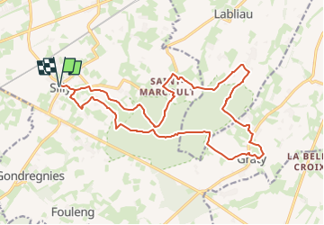
Lessines – Ogy – Flobecq – Wodecq – Ogy – Lessines
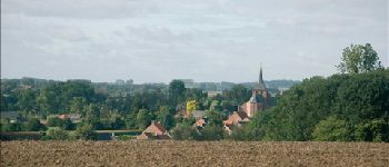
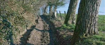
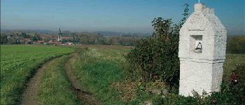
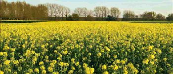
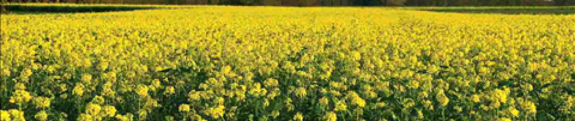
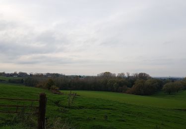
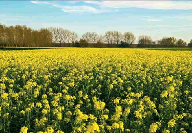
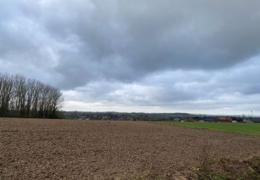
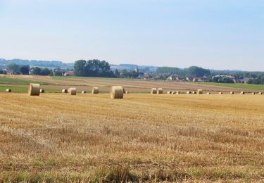
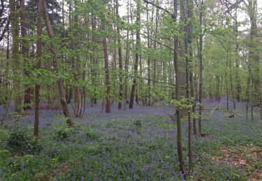
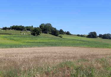
Lessines est bâtie sur les rives de la Dendre. Tout alentour, les chemins agricoles parcourent les molles ondulations de la campagne. Le relief s’accentue aux portes de Flobecq, située au coeur du parc naturel du Pays des Collines. Les promeneurs seront sensibles au charme paysager de cette région, où les ruisseaux ont creusé le relief de profonds vallons. Saules têtards et peupliers quadrillent la campagne et forment un bocage pittoresque.
Cartographie et documentation:
Cartes IGN au 1 : 20 000, 30/5-6 « Flobecq (Vloesberg) – Brakel » et 38/1-2
« Mainvault – Lessines ».
Topo-guide des GR 123/121 « Tour du Hainaut occidental ».
Où se désaltérer et se restaurer :
Le randonneur trouvera, bien sûr, cafés et restaurants à Lessines et à Flobecq. De
même, à Wodecq, un bistrot accueillant se situe à proximité de l’église.
Le Pays des Collines ne manque pas de chambres d’hôtes.
Plaatsbepaling
Opmerkingen
Wandeltochten in de omgeving
![Tocht Stappen Opzullik - HT-06_complet - Photo](https://media.geolcdn.com/t/375/260/f966d4d2-0dc0-4cd6-bca7-03c18785f611.jpg&format=jpg&maxdim=2)
![Stappen Stappen](https://static1.geolcdn.com/sitytour/trail-icons/101.png)
Stappen
![](/images/other/stat-length.png)
![](https://static1.geolcdn.com/siteimages/upload/files/16400158638029165_repeat_loop_refresh_sync_direction_icon.png)
![Tocht Stappen Opzullik - Wapi 3.02 - La promenade des Princes - Silly - Photo](https://media.geolcdn.com/t/375/260/98872b19-6c1a-4965-9bd7-5d3e9b88372a.jpg&format=jpg&maxdim=2)
![Stappen Stappen](https://static1.geolcdn.com/sitytour/trail-icons/101.png)
Stappen
![](/images/other/stat-length.png)
![](https://static1.geolcdn.com/siteimages/upload/files/16400158638029165_repeat_loop_refresh_sync_direction_icon.png)
![Tocht Stappen Opzullik - RB-Ha-03 - Raccourci - Du pays des carrières au parc naturel des Collines - Photo](https://media.geolcdn.com/t/375/260/ext.jpg?maxdim=2&url=https%3A%2F%2Fservices.sitytrail.com%2FGeolivesWS%2FDownloadMedia.ashx%3FTrailID%3D217835%26Media%3Dd7099cfa-d7c9-4bf3-bdfa-78aa37eb10bb.jpg)
![Stappen Stappen](https://static1.geolcdn.com/sitytour/trail-icons/101.png)
Stappen
![](/images/other/stat-length.png)
![](https://static1.geolcdn.com/siteimages/upload/files/16400158638029165_repeat_loop_refresh_sync_direction_icon.png)
![Tocht Stappen Aat - Dimanche 20/12/2020 - Photo](https://media.geolcdn.com/t/375/260/e7853499-b082-4f1a-bcac-5b446950aa41.jpg&format=jpg&maxdim=2)
![Stappen Stappen](https://static1.geolcdn.com/sitytour/trail-icons/101.png)
Stappen
![](/images/other/stat-length.png)
![](https://static1.geolcdn.com/siteimages/upload/files/16400158638029165_repeat_loop_refresh_sync_direction_icon.png)
![Tocht Te voet Opzullik - Gehuchten en hoogtepunten van Zullik-Hellebeek - Photo](https://media.geolcdn.com/t/375/260/ext.jpg?maxdim=2&url=https%3A%2F%2Fpivotmedia.tourismewallonie.be%2FANX-02-04K1-001F%2FANX-02-04K1-001F.JPG)
![Te voet Te voet](https://static1.geolcdn.com/sitytour/trail-icons/100.png)
Te voet
![](/images/other/stat-length.png)
![](https://static1.geolcdn.com/siteimages/upload/files/16400158638029165_repeat_loop_refresh_sync_direction_icon.png)
![Tocht Te voet Opzullik - Wandeling langs de kastelen en Bos van la Provision - Photo](https://media.geolcdn.com/t/375/260/ext.jpg?maxdim=2&url=https%3A%2F%2Fpivotmedia.tourismewallonie.be%2FANX-02-04OE-001F%2FANX-02-04OE-001F.JPG)
![Te voet Te voet](https://static1.geolcdn.com/sitytour/trail-icons/100.png)
Te voet
![](/images/other/stat-length.png)
![](https://static1.geolcdn.com/siteimages/upload/files/16400158638029165_repeat_loop_refresh_sync_direction_icon.png)
![Tocht Te voet Opzullik - Wandeling van het Maquis de Saint-Marcoult - Photo](https://media.geolcdn.com/t/375/260/ext.jpg?maxdim=2&url=https%3A%2F%2Fpivotmedia.tourismewallonie.be%2FANX-02-04OQ-005G%2FANX-02-04OQ-005G.JPG)
![Te voet Te voet](https://static1.geolcdn.com/sitytour/trail-icons/100.png)
Te voet
![](/images/other/stat-length.png)
![](https://static1.geolcdn.com/siteimages/upload/files/16400158638029165_repeat_loop_refresh_sync_direction_icon.png)
![Tocht Te voet Opzullik - Prinsen-wandeling - Photo](https://media.geolcdn.com/t/375/260/ext.jpg?maxdim=2&url=https%3A%2F%2Fpivotmedia.tourismewallonie.be%2FANX-02-04OT-001F%2FANX-02-04OT-001F.JPG)
![Te voet Te voet](https://static1.geolcdn.com/sitytour/trail-icons/100.png)
Te voet
![](/images/other/stat-length.png)
![](https://static1.geolcdn.com/siteimages/upload/files/16400158638029165_repeat_loop_refresh_sync_direction_icon.png)
![Tocht Te voet Opzullik - De paden en beboste heuvels van Thoricourt - Photo](https://media.geolcdn.com/t/375/260/ext.jpg?maxdim=2&url=https%3A%2F%2Fpivotmedia.tourismewallonie.be%2FANX-02-03WK-008K%2FANX-02-03WK-008K.JPG)
![Te voet Te voet](https://static1.geolcdn.com/sitytour/trail-icons/100.png)
Te voet
![](/images/other/stat-length.png)
![](https://static1.geolcdn.com/siteimages/upload/files/16400158638029165_repeat_loop_refresh_sync_direction_icon.png)