![](/images/other/stat-length.png)
![Tocht Sneeuwschoenen Ancelle - puy de manse - Photo](https://media.geolcdn.com/t/1900/400/ext.pjpeg?maxdim=2&url=https%3A%2F%2Fservices.sitytrail.com%2FGeolivesWS%2FDownloadMedia.ashx%3FTrailID%3D178293%26Media%3D20130301154531.jpeg)
puy de manse
will83
Gebruiker
![Lengte](/images/other/stat-length.png)
Lengte
3,3 km
![Max. hoogte](https://static1.geolcdn.com/siteimages/upload/files/1508320355ic_sort_altitude_max_24dp.png)
Max. hoogte
1626 m
![Positief hoogteverschil](https://static1.geolcdn.com/siteimages/upload/files/1508320355ic_sort_den_pos_24dp.png)
Positief hoogteverschil
282 m
![Km-Effort](/images/other/stat-length.png)
Km-Effort
7,1 km
![Min. hoogte](https://static1.geolcdn.com/siteimages/upload/files/1508320355ic_sort_altitude_min_24dp.png)
Min. hoogte
1338 m
![Negatief hoogteverschil](https://static1.geolcdn.com/siteimages/upload/files/1508320355ic_sort_den_neg_24dp.png)
Negatief hoogteverschil
279 m
![Boucle](https://static1.geolcdn.com/siteimages/upload/files/16400158638029165_repeat_loop_refresh_sync_direction_icon.png)
Boucle
Ja
Datum van aanmaak :
2014-12-10 00:00:00.0
Laatste wijziging :
2014-12-10 00:00:00.0
![Sneeuwschoenen](https://static1.geolcdn.com/sitytour/trail-icons/504.png)
1h30
Moeilijkheid : Moeilijk
![Scan deze QR-code om de tocht te openen in de SityTrail-applicatie](https://capi.geolives.com/qq0zvz2zws4bq2lad0pu/sitytour/trails/178293/qr.png?size=200)
Gratisgps-wandelapplicatie
Over ons
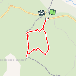
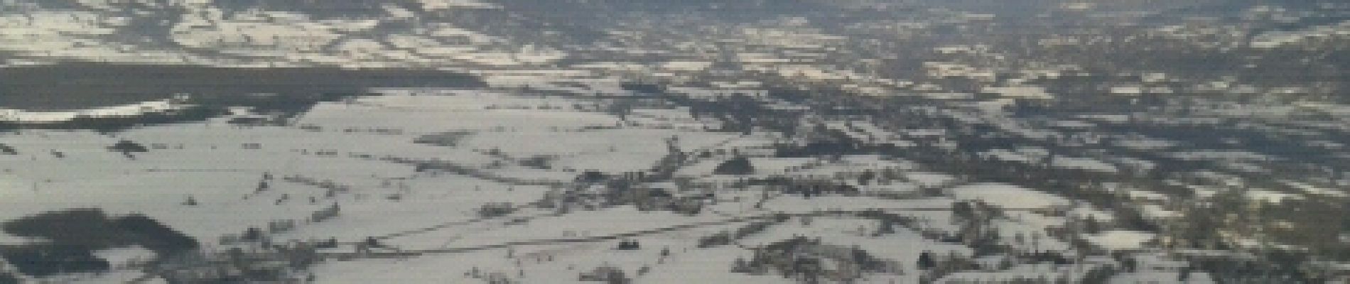
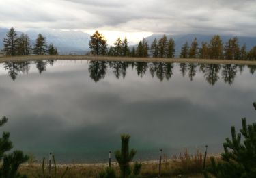
Tocht Sneeuwschoenen van 3,3 km beschikbaar op Provence-Alpes-Côte d'Azur, Hautes-Alpes, Ancelle. Deze tocht wordt voorgesteld door will83.
Beschrijving
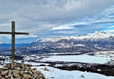
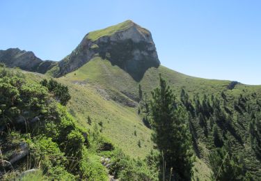
accès au point culminant par un des tracés le plus direct...court mais très physique... superbe descente dans le poudreuse
Plaatsbepaling
Land:
France
Regio :
Provence-Alpes-Côte d'Azur
Departement/Provincie :
Hautes-Alpes
Gemeente :
Ancelle
Locatie:
Unknown
Vertrek:(Dec)
Vertrek:(UTM)
274855 ; 4944929 (32T) N.
Opmerkingen
Wandeltochten in de omgeving
![Tocht Lopen Ancelle - Ancelle-Tour du Cuchon - Photo](https://media.geolcdn.com/t/375/260/ext.jpg?maxdim=2&url=https%3A%2F%2Fservices.sitytrail.com%2FGeolivesWS%2FDownloadMedia.ashx%3FTrailID%3D220701%26Media%3D20130912111439.jpg)
![Lopen Lopen](https://static1.geolcdn.com/sitytour/trail-icons/103.png)
Ancelle-Tour du Cuchon
Lopen
Heel gemakkelijk
(2)
Ancelle,
Provence-Alpes-Côte d'Azur,
Hautes-Alpes,
France
![](/images/other/stat-length.png)
15,4 km | 26 km-effort
3h 15min
![](https://static1.geolcdn.com/siteimages/upload/files/16400158638029165_repeat_loop_refresh_sync_direction_icon.png)
Ja
![Tocht Stappen Ancelle - Croix Saint Philippe Via Ancelle - Photo](https://media.geolcdn.com/t/375/260/dc5c5efc-aa17-49df-9643-c5a3a69b721c.jpg&format=jpg&maxdim=2)
![Stappen Stappen](https://static1.geolcdn.com/sitytour/trail-icons/101.png)
Croix Saint Philippe Via Ancelle
Stappen
Medium
(1)
Ancelle,
Provence-Alpes-Côte d'Azur,
Hautes-Alpes,
France
![](/images/other/stat-length.png)
9,7 km | 16,2 km-effort
4h 30min
![](https://static1.geolcdn.com/siteimages/upload/files/16400158638029165_repeat_loop_refresh_sync_direction_icon.png)
Ja
![Tocht Stappen Ancelle - L'arche et L'aiguille 01/09/23 - Photo](https://media.geolcdn.com/t/375/260/db1733c9-41d8-4b7e-9a2a-1b7dc4b88cc5.jpg&format=jpg&maxdim=2)
![Stappen Stappen](https://static1.geolcdn.com/sitytour/trail-icons/101.png)
L'arche et L'aiguille 01/09/23
Stappen
Zeer moeilijk
Ancelle,
Provence-Alpes-Côte d'Azur,
Hautes-Alpes,
France
![](/images/other/stat-length.png)
8,6 km | 19,6 km-effort
4h 27min
![](https://static1.geolcdn.com/siteimages/upload/files/16400158638029165_repeat_loop_refresh_sync_direction_icon.png)
Ja
![Stappen Stappen](https://static1.geolcdn.com/sitytour/trail-icons/101.png)
Arche
Stappen
Medium
Ancelle,
Provence-Alpes-Côte d'Azur,
Hautes-Alpes,
France
![](/images/other/stat-length.png)
6,9 km | 16 km-effort
3h 37min
![](https://static1.geolcdn.com/siteimages/upload/files/16400158638029165_repeat_loop_refresh_sync_direction_icon.png)
Neen
![Tocht Sneeuwschoenen Ancelle - Tour de Pourrachière - Photo](https://media.geolcdn.com/t/375/260/ext.jpg?maxdim=2&url=https%3A%2F%2Fstatic1.geolcdn.com%2Fsiteimages%2Fupload%2Ffiles%2F1524743153raquette.jpg)
![Sneeuwschoenen Sneeuwschoenen](https://static1.geolcdn.com/sitytour/trail-icons/504.png)
Tour de Pourrachière
Sneeuwschoenen
Moeilijk
(1)
Ancelle,
Provence-Alpes-Côte d'Azur,
Hautes-Alpes,
France
![](/images/other/stat-length.png)
14,9 km | 26 km-effort
6h 0min
![](https://static1.geolcdn.com/siteimages/upload/files/16400158638029165_repeat_loop_refresh_sync_direction_icon.png)
Neen
![Tocht Stappen Saint-Laurent-du-Cros - St Laurent du Cros 27/01/24 - Photo](https://media.geolcdn.com/t/375/260/d4cde02a-197e-4aa7-9109-8dadf21b331d.jpg&format=jpg&maxdim=2)
![Stappen Stappen](https://static1.geolcdn.com/sitytour/trail-icons/101.png)
St Laurent du Cros 27/01/24
Stappen
Gemakkelijk
Saint-Laurent-du-Cros,
Provence-Alpes-Côte d'Azur,
Hautes-Alpes,
France
![](/images/other/stat-length.png)
6,9 km | 9,2 km-effort
2h 4min
![](https://static1.geolcdn.com/siteimages/upload/files/16400158638029165_repeat_loop_refresh_sync_direction_icon.png)
Ja
![Tocht Stappen Ancelle - toufde la Pinouse : pré bouria . Le rouanne . la pinouse . moissiere . pré bouria - Photo](https://media.geolcdn.com/t/375/260/614e5dbc-3ed0-4432-ae56-f1f42bfeea31.jpg&format=jpg&maxdim=2)
![Stappen Stappen](https://static1.geolcdn.com/sitytour/trail-icons/101.png)
toufde la Pinouse : pré bouria . Le rouanne . la pinouse . moissiere . pré bo...
Stappen
Medium
Ancelle,
Provence-Alpes-Côte d'Azur,
Hautes-Alpes,
France
![](/images/other/stat-length.png)
8,4 km | 13,3 km-effort
3h 41min
![](https://static1.geolcdn.com/siteimages/upload/files/16400158638029165_repeat_loop_refresh_sync_direction_icon.png)
Ja
![Tocht Stappen Ancelle - crêtes d´Auréous : col de la Moissière . Chatégré . St Philippe . lac de Faudon - Photo](https://media.geolcdn.com/t/375/260/d004e4f1-0a22-4679-b327-94c9da3acf1e.jpg&format=jpg&maxdim=2)
![Stappen Stappen](https://static1.geolcdn.com/sitytour/trail-icons/101.png)
crêtes d´Auréous : col de la Moissière . Chatégré . St Philippe . lac de Faudon
Stappen
Gemakkelijk
Ancelle,
Provence-Alpes-Côte d'Azur,
Hautes-Alpes,
France
![](/images/other/stat-length.png)
6,9 km | 9,8 km-effort
2h 39min
![](https://static1.geolcdn.com/siteimages/upload/files/16400158638029165_repeat_loop_refresh_sync_direction_icon.png)
Ja
![Tocht Stappen Ancelle - Saint-Philippe 091021 - Photo](https://media.geolcdn.com/t/375/260/43b57a85-c96e-4eef-8fbe-196f124d40ba.jpg&format=jpg&maxdim=2)
![Stappen Stappen](https://static1.geolcdn.com/sitytour/trail-icons/101.png)
Saint-Philippe 091021
Stappen
Heel gemakkelijk
Ancelle,
Provence-Alpes-Côte d'Azur,
Hautes-Alpes,
France
![](/images/other/stat-length.png)
6,9 km | 9,9 km-effort
2h 43min
![](https://static1.geolcdn.com/siteimages/upload/files/16400158638029165_repeat_loop_refresh_sync_direction_icon.png)
Ja