![](/images/other/stat-length.png)
![Tocht Mountainbike Rocbaron - La Chapelle Sainte-Philomène - Rocbaron - Photo](https://media.geolcdn.com/t/1900/400/ext.pjpeg?maxdim=2&url=https%3A%2F%2Fservices.sitytrail.com%2FGeolivesWS%2FDownloadMedia.ashx%3FTrailID%3D173149%26Media%3D14715_4.jpg)
La Chapelle Sainte-Philomène - Rocbaron
tracegps
Gebruiker
![Lengte](/images/other/stat-length.png)
![Max. hoogte](https://static1.geolcdn.com/siteimages/upload/files/1508320355ic_sort_altitude_max_24dp.png)
![Positief hoogteverschil](https://static1.geolcdn.com/siteimages/upload/files/1508320355ic_sort_den_pos_24dp.png)
![Km-Effort](/images/other/stat-length.png)
![Min. hoogte](https://static1.geolcdn.com/siteimages/upload/files/1508320355ic_sort_altitude_min_24dp.png)
![Negatief hoogteverschil](https://static1.geolcdn.com/siteimages/upload/files/1508320355ic_sort_den_neg_24dp.png)
![Boucle](https://static1.geolcdn.com/siteimages/upload/files/16400158638029165_repeat_loop_refresh_sync_direction_icon.png)
![Mountainbike](https://static1.geolcdn.com/sitytour/trail-icons/202.png)
4h00
Moeilijkheid : Moeilijk
![Scan deze QR-code om de tocht te openen in de SityTrail-applicatie](https://capi.geolives.com/qq0zvz2zws4bq2lad0pu/sitytour/trails/173149/qr.png?size=200)
Gratisgps-wandelapplicatie
Over ons
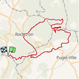
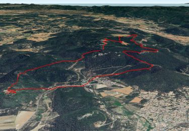
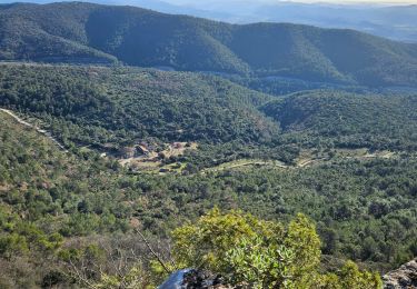
Tocht Mountainbike van 25 km beschikbaar op Provence-Alpes-Côte d'Azur, Var, Rocbaron. Deze tocht wordt voorgesteld door tracegps.
Beschrijving
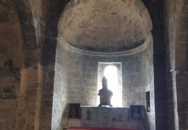
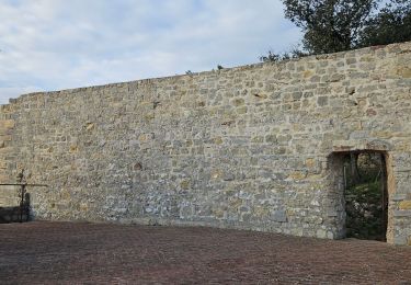
Du col de la Bigue prendre le GR 51. Arrivé sur la nationale, tourner à droite puis rapidement à gauche un petit sentier pour la Chapelle Ste Philomène. Descendre jusqu'au village de Puget, puis monter au GR 9 par l'église, l'école ou le stade. Au GR 9 aller à la piste ULM, où un petit aller-retour permet d'admirer un chêne majestueux, et ensuite par les pistes DFCI à Rocbaron. Retour par le GR 51 au col de la Bigue.
Plaatsbepaling
Opmerkingen
Wandeltochten in de omgeving
![Tocht Stappen Rocbaron - SityTrail - rocbaron victor - Photo](https://media.geolcdn.com/t/375/260/65b9c34e-6588-477e-8f02-e7295c203708.jpg&format=jpg&maxdim=2)
![Stappen Stappen](https://static1.geolcdn.com/sitytour/trail-icons/101.png)
Stappen
![](/images/other/stat-length.png)
![](https://static1.geolcdn.com/siteimages/upload/files/16400158638029165_repeat_loop_refresh_sync_direction_icon.png)
![Tocht Stappen Rocbaron - le pilon Saint Clément et les barres de Cuers - Photo](https://media.geolcdn.com/t/375/260/3bb3c32a-33e5-4027-b08e-a3329095baff.jpg&format=jpg&maxdim=2)
![Stappen Stappen](https://static1.geolcdn.com/sitytour/trail-icons/101.png)
Stappen
![](/images/other/stat-length.png)
![](https://static1.geolcdn.com/siteimages/upload/files/16400158638029165_repeat_loop_refresh_sync_direction_icon.png)
![Tocht Stappen Cuers - la foux cuers opidum - Photo](https://media.geolcdn.com/t/375/260/ext.jpg?maxdim=2&url=https%3A%2F%2Fservices.sitytrail.com%2FGeolivesWS%2FDownloadMedia.ashx%3FTrailID%3D518258%26Media%3Dfix__20160127150117.jpg)
![Stappen Stappen](https://static1.geolcdn.com/sitytour/trail-icons/101.png)
Stappen
![](/images/other/stat-length.png)
![](https://static1.geolcdn.com/siteimages/upload/files/16400158638029165_repeat_loop_refresh_sync_direction_icon.png)
![Tocht Stappen Rocbaron - Sainte Philomène depuis le col de la Bigue - Photo](https://media.geolcdn.com/t/375/260/1802182a-3a4b-4826-bf99-f072108d695c.jpg&format=jpg&maxdim=2)
![Stappen Stappen](https://static1.geolcdn.com/sitytour/trail-icons/101.png)
Stappen
![](/images/other/stat-length.png)
![](https://static1.geolcdn.com/siteimages/upload/files/16400158638029165_repeat_loop_refresh_sync_direction_icon.png)
![Tocht Stappen Puget-Ville - Puget-ville Sainte Philomène - Photo](https://media.geolcdn.com/t/375/260/2dc2febd-ae0c-4426-b6da-cece7743c366.jpg&format=jpg&maxdim=2)
![Stappen Stappen](https://static1.geolcdn.com/sitytour/trail-icons/101.png)
Stappen
![](/images/other/stat-length.png)
![](https://static1.geolcdn.com/siteimages/upload/files/16400158638029165_repeat_loop_refresh_sync_direction_icon.png)
![Tocht Stappen Cuers - Pilon Saint Clément - Photo](https://media.geolcdn.com/t/375/260/127c8d12-3441-42a6-b036-f1c61808aeac.jpg&format=jpg&maxdim=2)
![Stappen Stappen](https://static1.geolcdn.com/sitytour/trail-icons/101.png)
Stappen
![](/images/other/stat-length.png)
![](https://static1.geolcdn.com/siteimages/upload/files/16400158638029165_repeat_loop_refresh_sync_direction_icon.png)
![Tocht Stappen Cuers - Du col de la bigue vers le bas des barres de Cuers - Photo](https://media.geolcdn.com/t/375/260/4deb610c-bf41-4af0-baa2-7e7e353ac8a9.jpg&format=jpg&maxdim=2)
![Stappen Stappen](https://static1.geolcdn.com/sitytour/trail-icons/101.png)
Stappen
![](/images/other/stat-length.png)
![](https://static1.geolcdn.com/siteimages/upload/files/16400158638029165_repeat_loop_refresh_sync_direction_icon.png)
![Tocht Stappen Cuers - Sous les barres de Cuers en partant de La Foux - Photo](https://media.geolcdn.com/t/375/260/ddaffc22-d3b7-42da-aa7d-3b1cd8482841.jpg&format=jpg&maxdim=2)
![Stappen Stappen](https://static1.geolcdn.com/sitytour/trail-icons/101.png)
Stappen
![](/images/other/stat-length.png)
![](https://static1.geolcdn.com/siteimages/upload/files/16400158638029165_repeat_loop_refresh_sync_direction_icon.png)
![Tocht Stappen Cuers - Promenade sous les barres de Cuers, en partant du village de Cuers - Photo](https://media.geolcdn.com/t/375/260/763db821-3faf-41c8-99d4-ebbc220e66cf.jpg&format=jpg&maxdim=2)
![Stappen Stappen](https://static1.geolcdn.com/sitytour/trail-icons/101.png)
Stappen
![](/images/other/stat-length.png)
![](https://static1.geolcdn.com/siteimages/upload/files/16400158638029165_repeat_loop_refresh_sync_direction_icon.png)
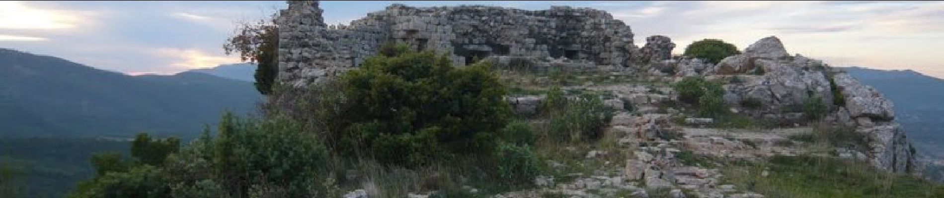
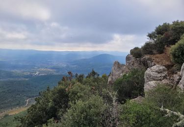
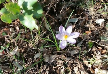
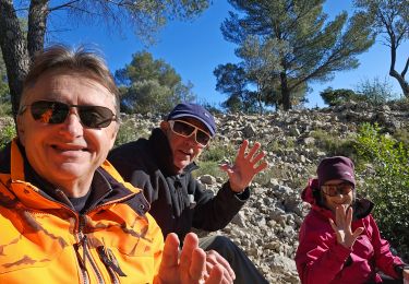
Superbe malgré quelques poussettes