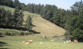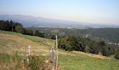

De La Chaldette à Fournels

tracegps
Gebruiker

Lengte
14,8 km

Max. hoogte
1161 m

Positief hoogteverschil
349 m

Km-Effort
19,6 km

Min. hoogte
941 m

Negatief hoogteverschil
407 m
Boucle
Neen
Datum van aanmaak :
2014-12-10 00:00:00.0
Laatste wijziging :
2014-12-10 00:00:00.0
3h16
Moeilijkheid : Moeilijk

Gratisgps-wandelapplicatie
Over ons
Tocht Stappen van 14,8 km beschikbaar op Occitanië, Lozère, Brion. Deze tocht wordt voorgesteld door tracegps.
Beschrijving
Départ du centre de La Chaldette. On débute par la montée à Reyrac. Passage près de la roche du Cheylaret, du village du même nom où se trouve un panneau expliquant les utilités du mobilier rural. On continue par la forêt jusqu'à Fournels.
Plaatsbepaling
Land:
France
Regio :
Occitanië
Departement/Provincie :
Lozère
Gemeente :
Brion
Locatie:
Unknown
Vertrek:(Dec)
Vertrek:(UTM)
503549 ; 4957715 (31T) N.
Opmerkingen
Wandeltochten in de omgeving
Ussels Veyres Luxal


Stappen
Medium
Brion,
Occitanië,
Lozère,
France

18,4 km | 24 km-effort
4h 55min
Ja

LA CHALDETTE 48 - Le Fau - Le Truc du Cheylaret - Reyrac


Stappen
Medium
(1)
Brion,
Occitanië,
Lozère,
France

10,5 km | 13,9 km-effort
2h 44min
Ja
la chaldette - termes


Stappen
Medium
Brion,
Occitanië,
Lozère,
France

26 km | 35 km-effort
5h 57min
Neen
Le Puy de la Tuile


Stappen
Medium
Deux-Verges,
Auvergne-Rhône-Alpes,
Cantal,
France

8,9 km | 12,5 km-effort
3h 0min
Ja
la chaldette - termes


Stappen
Heel gemakkelijk
Brion,
Occitanië,
Lozère,
France

29 km | 39 km-effort
7h 1min
Neen
Jeudi 9 mai


Stappen
Zeer moeilijk
Brion,
Occitanië,
Lozère,
France

19 km | 24 km-effort
5h 27min
Neen

Le Puech de Brion


Stappen
Gemakkelijk
Brion,
Occitanië,
Lozère,
France

7,4 km | 10,1 km-effort
1h 56min
Ja


 SityTrail


