![](/images/other/stat-length.png)
![Tocht Stappen Laguiole - De Laguiole à Saint-Urcize - Photo](https://media.geolcdn.com/t/1900/400/ext.pjpeg?maxdim=2&url=https%3A%2F%2Fservices.sitytrail.com%2FGeolivesWS%2FDownloadMedia.ashx%3FTrailID%3D172920%26Media%3D14388_6.jpg)
De Laguiole à Saint-Urcize
tracegps
Gebruiker
![Lengte](/images/other/stat-length.png)
![Max. hoogte](https://static1.geolcdn.com/siteimages/upload/files/1508320355ic_sort_altitude_max_24dp.png)
![Positief hoogteverschil](https://static1.geolcdn.com/siteimages/upload/files/1508320355ic_sort_den_pos_24dp.png)
![Km-Effort](/images/other/stat-length.png)
![Min. hoogte](https://static1.geolcdn.com/siteimages/upload/files/1508320355ic_sort_altitude_min_24dp.png)
![Negatief hoogteverschil](https://static1.geolcdn.com/siteimages/upload/files/1508320355ic_sort_den_neg_24dp.png)
![Boucle](https://static1.geolcdn.com/siteimages/upload/files/16400158638029165_repeat_loop_refresh_sync_direction_icon.png)
![Stappen](https://static1.geolcdn.com/sitytour/trail-icons/101.png)
3h52
Moeilijkheid : Moeilijk
![Scan deze QR-code om de tocht te openen in de SityTrail-applicatie](https://capi.geolives.com/qq0zvz2zws4bq2lad0pu/sitytour/trails/172920/qr.png?size=200)
Gratisgps-wandelapplicatie
Over ons
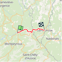
Tocht Stappen van 16,3 km beschikbaar op Occitanië, Aveyron, Laguiole. Deze tocht wordt voorgesteld door tracegps.
Beschrijving
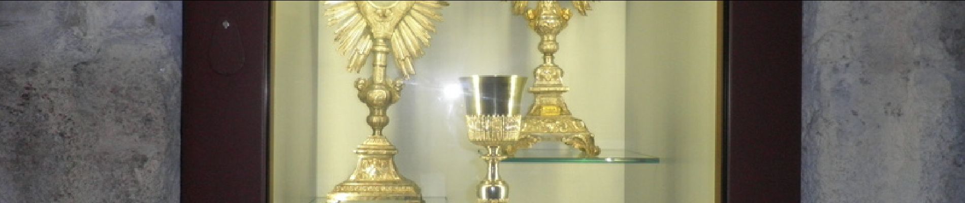
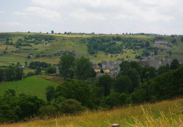
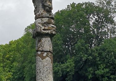
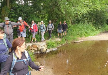
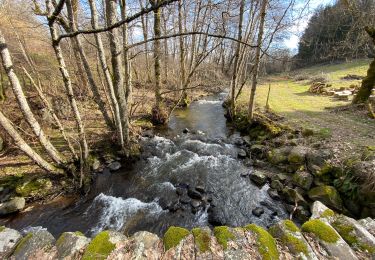
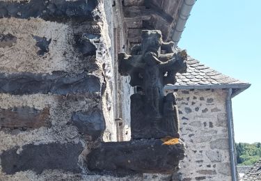
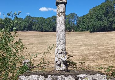
Départ du petit rond point au centre de Laguiole. Après une montée sur une petite route avant la traversée de la forêt on peut observer le buron (en rénovation). A la sortie de la forêt, magnifique vue sur les prairies d'Aubrac. Traversez des prairies puis descente sur Saint-Urcize où se trouve dans l'église, le calice de la dernière messe de Louis XVI.
Plaatsbepaling
Opmerkingen
Wandeltochten in de omgeving
![Tocht Fiets Laguiole - Les courbes infinies de l'Aubrac - Laguiole - Photo](https://media.geolcdn.com/t/375/260/ext.jpg?maxdim=2&url=https%3A%2F%2Fservices.sitytrail.com%2FGeolivesWS%2FDownloadMedia.ashx%3FTrailID%3D129656%26Media%3D13184_5.jpg)
![Fiets Fiets](https://static1.geolcdn.com/sitytour/trail-icons/200.png)
Fiets
![](/images/other/stat-length.png)
![](https://static1.geolcdn.com/siteimages/upload/files/16400158638029165_repeat_loop_refresh_sync_direction_icon.png)
![Tocht sport Soulages-Bonneval - 2024-06-12_14h41m44_visorando-circuit-autour-du-lac-des-galens - Photo](https://media.geolcdn.com/t/375/260/ext.jpg?maxdim=2&url=https%3A%2F%2Fsecurestorage.geolives.com%2Fsitytour%2Ftrail-bg%2Fdefault.jpg)
sport
![](/images/other/stat-length.png)
![](https://static1.geolcdn.com/siteimages/upload/files/16400158638029165_repeat_loop_refresh_sync_direction_icon.png)
![Tocht Stappen Curières - hier - Photo](https://media.geolcdn.com/t/375/260/9490aa44-9d58-4d6b-baaf-b8514dbcec92.jpg&format=jpg&maxdim=2)
![Stappen Stappen](https://static1.geolcdn.com/sitytour/trail-icons/101.png)
![Tocht Stappen Laguiole - Soulagese Chateau du ousquet - Photo](https://media.geolcdn.com/t/375/260/ed6186cd-dbcb-4b9f-86d8-0190cd90d208.jpg&format=jpg&maxdim=2)
![Stappen Stappen](https://static1.geolcdn.com/sitytour/trail-icons/101.png)
Stappen
![](/images/other/stat-length.png)
![](https://static1.geolcdn.com/siteimages/upload/files/16400158638029165_repeat_loop_refresh_sync_direction_icon.png)
![Tocht Stappen Laguiole - Laguiole Roc Del Cabres - Photo](https://media.geolcdn.com/t/375/260/572d7cbc-7f57-4674-9842-dac40b488b56.jpg&format=jpg&maxdim=2)
![Stappen Stappen](https://static1.geolcdn.com/sitytour/trail-icons/101.png)
Stappen
![](/images/other/stat-length.png)
![](https://static1.geolcdn.com/siteimages/upload/files/16400158638029165_repeat_loop_refresh_sync_direction_icon.png)
![Tocht Stappen Cassuéjouls - Cassuejouls 24 02 06 - Photo](https://media.geolcdn.com/t/375/260/25c7b790-2720-4c14-af65-90a96a4717b3.jpg&format=jpg&maxdim=2)
![Stappen Stappen](https://static1.geolcdn.com/sitytour/trail-icons/101.png)
Stappen
![](/images/other/stat-length.png)
![](https://static1.geolcdn.com/siteimages/upload/files/16400158638029165_repeat_loop_refresh_sync_direction_icon.png)
![Tocht Stappen Laguiole - Laguiole Pigasse - Photo](https://media.geolcdn.com/t/375/260/a4af4d41-c2d4-4b57-b319-c0c46e5ff3e0.jpg&format=jpg&maxdim=2)
![Stappen Stappen](https://static1.geolcdn.com/sitytour/trail-icons/101.png)
Stappen
![](/images/other/stat-length.png)
![](https://static1.geolcdn.com/siteimages/upload/files/16400158638029165_repeat_loop_refresh_sync_direction_icon.png)
![Tocht Stappen Laguiole - le roc des cabres - Photo](https://media.geolcdn.com/t/375/260/911a3d0d-fb87-43a8-ad59-9a05146d2b97.jpg&format=jpg&maxdim=2)
![Stappen Stappen](https://static1.geolcdn.com/sitytour/trail-icons/101.png)
Stappen
![](/images/other/stat-length.png)
![](https://static1.geolcdn.com/siteimages/upload/files/16400158638029165_repeat_loop_refresh_sync_direction_icon.png)
![Tocht Stappen Curières - la croix du Pal - Photo](https://media.geolcdn.com/t/375/260/b0f549f4-0aab-46a5-8cb4-8000321838be.jpg&format=jpg&maxdim=2)
![Stappen Stappen](https://static1.geolcdn.com/sitytour/trail-icons/101.png)
Stappen
![](/images/other/stat-length.png)
![](https://static1.geolcdn.com/siteimages/upload/files/16400158638029165_repeat_loop_refresh_sync_direction_icon.png)