
La forêt d'Octon

tracegps
Gebruiker

Lengte
4,4 km

Max. hoogte
369 m

Positief hoogteverschil
181 m

Km-Effort
6,8 km

Min. hoogte
203 m

Negatief hoogteverschil
181 m
Boucle
Ja
Datum van aanmaak :
2014-12-10 00:00:00.0
Laatste wijziging :
2014-12-10 00:00:00.0
1h15
Moeilijkheid : Gemakkelijk

Gratisgps-wandelapplicatie
Over ons
Tocht Stappen van 4,4 km beschikbaar op Occitanië, Hérault, Octon. Deze tocht wordt voorgesteld door tracegps.
Beschrijving
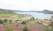
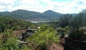
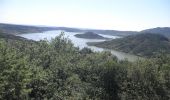
Départ derrière le camping "Le Village du Bosc". Bonne montée en forêt puis après un séjour sur le plateau, de superbes vues sur le lac du Salagou et le village d'Octon et enfin descente assez rapide.
Plaatsbepaling
Land:
France
Regio :
Occitanië
Departement/Provincie :
Hérault
Gemeente :
Octon
Locatie:
Unknown
Vertrek:(Dec)
Vertrek:(UTM)
525853 ; 4834223 (31T) N.
Opmerkingen
Wandeltochten in de omgeving
Malavieille - Montagne de la Boutine


Noords wandelen
Gemakkelijk
(1)
Mérifons,
Occitanië,
Hérault,
France

7 km | 9,7 km-effort
Onbekend
Ja
Les Vailhés Barrage du Salagou Mas Audran


Noords wandelen
Medium
(1)
Celles,
Occitanië,
Hérault,
France

14,4 km | 18,3 km-effort
3min
Ja
L'Auverne Salagou


Stappen
Moeilijk
(1)
Celles,
Occitanië,
Hérault,
France

11,2 km | 14 km-effort
3h 10min
Ja
Chemin Vicinal N°13 de Carlencas


Stappen
Medium
(2)
Mérifons,
Occitanië,
Hérault,
France

8,5 km | 12 km-effort
2h 30min
Ja
Montagne de Liausson depuis Mourèze


Stappen
Moeilijk
(1)
Mourèze,
Occitanië,
Hérault,
France

8,3 km | 13,4 km-effort
2h 45min
Ja
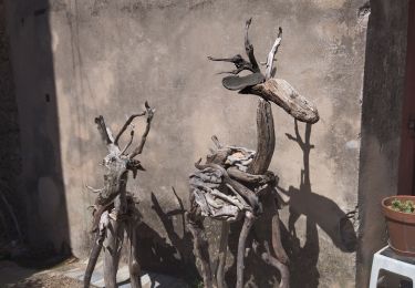
34 moureze 10.07.23


Stappen
Gemakkelijk
Mourèze,
Occitanië,
Hérault,
France

4,8 km | 6,9 km-effort
2h 5min
Neen

Le Lac du Salagou


Stappen
Gemakkelijk
(1)
Le Puech,
Occitanië,
Hérault,
France

10,1 km | 12,8 km-effort
4h 1min
Ja

Octon (chapelle Notre Dame de Roubignac)


Stappen
Gemakkelijk
(1)
Octon,
Occitanië,
Hérault,
France

14,7 km | 20 km-effort
5h 0min
Ja
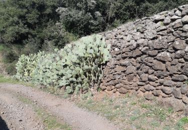
34 octon ND roubignac


Stappen
Gemakkelijk
Octon,
Occitanië,
Hérault,
France

14 km | 19,8 km-effort
5h 10min
Neen


 SityTrail


