![](/images/other/stat-length.png)
![Tocht Fiets Jarnac - Boucle vélo à Jarnac (23C) - Photo](https://media.geolcdn.com/t/1900/400/ext.pjpeg?maxdim=2&url=https%3A%2F%2Fservices.sitytrail.com%2FGeolivesWS%2FDownloadMedia.ashx%3FTrailID%3D172709%26Media%3D14098_5.jpg)
Boucle vélo à Jarnac (23C)
tracegps
Gebruiker
![Lengte](/images/other/stat-length.png)
Lengte
46 km
![Max. hoogte](https://static1.geolcdn.com/siteimages/upload/files/1508320355ic_sort_altitude_max_24dp.png)
Max. hoogte
54 m
![Positief hoogteverschil](https://static1.geolcdn.com/siteimages/upload/files/1508320355ic_sort_den_pos_24dp.png)
Positief hoogteverschil
313 m
![Km-Effort](/images/other/stat-length.png)
Km-Effort
51 km
![Min. hoogte](https://static1.geolcdn.com/siteimages/upload/files/1508320355ic_sort_altitude_min_24dp.png)
Min. hoogte
9 m
![Negatief hoogteverschil](https://static1.geolcdn.com/siteimages/upload/files/1508320355ic_sort_den_neg_24dp.png)
Negatief hoogteverschil
313 m
![Boucle](https://static1.geolcdn.com/siteimages/upload/files/16400158638029165_repeat_loop_refresh_sync_direction_icon.png)
Boucle
Ja
Datum van aanmaak :
2014-12-10 00:00:00.0
Laatste wijziging :
2014-12-10 00:00:00.0
![Fiets](https://static1.geolcdn.com/sitytour/trail-icons/200.png)
2h30
Moeilijkheid : Medium
![Scan deze QR-code om de tocht te openen in de SityTrail-applicatie](https://capi.geolives.com/qq0zvz2zws4bq2lad0pu/sitytour/trails/172709/qr.png?size=200)
Gratisgps-wandelapplicatie
Over ons
Tocht Fiets van 46 km beschikbaar op Nieuw-Aquitanië, Charente, Jarnac. Deze tocht wordt voorgesteld door tracegps.
Beschrijving
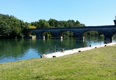
Circuit proposé par l'Office de Tourisme de la Communauté de Communes de Jarnac. Départ place du Général de Gaulle à Jarnac. Retrouvez le plan du circuit sur le site de l'Office de Tourisme de la Communauté de Communes de Jarnac.
Plaatsbepaling
Land:
France
Regio :
Nieuw-Aquitanië
Departement/Provincie :
Charente
Gemeente :
Jarnac
Locatie:
Unknown
Vertrek:(Dec)
Vertrek:(UTM)
720456 ; 5062536 (30T) N.
Opmerkingen
Wandeltochten in de omgeving
![Tocht Stappen Bassac - Jarnac amont - Photo](https://media.geolcdn.com/t/375/260/e0ab9ffa-323a-48d5-9b11-5f7d99eb8fde.jpg&format=jpg&maxdim=2)
![Stappen Stappen](https://static1.geolcdn.com/sitytour/trail-icons/101.png)
Jarnac amont
Stappen
Gemakkelijk
Bassac,
Nieuw-Aquitanië,
Charente,
France
![](/images/other/stat-length.png)
11,6 km | 12,3 km-effort
2h 50min
![](https://static1.geolcdn.com/siteimages/upload/files/16400158638029165_repeat_loop_refresh_sync_direction_icon.png)
Ja
![Tocht Stappen Bourg-Charente - Bourg Charente - Photo](https://media.geolcdn.com/t/375/260/ext.jpg?maxdim=2&url=https%3A%2F%2Fservices.sitytrail.com%2FGeolivesWS%2FDownloadMedia.ashx%3FTrailID%3D324888%26Media%3Dfix__20140716122458.jpg)
![Stappen Stappen](https://static1.geolcdn.com/sitytour/trail-icons/101.png)
Bourg Charente
Stappen
Heel gemakkelijk
Bourg-Charente,
Nieuw-Aquitanië,
Charente,
France
![](/images/other/stat-length.png)
12,4 km | 13,9 km-effort
3h 3min
![](https://static1.geolcdn.com/siteimages/upload/files/16400158638029165_repeat_loop_refresh_sync_direction_icon.png)
Ja
![Tocht Stappen Jarnac - Circuit des Pierrères - Jarnac - Photo](https://media.geolcdn.com/t/375/260/ext.jpg?maxdim=2&url=https%3A%2F%2Fservices.sitytrail.com%2FGeolivesWS%2FDownloadMedia.ashx%3FTrailID%3D172708%26Media%3D14097_6.jpg)
![Stappen Stappen](https://static1.geolcdn.com/sitytour/trail-icons/101.png)
Circuit des Pierrères - Jarnac
Stappen
Moeilijk
Jarnac,
Nieuw-Aquitanië,
Charente,
France
![](/images/other/stat-length.png)
13,1 km | 14,8 km-effort
3h 15min
![](https://static1.geolcdn.com/siteimages/upload/files/16400158638029165_repeat_loop_refresh_sync_direction_icon.png)
Ja
![Tocht Andere activiteiten Graves-Saint-Amant - bbb - Photo](https://media.geolcdn.com/t/375/260/ext.jpg?maxdim=2&url=https%3A%2F%2Fstatic1.geolcdn.com%2Fsiteimages%2Fupload%2Ffiles%2F1545311037marcheuse_200dpi.jpg)
![Andere activiteiten Andere activiteiten](https://static1.geolcdn.com/sitytour/trail-icons/900.png)
bbb
Andere activiteiten
Heel gemakkelijk
Graves-Saint-Amant,
Nieuw-Aquitanië,
Charente,
France
![](/images/other/stat-length.png)
33 km | 37 km-effort
1h 41min
![](https://static1.geolcdn.com/siteimages/upload/files/16400158638029165_repeat_loop_refresh_sync_direction_icon.png)
Ja
![Tocht Stappen Jarnac - jarnac - Photo](https://media.geolcdn.com/t/375/260/ext.jpg?maxdim=2&url=https%3A%2F%2Fstatic1.geolcdn.com%2Fsiteimages%2Fupload%2Ffiles%2F1553511878bg_sport_marche.png)
![Stappen Stappen](https://static1.geolcdn.com/sitytour/trail-icons/101.png)
jarnac
Stappen
Gemakkelijk
Jarnac,
Nieuw-Aquitanië,
Charente,
France
![](/images/other/stat-length.png)
3,5 km | 3,7 km-effort
1h 15min
![](https://static1.geolcdn.com/siteimages/upload/files/16400158638029165_repeat_loop_refresh_sync_direction_icon.png)
Neen
![Tocht Stappen Bourg-Charente - Bourg-Charente Jarnac aller-retour - Photo](https://media.geolcdn.com/t/375/260/ext.jpg?maxdim=2&url=https%3A%2F%2Fstatic1.geolcdn.com%2Fsiteimages%2Fupload%2Ffiles%2F1553511878bg_sport_marche.png)
![Stappen Stappen](https://static1.geolcdn.com/sitytour/trail-icons/101.png)
Bourg-Charente Jarnac aller-retour
Stappen
Gemakkelijk
Bourg-Charente,
Nieuw-Aquitanië,
Charente,
France
![](/images/other/stat-length.png)
9,1 km | 9,8 km-effort
1h 48min
![](https://static1.geolcdn.com/siteimages/upload/files/16400158638029165_repeat_loop_refresh_sync_direction_icon.png)
Ja
![Tocht Stappen Jarnac - GR4-74 - Jarnac - Cognac - Photo](https://media.geolcdn.com/t/375/260/ext.jpg?maxdim=2&url=https%3A%2F%2Fstatic1.geolcdn.com%2Fsiteimages%2Fupload%2Ffiles%2F1553511878bg_sport_marche.png)
![Stappen Stappen](https://static1.geolcdn.com/sitytour/trail-icons/101.png)
GR4-74 - Jarnac - Cognac
Stappen
Zeer moeilijk
Jarnac,
Nieuw-Aquitanië,
Charente,
France
![](/images/other/stat-length.png)
18,2 km | 20 km-effort
4h 30min
![](https://static1.geolcdn.com/siteimages/upload/files/16400158638029165_repeat_loop_refresh_sync_direction_icon.png)
Neen
![Tocht Stappen Mainxe-Gondeville - mainxe - Photo](https://media.geolcdn.com/t/375/260/ext.jpg?maxdim=2&url=https%3A%2F%2Fstatic1.geolcdn.com%2Fsiteimages%2Fupload%2Ffiles%2F1553511878bg_sport_marche.png)
![Stappen Stappen](https://static1.geolcdn.com/sitytour/trail-icons/101.png)
mainxe
Stappen
Heel gemakkelijk
Mainxe-Gondeville,
Nieuw-Aquitanië,
Charente,
France
![](/images/other/stat-length.png)
12,5 km | 14 km-effort
2h 50min
![](https://static1.geolcdn.com/siteimages/upload/files/16400158638029165_repeat_loop_refresh_sync_direction_icon.png)
Ja
![Tocht Wegfiets Mainxe-Gondeville - chez Roland billard Saint-Preuil - Photo](https://media.geolcdn.com/t/375/260/ext.jpg?maxdim=2&url=https%3A%2F%2Fstatic1.geolcdn.com%2Fsiteimages%2Fupload%2Ffiles%2F1524743154velo.jpg)
![Wegfiets Wegfiets](https://static1.geolcdn.com/sitytour/trail-icons/201.png)
chez Roland billard Saint-Preuil
Wegfiets
Medium
Mainxe-Gondeville,
Nieuw-Aquitanië,
Charente,
France
![](/images/other/stat-length.png)
28 km | 32 km-effort
1h 14min
![](https://static1.geolcdn.com/siteimages/upload/files/16400158638029165_repeat_loop_refresh_sync_direction_icon.png)
Ja