Tocht Stappen Villedômer - 013 Villedomer Vouvray - Photo
 lucille
lucille

Gebruiker

© OpenStreetMap contributors
Lengte
Lengte
23 km
Max. hoogte
Max. hoogte
121 m
Positief hoogteverschil
250 m
Km-Effort
Km-Effort  
26 km
Min. hoogte
Min. hoogte
50 m
Negatief hoogteverschil
272 m
Boucle
Boucle
Neen
Datum van aanmaak :
2014-12-10 00:00:00.0
Laatste wijziging :
2014-12-10 00:00:00.0

(0 Bericht)

Stappen
Stappen
5h39
Moeilijkheid : Onbekend

Scan deze QR-code om de tocht te openen in de SityTrail-applicatie

Gratisgps-wandelapplicatie

Logo SityTrail SityTrail

IGN / Geografische instituten

SityTrail uit de App Store downloaden SityTrail uit Google Play downloaden

Logo SityTrail SityTrail World

De wereld gaat voor u open

SityTrail uit de App Store downloaden SityTrail uit Google Play downloaden SityTrail op Huawei AppGallery downloaden

Over ons

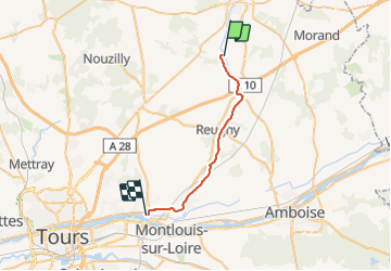
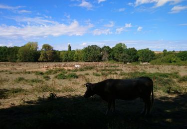
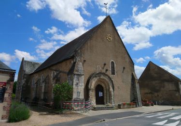
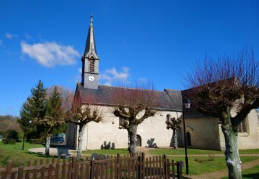
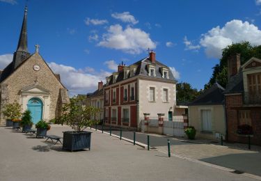
Tocht Stappen van 23 km beschikbaar op Centre-Val de Loire, Indre-et-Loire, Villedômer. Deze tocht wordt voorgesteld door lucille.

Beschrijving

Villedômer / Vouvray
Camping Municipal Le bec Cisse

Hoogteprofiel

Plaatsbepaling

Land:
France
Regio :
Centre-Val de Loire
Departement/Provincie :
Indre-et-Loire
Gemeente :
Villedômer
Locatie:
Unknown
Vertrek:(Dec)
Vertrek:(UTM)
341565 ; 5267855 (31T) N.

Wandeltochten in de omgeving

Tocht Stappen Villedômer - la Grand'Vallée - Saint-Laurent-en-Gâtines via PRs - 26.8km 225m 5h35 (35mn) - 2022 12 03 - Photo
Stappen
GUIDE
Orcal37

Stappen

Medium
Villedômer, Centre-Val de Loire, Indre-et-Loire, France
27 km | 30 km-effort
5h 35min
Ja
Tocht Stappen Villedômer - Étang de l'Archevêque - Crotelles la Grand' Vallée - 20.3km 215m 4h25 (35mn) - 2022 11 26 - Photo
Stappen
GUIDE
Orcal37

Stappen

Gemakkelijk
Villedômer, Centre-Val de Loire, Indre-et-Loire, France
20 km | 23 km-effort
4h 25min
Ja
Tocht Stappen Neuillé-le-Lierre - Neuillé-le-Lierre - Étang de l'Archevêque - 21.4km 180m 4h45 (35mn) - 2022 11 11 - Photo
Stappen
GUIDE
Orcal37

Stappen

Gemakkelijk
Neuillé-le-Lierre, Centre-Val de Loire, Indre-et-Loire, France
21 km | 24 km-effort
4h 45min
Ja
Tocht Stappen Auzouer-en-Touraine - Auzouer-en-Touraine - Circuit Bec Sec variante - 18.4km 220m 4h10 (30mn) - 2022 09 06 - Photo
Stappen
GUIDE
Orcal37

Stappen

Medium
Auzouer-en-Touraine, Centre-Val de Loire, Indre-et-Loire, France
18,4 km | 21 km-effort
4h 10min
Ja
Tocht Stappen Château-Renault - Château-Renault - GR655ouest Villechauve - 21.9km 235m 4h55 (30mn) - 2021 10 23 - Photo
Stappen
GUIDE
Orcal37

Stappen

Gemakkelijk
Château-Renault, Centre-Val de Loire, Indre-et-Loire, France
22 km | 25 km-effort
4h 55min
Ja
Tocht Stappen Auzouer-en-Touraine - Auzouer-en-Touraine - circuit de la Quintaine - 12.7km 150m 2h40 - 2021 07 06 - Photo
Stappen
GUIDE
Orcal37

Stappen

Gemakkelijk
Auzouer-en-Touraine, Centre-Val de Loire, Indre-et-Loire, France
12,7 km | 14,7 km-effort
2h 40min
Ja
Tocht Stappen Crotelles - Crotelles - PR avec variante - 21.4km 285m 4h35 (30mn) - 2021 03 20 - Photo
Stappen
GUIDE
Orcal37

Stappen

Gemakkelijk
Crotelles, Centre-Val de Loire, Indre-et-Loire, France
21 km | 25 km-effort
4h 35min
Ja
Tocht Stappen Villedômer - Villedômer - Le sentier des Bois - 22.4km 265m 5h05 (25mn) - 2019 08 10 - Photo
Stappen
GUIDE
Orcal37

Stappen

Gemakkelijk
Villedômer, Centre-Val de Loire, Indre-et-Loire, France
22 km | 26 km-effort
5h 5min
Ja
Tocht Stappen Villedômer - Villedômer - Photo
Stappen
guydu41

Stappen

Gemakkelijk
Villedômer, Centre-Val de Loire, Indre-et-Loire, France
10,8 km | 12,8 km-effort
2h 54min
Ja


Sluiten
Mijn abonnementen