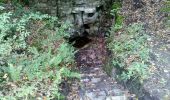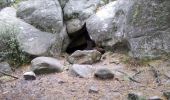

GLM-120926.2 - RerStGermain-GtteCristaux

randodan
Gebruiker

Lengte
5,6 km

Max. hoogte
150 m

Positief hoogteverschil
85 m

Km-Effort
6,8 km

Min. hoogte
85 m

Negatief hoogteverschil
87 m
Boucle
Ja
Datum van aanmaak :
2014-12-10 00:00:00.0
Laatste wijziging :
2014-12-10 00:00:00.0
2h32
Moeilijkheid : Gemakkelijk

Gratisgps-wandelapplicatie
Over ons
Tocht Stappen van 5,6 km beschikbaar op Île-de-France, Seine-et-Marne, Fontainebleau. Deze tocht wordt voorgesteld door randodan.
Beschrijving
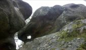
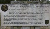
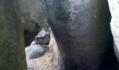
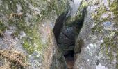
Les Gais Lurons du Mercredi . 26 septembre 2012 ap.midi . Départ parking Cabaret Masson . Denecourt 4 (Rocher St-Germain), aller par le Nord, retour par le Sud . Nombreux rochers et passages remarquables .
3 participants .
POI's
Plaatsbepaling
Land:
France
Regio :
Île-de-France
Departement/Provincie :
Seine-et-Marne
Gemeente :
Fontainebleau
Locatie:
Unknown
Vertrek:(Dec)
Vertrek:(UTM)
477018 ; 5365380 (31U) N.
Opmerkingen
Wandeltochten in de omgeving

La Mare aux Fées 18km - Forêt de Fontainebleau


Stappen
Medium
(5)
Fontainebleau,
Île-de-France,
Seine-et-Marne,
France

18 km | 22 km-effort
4h 41min
Ja
Sur les traces de Césaire Sempité - Fontainebleau rocher canon


Stappen
Gemakkelijk
(1)
Fontainebleau,
Île-de-France,
Seine-et-Marne,
France

17,3 km | 21 km-effort
4h 8min
Ja
3pi-150428 - DésertApremont-Jupiter


Stappen
Gemakkelijk
(1)
Fontainebleau,
Île-de-France,
Seine-et-Marne,
France

16 km | 19,4 km-effort
6h 30min
Ja
Rando mares aux fees Gilles18 km


Stappen
Zeer moeilijk
(1)
Fontainebleau,
Île-de-France,
Seine-et-Marne,
France

17,8 km | 22 km-effort
4h 58min
Ja
170822 - RECO BoisLeRoi-Cmcas


Stappen
Heel gemakkelijk
(1)
Bois-le-Roi,
Île-de-France,
Seine-et-Marne,
France

8,7 km | 10 km-effort
2h 41min
Ja
131204-GLM - CxToulouse-StLouis


Stappen
Gemakkelijk
(3)
Fontainebleau,
Île-de-France,
Seine-et-Marne,
France

9 km | 10,7 km-effort
3h 0min
Ja
Boucle du Château de Fontainebleau à Thomery 21 km


Stappen
Medium
Fontainebleau,
Île-de-France,
Seine-et-Marne,
France

21 km | 24 km-effort
4h 27min
Ja
Fontainebleau les monts de Fay


Te voet
Medium
Fontainebleau,
Île-de-France,
Seine-et-Marne,
France

22 km | 27 km-effort
6h 12min
Ja

SityTrail - JC 71 Fontainebleau Rocher Cassepot, Tour Denecourt


Stappen
Moeilijk
(1)
Fontainebleau,
Île-de-France,
Seine-et-Marne,
France

16,9 km | 22 km-effort
4h 55min
Ja


 SityTrail


