![](/images/other/stat-length.png)
![Tocht Stappen Saint-Aignan - GR41 et bord de Cher quand même possible - Photo](https://media.geolcdn.com/t/1900/400/ext.pjpeg?maxdim=2&url=https%3A%2F%2Fservices.sitytrail.com%2FGeolivesWS%2FDownloadMedia.ashx%3FTrailID%3D145626%26Media%3D20120811174757.jpg)
GR41 et bord de Cher quand même possible
Arnoldr8491
Gebruiker
![Lengte](/images/other/stat-length.png)
![Max. hoogte](https://static1.geolcdn.com/siteimages/upload/files/1508320355ic_sort_altitude_max_24dp.png)
![Positief hoogteverschil](https://static1.geolcdn.com/siteimages/upload/files/1508320355ic_sort_den_pos_24dp.png)
![Km-Effort](/images/other/stat-length.png)
![Min. hoogte](https://static1.geolcdn.com/siteimages/upload/files/1508320355ic_sort_altitude_min_24dp.png)
![Negatief hoogteverschil](https://static1.geolcdn.com/siteimages/upload/files/1508320355ic_sort_den_neg_24dp.png)
![Boucle](https://static1.geolcdn.com/siteimages/upload/files/16400158638029165_repeat_loop_refresh_sync_direction_icon.png)
![Stappen](https://static1.geolcdn.com/sitytour/trail-icons/101.png)
5h38
Moeilijkheid : Onbekend
![Scan deze QR-code om de tocht te openen in de SityTrail-applicatie](https://capi.geolives.com/qq0zvz2zws4bq2lad0pu/sitytour/trails/145626/qr.png?size=200)
Gratisgps-wandelapplicatie
Over ons
Tocht Stappen van 13,4 km beschikbaar op Centre-Val de Loire, Loir-et-Cher, Saint-Aignan. Deze tocht wordt voorgesteld door Arnoldr8491.
Beschrijving
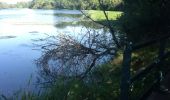
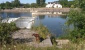
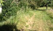
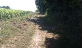
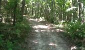
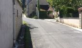
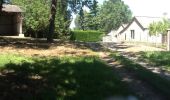
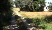
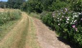
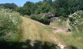
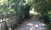
Petite boucle depuis Saint-Aignan, sur GR41 d'une part (très agréable) et retour depuis Marieul-sur-Cher le long du Cher bien que ne figure par les cartes IGN, absolument praticable. Attention par forts vents, à mon avis risques de d'arbres, probablement la raison pour laquelle non décrite. Dernier km sur Saint-Aignan pas trop sympathique. Une crêpe à la crêperie Au Bigouden au bas de la ville, pourrait arranger les choses..
Plaatsbepaling
Opmerkingen
Wandeltochten in de omgeving
![Tocht Stappen Seigy - Seigy - GR41 Saint-Aignan - 15.3km 250m 3h50 - 2022 08 27 - Photo](https://media.geolcdn.com/t/375/260/ce233dd4-c4b8-4702-89cb-342a0e34bd99.jpg&format=jpg&maxdim=2)
![Stappen Stappen](https://static1.geolcdn.com/sitytour/trail-icons/101.png)
Stappen
![](/images/other/stat-length.png)
![](https://static1.geolcdn.com/siteimages/upload/files/16400158638029165_repeat_loop_refresh_sync_direction_icon.png)
![Tocht Stappen Mareuil-sur-Cher - Mareuil-sur-Cher - les Sables GR41 et PR - 15.7km 240m 4h00 - 2022 04 22 - Photo](https://media.geolcdn.com/t/375/260/9ff3c148-2d06-4258-887c-304935c254d0.jpg&format=jpg&maxdim=2)
![Stappen Stappen](https://static1.geolcdn.com/sitytour/trail-icons/101.png)
Stappen
![](/images/other/stat-length.png)
![](https://static1.geolcdn.com/siteimages/upload/files/16400158638029165_repeat_loop_refresh_sync_direction_icon.png)
![Tocht Stappen Saint-Aignan - Beauval - 5 km 60m 2h20 - 2017 04 01 - Photo](https://media.geolcdn.com/t/375/260/5ff467b2-15fa-4f85-a626-c5126ab956ad.jpg&format=jpg&maxdim=2)
![Stappen Stappen](https://static1.geolcdn.com/sitytour/trail-icons/101.png)
Stappen
![](/images/other/stat-length.png)
![](https://static1.geolcdn.com/siteimages/upload/files/16400158638029165_repeat_loop_refresh_sync_direction_icon.png)
![Tocht Stappen Saint-Aignan - Saint-Aignan-sur-Cher - Zoo - 2015 12 27 - Photo](https://media.geolcdn.com/t/375/260/fab5d5de-43d5-47b2-9ea1-fda1490e2a16.jpg&format=jpg&maxdim=2)
![Stappen Stappen](https://static1.geolcdn.com/sitytour/trail-icons/101.png)
Stappen
![](/images/other/stat-length.png)
![](https://static1.geolcdn.com/siteimages/upload/files/16400158638029165_repeat_loop_refresh_sync_direction_icon.png)
![Stappen Stappen](https://static1.geolcdn.com/sitytour/trail-icons/101.png)
Stappen
![](/images/other/stat-length.png)
![](https://static1.geolcdn.com/siteimages/upload/files/16400158638029165_repeat_loop_refresh_sync_direction_icon.png)
![Stappen Stappen](https://static1.geolcdn.com/sitytour/trail-icons/101.png)
Stappen
![](/images/other/stat-length.png)
![](https://static1.geolcdn.com/siteimages/upload/files/16400158638029165_repeat_loop_refresh_sync_direction_icon.png)
![Tocht Stappen Saint-Aignan - Beauval - 2016 05 17 - Photo](https://media.geolcdn.com/t/375/260/776277b7-df6c-4824-aa9a-f8dd855bebc1.jpg&format=jpg&maxdim=2)
![Stappen Stappen](https://static1.geolcdn.com/sitytour/trail-icons/101.png)
Stappen
![](/images/other/stat-length.png)
![](https://static1.geolcdn.com/siteimages/upload/files/16400158638029165_repeat_loop_refresh_sync_direction_icon.png)
![Tocht Stappen Saint-Aignan - beauva - Photo](https://media.geolcdn.com/t/375/260/6cc3c8eb-a808-4722-8e77-106ecb7ecde9.jpg&format=jpg&maxdim=2)
![Stappen Stappen](https://static1.geolcdn.com/sitytour/trail-icons/101.png)
Stappen
![](/images/other/stat-length.png)
![](https://static1.geolcdn.com/siteimages/upload/files/16400158638029165_repeat_loop_refresh_sync_direction_icon.png)
![Tocht Stappen Saint-Aignan - Beauval - Photo](https://media.geolcdn.com/t/375/260/ext.jpg?maxdim=2&url=https%3A%2F%2Fservices.sitytrail.com%2FGeolivesWS%2FDownloadMedia.ashx%3FTrailID%3D344859%26Media%3Dfix__20140914102049.jpg)
![Stappen Stappen](https://static1.geolcdn.com/sitytour/trail-icons/101.png)
Stappen
![](/images/other/stat-length.png)
![](https://static1.geolcdn.com/siteimages/upload/files/16400158638029165_repeat_loop_refresh_sync_direction_icon.png)
Downloaded the whole of France for 3 types of Maps. Two are NOT working off line. Very frustrating. Will delete this app