


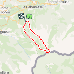

24 km | 43 km-effort


Gebruiker


Gratisgps-wandelapplicatie
 SityTrail
IGN / Geografische instituten
SityTrail World
De wereld gaat voor u open
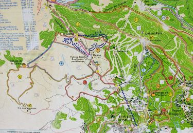
Tocht Andere activiteiten van 17,7 km beschikbaar op Occitanië, Pyrénées-Orientales, Eyne. Deze tocht wordt voorgesteld door bone52.
par la vallée d'Eyne, retour par la Torre d'Eyne
Belle rando, un peu longue sur la descente
point de vue magnifique sur les Pyrénées catalanes

Stappen

Stappen

Stappen

Mountainbike

Stappen
Stappen
Stappen

Stappen
Stappen