2012-06-16 12h31m17 SityTrail > Tochten > Outdoor > France > Bourgondië-Franche-Comté > Yonne > Cry SityTrail > Tochten > Outdoor > France > Bourgondië-Franche-Comté > Yonne > Cry 2012-06-16 12h31m17 spinnerfrog Gebruiker 3D © OpenStreetMap contributors Lengte 41 km Max. hoogte 338 m Positief hoogteverschil 447 m Km-Effort 47 km Min. hoogte 186 m Negatief hoogteverschil 385 m Boucle Neen Datum van aanmaak : 2014-12-10 00:00:00.0 Laatste wijziging : 2014-12-10 00:00:00.0 (2 Bericht) Motor 29m Moeilijkheid : Gemakkelijk Gratisgps-wandelapplicatie SityTrail IGN / Geografische instituten SityTrail World De wereld gaat voor u open Over ons 
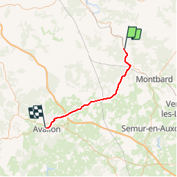
Tocht Motor van 41 km beschikbaar op Bourgondië-Franche-Comté, Yonne, Cry. Deze tocht wordt voorgesteld door spinnerfrog. Legenden | Meer details (PDF) Hoogteprofiel Legenden > 15% 15% - 10% 10% - 5% vlak 5% - 10% 10% - 15% 15% - 30% > 30% Plaatsbepaling Land: France Regio : Bourgondië-Franche-Comté Departement/Provincie : Yonne Gemeente : Cry Locatie: Unknown Vertrek:(Dec) 47.70546 / 4.219074 Vertrek:(UTM) 591453 ; 5284284 (31T) N. Opmerkingen Gelieve in te loggen om een commentaar of een beoordeling achter te laten guest 2017-04-23 00:00:00.0 guest 2015-04-19 00:00:00.0 bonne application pour des randonnées en quad,localisation hors ligne,très utile ,ras. Wandeltochten in de omgeving ghjpmlo raid armançon 18km 17 09 2016 Andere activiteiten Heel gemakkelijk Ravières, Bourgondië-Franche-Comté, Yonne, France 21 km | 25 km-effort 2h 13min Ja
guest 2015-04-19 00:00:00.0 bonne application pour des randonnées en quad,localisation hors ligne,très utile ,ras.
bonne application pour des randonnées en quad,localisation hors ligne,très utile ,ras.