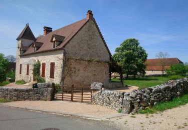
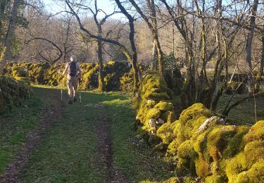
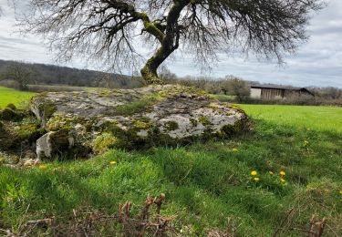
Tocht Stappen Reilhac - Reilhac  - Photo
 marmotte64
marmotte64

Gebruiker

© OpenStreetMap contributors
Lengte
Lengte
10 km
Max. hoogte
Max. hoogte
391 m
Positief hoogteverschil
147 m
Km-Effort
Km-Effort  
11,9 km
Min. hoogte
Min. hoogte
325 m
Negatief hoogteverschil
145 m
Boucle
Boucle
Ja
Datum van aanmaak :
2014-12-10 00:00:00.0
Laatste wijziging :
2014-12-10 00:00:00.0

(1 Bericht)

Stappen
Stappen
2h39
Moeilijkheid : Gemakkelijk

Scan deze QR-code om de tocht te openen in de SityTrail-applicatie

Gratisgps-wandelapplicatie

Logo SityTrail SityTrail

IGN / Geografische instituten

SityTrail uit de App Store downloaden SityTrail uit Google Play downloaden

Logo SityTrail SityTrail World

De wereld gaat voor u open

SityTrail uit de App Store downloaden SityTrail uit Google Play downloaden SityTrail op Huawei AppGallery downloaden

Over ons

Tocht Stappen van 10 km beschikbaar op Occitanië, Lot, Reilhac. Deze tocht wordt voorgesteld door marmotte64.

Hoogteprofiel

POI's

POI Reilhac - gariotte  - Photo
marmotte64
REILHAC 
POI Reilhac - observation dès étoiles  - Photo
marmotte64

Plaatsbepaling

Land:
France
Regio :
Occitanië
Departement/Provincie :
Lot
Gemeente :
Reilhac
Locatie:
Unknown
Vertrek:(Dec)
Vertrek:(UTM)
398479 ; 4950430 (31T) N.

Opmerkingen

Gelieve in te loggen om een commentaar of een beoordeling achter te laten


Monteils Marcilhac Grezes Brengues Grealou Marcilhac Monteils ; 2 côtes


Wandeltochten in de omgeving

Tocht Stappen Reilhac - Reihlac  - Photo
Stappen
Gegetop

Stappen

Heel gemakkelijk
(1)
Reilhac, Occitanië, Lot, France
9 km | 10,5 km-effort
2h 34min
Ja
Tocht Andere activiteiten Reilhac - reilhac - Photo
Andere activiteiten
fouilladepierre

Andere activiteiten

Heel gemakkelijk
(1)
Reilhac, Occitanië, Lot, France
17,4 km | 20 km-effort
4h 0min
Ja
Tocht Stappen Reilhac - Autour de Reilhac - Photo
Stappen
neleda

Stappen

Heel gemakkelijk
Reilhac, Occitanië, Lot, France
10,6 km | 12,6 km-effort
3h 11min
Ja
Tocht Stappen Issendolus - Chemin des gariottes - Photo
Stappen
viam19

Stappen

Gemakkelijk
Issendolus, Occitanië, Lot, France
10,6 km | 12,6 km-effort
4h 10min
Ja
Tocht Wegfiets Le Bastit - Rando-Cyclo6-Rocamadour-63km-Juin21 - Photo
Wegfiets
Patrick2019

Wegfiets

Zeer moeilijk
Le Bastit, Occitanië, Lot, France
63 km | 79 km-effort
4h 47min
Ja
Tocht Wegfiets Le Bastit - Rando-Cyclo14-LeCausse-62km-Juin21 - Photo
Wegfiets
Patrick2019

Wegfiets

Zeer moeilijk
Le Bastit, Occitanië, Lot, France
62 km | 75 km-effort
4h 33min
Ja
Tocht Wegfiets Le Bastit - Rando-Cyclo15-Racamadour-56Km-Juin21 - Photo
Wegfiets
Patrick2019

Wegfiets

Zeer moeilijk
Le Bastit, Occitanië, Lot, France
56 km | 70 km-effort
4h 15min
Ja
Tocht Huifkarwandeling Cœur de Causse - Fontannes du causse - Photo
Huifkarwandeling
Eimie Proost

Huifkarwandeling

Heel gemakkelijk
Cœur de Causse, Occitanië, Lot, France
21 km | 26 km-effort
Onbekend
Ja
Tocht Stappen Reilhac - Reilhac/ Pech du Cornouiller/ Goudelan-8014127 - Photo
Stappen
houbart

Stappen

Moeilijk
(1)
Reilhac, Occitanië, Lot, France
10,7 km | 12,8 km-effort
2h 54min
Ja


Sluiten
Mijn abonnementen