


12 km | 18,7 km-effort


Gebruiker


Gratisgps-wandelapplicatie
 SityTrail
IGN / Geografische instituten
SityTrail World
De wereld gaat voor u open
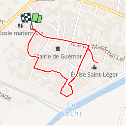
Tocht Stappen van 884 m beschikbaar op Grand Est, Haut-Rhin, Guémar. Deze tocht wordt voorgesteld door ribeauville.
Guémar est un ancien village de pêcheurs et d’agriculteurs qui comporte encore aujourd’hui quelques fermes en maçonnerie et pan de bois avec des dépendances (granges, étables, anciens séchoirs à tabac).
L’agglomération au bâti très dense, enfermée dans son enceinte jusqu’au début du XXe siècle, s’est agrandie après la dernière guerre. Les fossés de l’enceinte ont été aménagés en promenade et plantés de jardins potagers formant une ceinture verte autour de l’agglomération.
La charmante ville de Guémar offre aujourd’hui le visage d’une localité paisible et fleurie où l’on peut découvrir à loisir les vestiges de son riche passé.

Stappen
Stappen
Stappen

Stappen

Stappen

Paardrijden

Paardrijden

Stappen
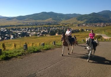
Paardrijden