![](/images/other/stat-length.png)
![Tocht Stappen Blot-l'Église - Blot l'Eglise et le Château Rocher - Photo](https://media.geolcdn.com/t/1900/400/ext.pjpeg?maxdim=2&url=https%3A%2F%2Fservices.sitytrail.com%2FGeolivesWS%2FDownloadMedia.ashx%3FTrailID%3D129845%26Media%3D13398_4.jpg)
Blot l'Eglise et le Château Rocher
tracegps
Gebruiker
![Lengte](/images/other/stat-length.png)
![Max. hoogte](https://static1.geolcdn.com/siteimages/upload/files/1508320355ic_sort_altitude_max_24dp.png)
![Positief hoogteverschil](https://static1.geolcdn.com/siteimages/upload/files/1508320355ic_sort_den_pos_24dp.png)
![Km-Effort](/images/other/stat-length.png)
![Min. hoogte](https://static1.geolcdn.com/siteimages/upload/files/1508320355ic_sort_altitude_min_24dp.png)
![Negatief hoogteverschil](https://static1.geolcdn.com/siteimages/upload/files/1508320355ic_sort_den_neg_24dp.png)
![Boucle](https://static1.geolcdn.com/siteimages/upload/files/16400158638029165_repeat_loop_refresh_sync_direction_icon.png)
![Stappen](https://static1.geolcdn.com/sitytour/trail-icons/101.png)
5h30
Moeilijkheid : Moeilijk
![Scan deze QR-code om de tocht te openen in de SityTrail-applicatie](https://capi.geolives.com/qq0zvz2zws4bq2lad0pu/sitytour/trails/129845/qr.png?size=200)
Gratisgps-wandelapplicatie
Over ons
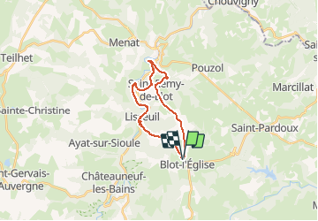
Tocht Stappen van 20 km beschikbaar op Auvergne-Rhône-Alpes, Puy-de-Dôme, Blot-l'Église. Deze tocht wordt voorgesteld door tracegps.
Beschrijving
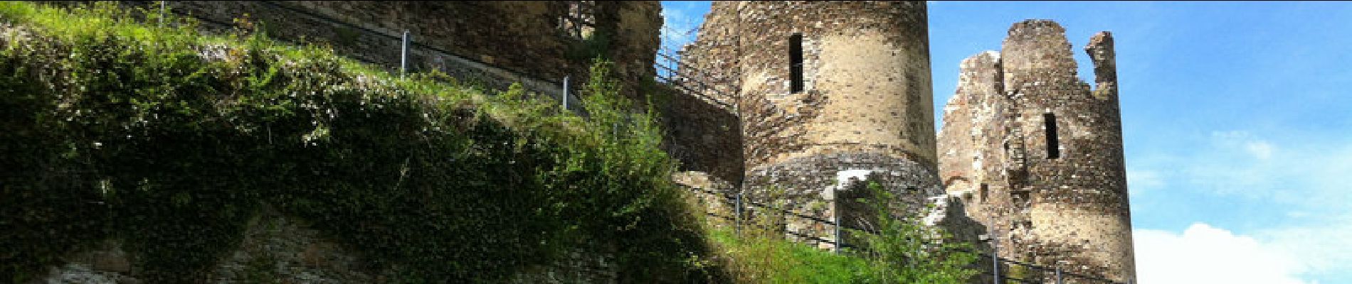
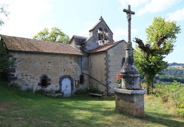
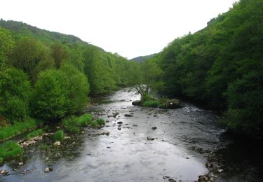
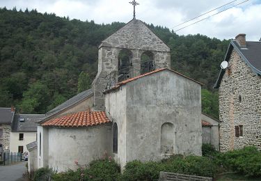
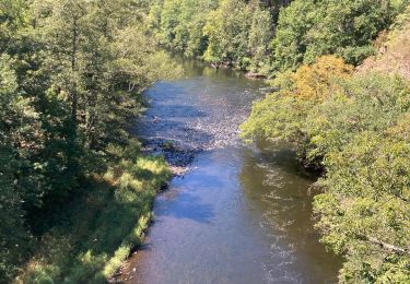
Un bel itinéraire qui longe la Sioule en certains endroits, qui conduit au Château Rocher, ruines en constantes restaurations, avec des paysages vallonnés boisés et des vues de tous cotés. Le parcours peut-être raccourci si besoin un peu au Nord de St-Rémy de Biot.
Plaatsbepaling
Opmerkingen
Wandeltochten in de omgeving
![Tocht Stappen Blot-l'Église - Blot_Eglise_Pery - Photo](https://media.geolcdn.com/t/375/260/d9de8da0-8f81-48e6-a962-7e78784a81e9.jpg&format=jpg&maxdim=2)
![Stappen Stappen](https://static1.geolcdn.com/sitytour/trail-icons/101.png)
Stappen
![](/images/other/stat-length.png)
![](https://static1.geolcdn.com/siteimages/upload/files/16400158638029165_repeat_loop_refresh_sync_direction_icon.png)
![Tocht Stappen Châteauneuf-les-Bains - La chapelle Saint Valentin - Chateauneuf les Bains - Photo](https://media.geolcdn.com/t/375/260/ext.jpg?maxdim=2&url=https%3A%2F%2Fservices.sitytrail.com%2FGeolivesWS%2FDownloadMedia.ashx%3FTrailID%3D107367%26Media%3D12265_4.jpg)
![Stappen Stappen](https://static1.geolcdn.com/sitytour/trail-icons/101.png)
Stappen
![](/images/other/stat-length.png)
![](https://static1.geolcdn.com/siteimages/upload/files/16400158638029165_repeat_loop_refresh_sync_direction_icon.png)
![Tocht Te voet Blot-l'Église - Chapelle Saint-Valentin - Photo](https://media.geolcdn.com/t/375/260/636b7308-827b-484c-af88-d10eb681c6f6.jpeg&format=jpg&maxdim=2)
![Te voet Te voet](https://static1.geolcdn.com/sitytour/trail-icons/100.png)
Te voet
![](/images/other/stat-length.png)
![](https://static1.geolcdn.com/siteimages/upload/files/16400158638029165_repeat_loop_refresh_sync_direction_icon.png)
![Tocht Te voet Ayat-sur-Sioule - Les Cotes - Photo](https://media.geolcdn.com/t/375/260/1a7ac899-7188-4fdf-bd9b-f25ee51e895d.jpeg&format=jpg&maxdim=2)
![Te voet Te voet](https://static1.geolcdn.com/sitytour/trail-icons/100.png)
Te voet
![](/images/other/stat-length.png)
![](https://static1.geolcdn.com/siteimages/upload/files/16400158638029165_repeat_loop_refresh_sync_direction_icon.png)
![Tocht Te voet Lisseuil - Lisseuil - Photo](https://media.geolcdn.com/t/375/260/5816c14b-dd3a-4f14-83b4-045502c6d651.jpeg&format=jpg&maxdim=2)
![Te voet Te voet](https://static1.geolcdn.com/sitytour/trail-icons/100.png)
Te voet
![](/images/other/stat-length.png)
![](https://static1.geolcdn.com/siteimages/upload/files/16400158638029165_repeat_loop_refresh_sync_direction_icon.png)
![Tocht Te voet Saint-Rémy-de-Blot - Chateau-Rocher - Photo](https://media.geolcdn.com/t/375/260/b4e40603-7f2c-4069-952e-528bc9ebae62.jpeg&format=jpg&maxdim=2)
![Te voet Te voet](https://static1.geolcdn.com/sitytour/trail-icons/100.png)
Te voet
![](/images/other/stat-length.png)
![](https://static1.geolcdn.com/siteimages/upload/files/16400158638029165_repeat_loop_refresh_sync_direction_icon.png)
![Tocht Mountainbike Saint-Angel - St-Angel_Sioule_35 - Photo](https://media.geolcdn.com/t/375/260/ext.jpg?maxdim=2&url=https%3A%2F%2Fstatic1.geolcdn.com%2Fsiteimages%2Fupload%2Ffiles%2F1524743154velo.jpg)
![Mountainbike Mountainbike](https://static1.geolcdn.com/sitytour/trail-icons/202.png)
Mountainbike
![](/images/other/stat-length.png)
![](https://static1.geolcdn.com/siteimages/upload/files/16400158638029165_repeat_loop_refresh_sync_direction_icon.png)
![Tocht Stappen Lisseuil - Lisseuil_Chateau_Rocher - Photo](https://media.geolcdn.com/t/375/260/d16a416c-06fd-4b71-8673-2d1f708bade4.jpg&format=jpg&maxdim=2)
![Stappen Stappen](https://static1.geolcdn.com/sitytour/trail-icons/101.png)
Stappen
![](/images/other/stat-length.png)
![](https://static1.geolcdn.com/siteimages/upload/files/16400158638029165_repeat_loop_refresh_sync_direction_icon.png)
![Tocht Stappen Châteauneuf-les-Bains - Gorges de la sioule - Photo](https://media.geolcdn.com/t/375/260/3e504d16-c296-422e-84ea-74304fd11fa5.jpg&format=jpg&maxdim=2)
![Stappen Stappen](https://static1.geolcdn.com/sitytour/trail-icons/101.png)
Stappen
![](/images/other/stat-length.png)
![](https://static1.geolcdn.com/siteimages/upload/files/16400158638029165_repeat_loop_refresh_sync_direction_icon.png)