![](/images/other/stat-length.png)
![Tocht Stappen Carolles - 2012-04-08 Champeaux Falaises et landes - Photo](https://media.geolcdn.com/t/1900/400/ext.pjpeg?maxdim=2&url=https%3A%2F%2Fstatic1.geolcdn.com%2Fsiteimages%2Fupload%2Ffiles%2F1553511878bg_sport_marche.png)
2012-04-08 Champeaux Falaises et landes
mousetik
Gebruiker
![Lengte](/images/other/stat-length.png)
Lengte
16,2 km
![Max. hoogte](https://static1.geolcdn.com/siteimages/upload/files/1508320355ic_sort_altitude_max_24dp.png)
Max. hoogte
100 m
![Positief hoogteverschil](https://static1.geolcdn.com/siteimages/upload/files/1508320355ic_sort_den_pos_24dp.png)
Positief hoogteverschil
273 m
![Km-Effort](/images/other/stat-length.png)
Km-Effort
19,8 km
![Min. hoogte](https://static1.geolcdn.com/siteimages/upload/files/1508320355ic_sort_altitude_min_24dp.png)
Min. hoogte
9 m
![Negatief hoogteverschil](https://static1.geolcdn.com/siteimages/upload/files/1508320355ic_sort_den_neg_24dp.png)
Negatief hoogteverschil
274 m
![Boucle](https://static1.geolcdn.com/siteimages/upload/files/16400158638029165_repeat_loop_refresh_sync_direction_icon.png)
Boucle
Ja
Datum van aanmaak :
2014-12-10 00:00:00.0
Laatste wijziging :
2014-12-10 00:00:00.0
![Stappen](https://static1.geolcdn.com/sitytour/trail-icons/101.png)
3h49
Moeilijkheid : Moeilijk
![Scan deze QR-code om de tocht te openen in de SityTrail-applicatie](https://capi.geolives.com/qq0zvz2zws4bq2lad0pu/sitytour/trails/120580/qr.png?size=200)
Gratisgps-wandelapplicatie
Over ons
Tocht Stappen van 16,2 km beschikbaar op Normandië, Manche, Carolles. Deze tocht wordt voorgesteld door mousetik.
Beschrijving
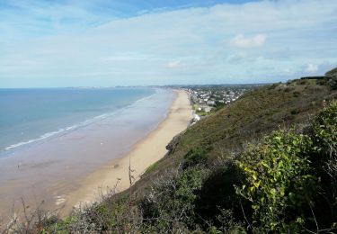
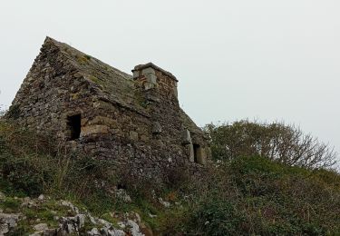
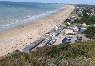
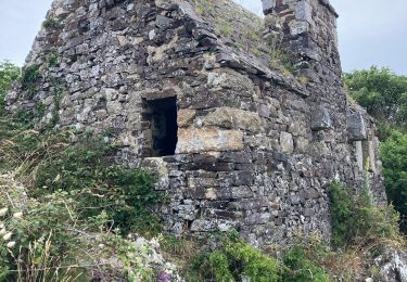
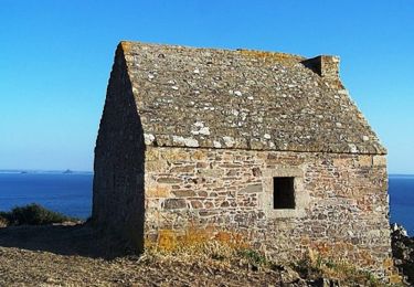
Départ Parking Cabane Vauban
Chemin des douaniers jusqu'à Saint Jean Le Thomas
Remontée dans l'arrière pays de Champeaux et de Carolles
Retour au parking
Plaatsbepaling
Land:
France
Regio :
Normandië
Departement/Provincie :
Manche
Gemeente :
Carolles
Locatie:
Unknown
Vertrek:(Dec)
Vertrek:(UTM)
605470 ; 5399898 (30U) N.
Opmerkingen
Wandeltochten in de omgeving
![Tocht Stappen Carolles - La Vallée du Lude - Carolles - Photo](https://media.geolcdn.com/t/375/260/ext.jpg?maxdim=2&url=https%3A%2F%2Fservices.sitytrail.com%2FGeolivesWS%2FDownloadMedia.ashx%3FTrailID%3D111207%26Media%3D6732_2.jpg)
![Stappen Stappen](https://static1.geolcdn.com/sitytour/trail-icons/101.png)
La Vallée du Lude - Carolles
Stappen
Medium
(1)
Carolles,
Normandië,
Manche,
France
![](/images/other/stat-length.png)
6,7 km | 8,6 km-effort
2h 30min
![](https://static1.geolcdn.com/siteimages/upload/files/16400158638029165_repeat_loop_refresh_sync_direction_icon.png)
Neen
![Tocht Stappen Carolles - Falaises de Carolles - Photo](https://media.geolcdn.com/t/375/260/5d1fc960-65ea-42db-9e46-60d9d0864366.jpg&format=jpg&maxdim=2)
![Stappen Stappen](https://static1.geolcdn.com/sitytour/trail-icons/101.png)
Falaises de Carolles
Stappen
Heel gemakkelijk
Carolles,
Normandië,
Manche,
France
![](/images/other/stat-length.png)
4,1 km | 5,4 km-effort
1h 6min
![](https://static1.geolcdn.com/siteimages/upload/files/16400158638029165_repeat_loop_refresh_sync_direction_icon.png)
Ja
![Tocht Stappen Champeaux - les falaises de Carolles - Champeaux - Photo](https://media.geolcdn.com/t/375/260/b4018617-2a83-4486-b109-eba5df37275a.jpg&format=jpg&maxdim=2)
![Stappen Stappen](https://static1.geolcdn.com/sitytour/trail-icons/101.png)
les falaises de Carolles - Champeaux
Stappen
Medium
Champeaux,
Normandië,
Manche,
France
![](/images/other/stat-length.png)
8,6 km | 10,9 km-effort
2h 13min
![](https://static1.geolcdn.com/siteimages/upload/files/16400158638029165_repeat_loop_refresh_sync_direction_icon.png)
Ja
![Tocht Stappen Carolles - Carolle-plage--Cabane Vauban - Photo](https://media.geolcdn.com/t/375/260/a1294c86-a38d-47df-96a5-f6a609fcfeb5.jpg&format=jpg&maxdim=2)
![Stappen Stappen](https://static1.geolcdn.com/sitytour/trail-icons/101.png)
Carolle-plage--Cabane Vauban
Stappen
Medium
Carolles,
Normandië,
Manche,
France
![](/images/other/stat-length.png)
5,9 km | 7,8 km-effort
3h 0min
![](https://static1.geolcdn.com/siteimages/upload/files/16400158638029165_repeat_loop_refresh_sync_direction_icon.png)
Ja
![Tocht Stappen Champeaux - La cabane Vauban et ses falaises - Photo](https://media.geolcdn.com/t/375/260/0537bf9f-7396-4153-894c-ff80f4b1c8c9.jpg&format=jpg&maxdim=2)
![Stappen Stappen](https://static1.geolcdn.com/sitytour/trail-icons/101.png)
La cabane Vauban et ses falaises
Stappen
Medium
Champeaux,
Normandië,
Manche,
France
![](/images/other/stat-length.png)
7,9 km | 9,5 km-effort
2h 54min
![](https://static1.geolcdn.com/siteimages/upload/files/16400158638029165_repeat_loop_refresh_sync_direction_icon.png)
Ja
![Tocht Stappen Carolles - carolles 2 Françoise Chan - Photo](https://media.geolcdn.com/t/375/260/84d08c68-e3bb-40fc-8c58-d13ee2f789eb.jpg&format=jpg&maxdim=2)
![Stappen Stappen](https://static1.geolcdn.com/sitytour/trail-icons/101.png)
carolles 2 Françoise Chan
Stappen
Medium
Carolles,
Normandië,
Manche,
France
![](/images/other/stat-length.png)
8,5 km | 10,6 km-effort
2h 50min
![](https://static1.geolcdn.com/siteimages/upload/files/16400158638029165_repeat_loop_refresh_sync_direction_icon.png)
Ja
![Tocht Noords wandelen Carolles - Carolles 7 km chantal Françoise - Photo](https://media.geolcdn.com/t/375/260/511e2612-50d0-4984-9fe7-21900970065f.jpg&format=jpg&maxdim=2)
![Noords wandelen Noords wandelen](https://static1.geolcdn.com/sitytour/trail-icons/102.png)
Carolles 7 km chantal Françoise
Noords wandelen
Heel gemakkelijk
Carolles,
Normandië,
Manche,
France
![](/images/other/stat-length.png)
7 km | 9,3 km-effort
2h 33min
![](https://static1.geolcdn.com/siteimages/upload/files/16400158638029165_repeat_loop_refresh_sync_direction_icon.png)
Ja
![Tocht Stappen Jullouville - Jullouville - Carolles - Photo](https://media.geolcdn.com/t/375/260/7a08b560-2c53-4e14-8982-7e1346600440.jpg&format=jpg&maxdim=2)
![Stappen Stappen](https://static1.geolcdn.com/sitytour/trail-icons/101.png)
Jullouville - Carolles
Stappen
Medium
Jullouville,
Normandië,
Manche,
France
![](/images/other/stat-length.png)
7,4 km | 8,6 km-effort
2h 4min
![](https://static1.geolcdn.com/siteimages/upload/files/16400158638029165_repeat_loop_refresh_sync_direction_icon.png)
Neen
![Tocht Stappen Dragey-Ronthon - Le Bec d’Andaine - Photo](https://media.geolcdn.com/t/375/260/9bab126b-7d02-49a6-a8e6-abf4befe4e3f.jpg&format=jpg&maxdim=2)
![Stappen Stappen](https://static1.geolcdn.com/sitytour/trail-icons/101.png)
Le Bec d’Andaine
Stappen
Gemakkelijk
Dragey-Ronthon,
Normandië,
Manche,
France
![](/images/other/stat-length.png)
10,2 km | 11,2 km-effort
3h 1min
![](https://static1.geolcdn.com/siteimages/upload/files/16400158638029165_repeat_loop_refresh_sync_direction_icon.png)
Ja