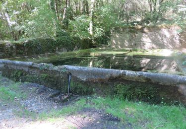
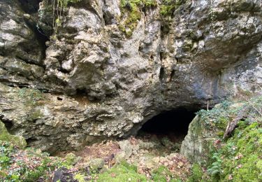
Tocht Stappen Caylus - Rallye - Photo
 albert13
albert13

Gebruiker

© OpenStreetMap contributors
Lengte
Lengte
19,6 km
Max. hoogte
Max. hoogte
369 m
Positief hoogteverschil
326 m
Km-Effort
Km-Effort  
24 km
Min. hoogte
Min. hoogte
208 m
Negatief hoogteverschil
311 m
Boucle
Boucle
Neen
Datum van aanmaak :
2014-12-10 00:00:00.0
Laatste wijziging :
2014-12-10 00:00:00.0

(1 Bericht)

Stappen
Stappen
--
Moeilijkheid : Moeilijk

Scan deze QR-code om de tocht te openen in de SityTrail-applicatie

Gratisgps-wandelapplicatie

Logo SityTrail SityTrail

IGN / Geografische instituten

SityTrail uit de App Store downloaden SityTrail uit Google Play downloaden

Logo SityTrail SityTrail World

De wereld gaat voor u open

SityTrail uit de App Store downloaden SityTrail uit Google Play downloaden SityTrail op Huawei AppGallery downloaden

Over ons

Tocht Stappen van 19,6 km beschikbaar op Occitanië, Tarn-et-Garonne, Caylus. Deze tocht wordt voorgesteld door albert13.

Hoogteprofiel

POI's

POI Caylus - P1 - Photo
albert13
CAYLUS 
POI Caylus - P2 - Photo
albert13
CAYLUS 
POI Caylus - P3 - Photo
albert13
CAYLUS 
POI Caylus - B1 - Photo
albert13
CAYLUS 
POI Caylus - O2 - Photo
albert13
CAYLUS 
POI Caylus - O1 - Photo
albert13
CAYLUS 
POI Caylus - R3 - Photo
albert13
CAYLUS 
POI Caylus - R2 - Photo
albert13
CAYLUS 
POI Caylus - R1 - Photo
albert13
CAYLUS 
POI Puylaroque - B2 - Photo
albert13
PUYLAROQUE 
POI Puylaroque - B3 - Photo
albert13
PUYLAROQUE 
POI Puylaroque - detour - Photo
albert13
PUYLAROQUE 
POI Caylus - detour - Photo
albert13
CAYLUS 

Plaatsbepaling

Land:
France
Regio :
Occitanië
Departement/Provincie :
Tarn-et-Garonne
Gemeente :
Caylus
Locatie:
Unknown
Vertrek:(Dec)
Vertrek:(UTM)
400029 ; 4903297 (31T) N.

Opmerkingen

Gelieve in te loggen om een commentaar of een beoordeling achter te laten


Wandeltochten in de omgeving

Tocht Stappen Lacapelle-Livron - PR1 Lacapelle-Livron : Chemin des anciens moulins - Photo
Stappen
houbart

Stappen

Medium
(1)
Lacapelle-Livron, Occitanië, Tarn-et-Garonne, France
7,2 km | 9,6 km-effort
2h 11min
Ja
Tocht sport Saint-Projet - St projet beauregard - Photo
sport
Glurps

sport

Heel gemakkelijk
Saint-Projet, Occitanië, Tarn-et-Garonne, France
15,7 km | 18,8 km-effort
Onbekend
Ja
Tocht Stappen Caylus -  caylus 1 - Photo
Stappen
gcournac

Stappen

Zeer moeilijk
Caylus, Occitanië, Tarn-et-Garonne, France
16,3 km | 21 km-effort
2h 44min
Ja
Tocht Mountainbike Caylus - VTT Caylus 45km 1100D+ 2021-12-16 - Photo
Mountainbike
Levillefranchois

Mountainbike

Moeilijk
Caylus, Occitanië, Tarn-et-Garonne, France
44 km | 57 km-effort
Onbekend
Ja
Tocht Stappen Caylus - 211115 Rando ARAT Caylus - Photo
Stappen
VIRGULIN

Stappen

Medium
Caylus, Occitanië, Tarn-et-Garonne, France
14,8 km | 18,6 km-effort
5h 36min
Ja
Tocht Andere activiteiten Caylus - 12.5 km - Photo
Andere activiteiten
albert13

Andere activiteiten

Heel gemakkelijk
Caylus, Occitanië, Tarn-et-Garonne, France
15,3 km | 17,9 km-effort
Onbekend
Ja
Tocht Stappen Caylus - 101024 - Photo
Stappen
ricou1964

Stappen

Medium
Caylus, Occitanië, Tarn-et-Garonne, France
18,9 km | 24 km-effort
4h 51min
Ja
Tocht Stappen Caylus - caylus - Photo
Stappen
marcolivier

Stappen

Zeer moeilijk
Caylus, Occitanië, Tarn-et-Garonne, France
17,9 km | 23 km-effort
5h 16min
Ja
Tocht Stappen Caylus - caylus pr6 petit bois du causse et cirque de caylus - Photo
Stappen
BernardEsteban

Stappen

Medium
Caylus, Occitanië, Tarn-et-Garonne, France
15,1 km | 20 km-effort
5h 2min
Ja


Sluiten
Mijn abonnementen