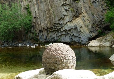
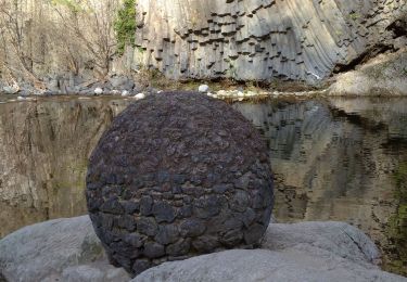
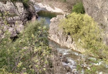
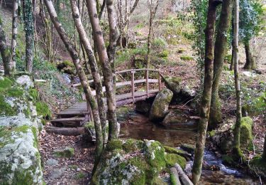
Tocht Stappen Thueyts - Trail balisage 51 km_maj_20_01_2017 - Photo

Trail balisage 51 km_maj_20_01_2017

 Lustou
Lustou

Gebruiker

© OpenStreetMap contributors
Lengte
Lengte
50 km
Max. hoogte
Max. hoogte
1349 m
Positief hoogteverschil
2758 m
Km-Effort
Km-Effort  
87 km
Min. hoogte
Min. hoogte
387 m
Negatief hoogteverschil
2764 m
Boucle
Boucle
Ja
Datum van aanmaak :
2019-04-26 19:24:55.384
Laatste wijziging :
2019-04-26 19:24:55.384

(0 Bericht)

Stappen
Stappen
17h42
Moeilijkheid : Onbekend

Scan deze QR-code om de tocht te openen in de SityTrail-applicatie

Gratisgps-wandelapplicatie

Logo SityTrail SityTrail

IGN / Geografische instituten

SityTrail uit de App Store downloaden SityTrail uit Google Play downloaden

Logo SityTrail SityTrail World

De wereld gaat voor u open

SityTrail uit de App Store downloaden SityTrail uit Google Play downloaden SityTrail op Huawei AppGallery downloaden

Over ons

Tocht Stappen van 50 km beschikbaar op Auvergne-Rhône-Alpes, Ardèche, Thueyts. Deze tocht wordt voorgesteld door Lustou.

Hoogteprofiel

POI's

POI Mayres - COL D'ABRAHAM - Photo
Lustou
POI Thueyts - ROCHER MIDI 0990  - Photo
Lustou
POI Jaujac - ROCHER MIDI 0960 - Photo
Lustou
POI Barnas - GRANGES 1000 - Photo
Lustou
BARNAS 
POI Barnas - GRANGES 1960 - Photo
Lustou
BARNAS 
POI Barnas - GRANGES D'ABRAHAM - Photo
Lustou
POI Barnas - LE FENADOU - Photo
Lustou
BARNAS 
POI Le Roux - X CHAUMIENNE 3750 - Photo
Lustou
POI Jaujac - TRAVERSES 1960 - Photo
Lustou
POI Thueyts - COURCOUSSAT 0840 - Photo
Lustou
POI Le Roux - X CHAUMIENNE 3250 - Photo
Lustou
POI Barnas - FONTFREYDE 4330 - Photo
Lustou
POI Mazan-l'Abbaye - X CHAUMIENNE 2540 - Photo
Lustou
MAZAN-L'ABBAYE 
POI Mazan-l'Abbaye - X CHAUMIENNE 1540 - Photo
Lustou
MAZAN-L'ABBAYE 
POI Mazan-l'Abbaye - X CHAUMIENNE 1000 - Photo
Lustou
MAZAN-L'ABBAYE 
POI Jaujac - LE FAU 0480 - Photo
Lustou
JAUJAC 
POI Barnas - Ravito 1 km - Photo
Lustou
BARNAS 
POI Jaujac - LE FAU 0430 - Photo
Lustou
JAUJAC 
POI Mazan-l'Abbaye - X CHAUMIENNE 0380 - Photo
Lustou
MAZAN-L'ABBAYE 
POI Mayres - ABRAHAM 1000 - Photo
Lustou
MAYRES 
POI Jaujac - LE FAU 0350 - Photo
Lustou
JAUJAC 
POI Mayres - 1 km controle - Photo
Lustou
POI Mazan-l'Abbaye - CROIX DE CHAUMIENNE - Photo
Lustou
MAZAN-L'ABBAYE 
POI Mayres - VIEUX-MAYRES 2260 - Photo
Lustou
POI Mayres - MAYRES 3100 - Photo
Lustou
MAYRES 
POI Thueyts - FONTFREYDE - Photo
Lustou
THUEYTS 
POI Mayres - MAYRES 2790 - Photo
Lustou
MAYRES 
POI Thueyts - ROCHER MIDI 1380  - Photo
Lustou
POI Mayres - MAYRES 1520 - Photo
Lustou
MAYRES 
POI Mayres - MAYRES 0690 - Photo
Lustou
MAYRES 
POI Barnas - FONTFREYDE 1000 - Photo
Lustou
POI Barnas - 1 km point d'eau - Photo
Lustou
POI Barnas - FONTFREYDE 3200 - Photo
Lustou
POI Mazan-l'Abbaye - Point d'eau 1 km - Photo
Lustou
MAZAN-L'ABBAYE 
POI Mayres - VIEUX-MAYRES - Photo
Lustou
MAYRES 
POI Mayres - MAYRES 1000 - Photo
Lustou
MAYRES 
POI Thueyts - COURCOUSSAT - Photo
Lustou
THUEYTS 
POI Thueyts - 1 km ravitaillement - Photo
Lustou
POI Thueyts - FARGEBELLE-HAUT 0580 - Photo
Lustou
POI Thueyts - FARGEBELLE-HAUT 0050 - Photo
Lustou
POI Thueyts - FARGEBELLE-HAUT - Photo
Lustou
POI Meyras - COURCOUSSAT 1560 - Photo
Lustou
POI Meyras - COURCOUSSAT 1820 - Photo
Lustou
POI Mayres - PASSADOU 0970 - Photo
Lustou
POI Mayres - ABRAHAM 2490 - Photo
Lustou
MAYRES 
POI Mayres - LE PASSADOU - Photo
Lustou
MAYRES 
POI Mayres - ABRAHAM 2290 - Photo
Lustou
MAYRES 
POI Barnas - COL DE BARBEJO - Photo
Lustou
POI Barnas - FONTFREYDE 3920 - Photo
Lustou
POI Jaujac - ROCHER DU MIDI - Photo
Lustou
POI Jaujac - TRAVERSES 3090 - Photo
Lustou
POI Jaujac - TRAVERSES 2620 - Photo
Lustou
POI Jaujac - LE FAU - Photo
Lustou
JAUJAC 
POI Jaujac - SERANGELIER 2750 - Photo
Lustou
POI Jaujac - SERANGELIER 0200 - Photo
Lustou
POI Jaujac - SERANGELIER - Photo
Lustou
JAUJAC 
POI Mazan-l'Abbaye - Point d'eau - Photo
Lustou
MAZAN-L'ABBAYE 
POI Mayres - ravitaillement - Photo
Lustou
POI Mayres - Secours - Photo
Lustou
MAYRES 
POI Mayres - Controle MANUEL - Photo
Lustou
POI Mayres - Barriere hoaire - Photo
Lustou
POI Barnas - Controle - Photo
Lustou
BARNAS 
POI Barnas - Ravitaillement - Photo
Lustou
POI Barnas - Secours - Photo
Lustou
BARNAS 
POI Thueyts - Point d'eau - Photo
Lustou
THUEYTS 
POI Jaujac - Ravitaillement - Photo
Lustou
POI Jaujac - Controle - Photo
Lustou
JAUJAC 
POI Jaujac - Secours - Photo
Lustou
JAUJAC 
POI Jaujac - Barriere horaire - Photo
Lustou
POI Thueyts - Ravitaillement - Photo
Lustou
POI Thueyts - Controle - Photo
Lustou
THUEYTS 
POI Thueyts - Point d'eau - Photo
Lustou
THUEYTS 
POI Thueyts - FARGEBELLE - Photo
Lustou
THUEYTS 
POI Barnas - GRANGES 1960 - Photo
Lustou
BARNAS 
POI Le Roux - X CHAUMIENNE 2720 - Photo
Lustou
POI Thueyts - LES PLEINES - Photo
Lustou
THUEYTS 

Plaatsbepaling

Land:
France
Regio :
Auvergne-Rhône-Alpes
Departement/Provincie :
Ardèche
Gemeente :
Thueyts
Locatie:
Unknown
Vertrek:(Dec)
Vertrek:(UTM)
596877 ; 4947734 (31T) N.

Wandeltochten in de omgeving

Tocht Stappen Jaujac - Jaujac Le Ventapet 14km - Photo
Stappen
GUIDE
thonyc

Stappen

Zeer moeilijk
(1)
Jaujac, Auvergne-Rhône-Alpes, Ardèche, France
13,6 km | 23 km-effort
5h 18min
Ja
Tocht Stappen Saint-Pierre-de-Colombier - SityTrail - 2775482 - st-pierre-burzet - Photo
Stappen
coureursdecretes

Stappen

Zeer moeilijk
(1)
Saint-Pierre-de-Colombier, Auvergne-Rhône-Alpes, Ardèche, France
11,5 km | 17,1 km-effort
4h 45min
Ja
Tocht Stappen Jaujac - 07 jaujac rocher de l aigle - Photo
Stappen
GUIDE
randodyssée

Stappen

Gemakkelijk
(1)
Jaujac, Auvergne-Rhône-Alpes, Ardèche, France
11,2 km | 19,7 km-effort
6h 23min
Ja
Tocht Stappen Meyras - neyrac les bains - Photo
Stappen
raab

Stappen

Gemakkelijk
(1)
Meyras, Auvergne-Rhône-Alpes, Ardèche, France
4,4 km | 6,8 km-effort
1h 36min
Ja
Tocht Stappen Chirols - Ste Marguerite - Photo
Stappen
Michel07

Stappen

Medium
(2)
Chirols, Auvergne-Rhône-Alpes, Ardèche, France
12,7 km | 22 km-effort
3h 57min
Ja
Tocht Stappen Jaujac - 07_jaujac_Orgues_9km360m - Photo
Stappen
SyMA

Stappen

Medium
Jaujac, Auvergne-Rhône-Alpes, Ardèche, France
9,1 km | 13,8 km-effort
3h 7min
Ja
Tocht Stappen Barnas - 231220 Barnas  - Photo
Stappen
Rudy07

Stappen

Medium
Barnas, Auvergne-Rhône-Alpes, Ardèche, France
6,7 km | 9,9 km-effort
2h 15min
Ja
Tocht Stappen Thueyts - 231217 Thueyts-Brige - Photo
Stappen
Rudy07

Stappen

Gemakkelijk
(1)
Thueyts, Auvergne-Rhône-Alpes, Ardèche, France
5,7 km | 9,6 km-effort
2h 11min
Ja
Tocht Stappen La Souche - La Souche : de Montflat au Rocher du Midi avec un retour par les Rudils - Photo
Stappen
jeannine grandjean

Stappen

Moeilijk
La Souche, Auvergne-Rhône-Alpes, Ardèche, France
6,8 km | 12,8 km-effort
2h 53min
Ja


Sluiten
Mijn abonnementen