![](/images/other/stat-length.png)
![Tocht Stappen Domvallier - Sentier Victor Hugo avec variantes - Domvallier - Photo](https://media.geolcdn.com/t/1900/400/ext.pjpeg?maxdim=2&url=https%3A%2F%2Fservices.sitytrail.com%2FGeolivesWS%2FDownloadMedia.ashx%3FTrailID%3D112758%26Media%3D12090_5.jpg)
Sentier Victor Hugo avec variantes - Domvallier
tracegps
Gebruiker
![Lengte](/images/other/stat-length.png)
![Max. hoogte](https://static1.geolcdn.com/siteimages/upload/files/1508320355ic_sort_altitude_max_24dp.png)
![Positief hoogteverschil](https://static1.geolcdn.com/siteimages/upload/files/1508320355ic_sort_den_pos_24dp.png)
![Km-Effort](/images/other/stat-length.png)
![Min. hoogte](https://static1.geolcdn.com/siteimages/upload/files/1508320355ic_sort_altitude_min_24dp.png)
![Negatief hoogteverschil](https://static1.geolcdn.com/siteimages/upload/files/1508320355ic_sort_den_neg_24dp.png)
![Boucle](https://static1.geolcdn.com/siteimages/upload/files/16400158638029165_repeat_loop_refresh_sync_direction_icon.png)
![Stappen](https://static1.geolcdn.com/sitytour/trail-icons/101.png)
2h40
Moeilijkheid : Medium
![Scan deze QR-code om de tocht te openen in de SityTrail-applicatie](https://capi.geolives.com/qq0zvz2zws4bq2lad0pu/sitytour/trails/112758/qr.png?size=200)
Gratisgps-wandelapplicatie
Over ons
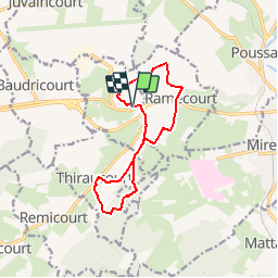
Tocht Stappen van 10,8 km beschikbaar op Grand Est, Vogezen, Domvallier. Deze tocht wordt voorgesteld door tracegps.
Beschrijving
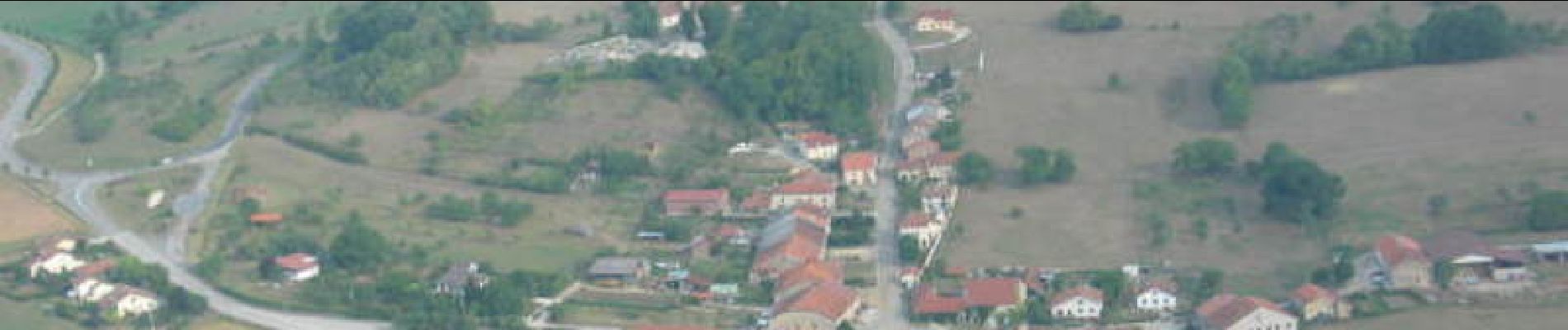
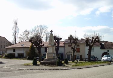
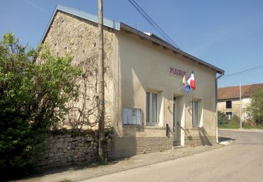
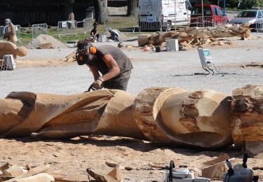
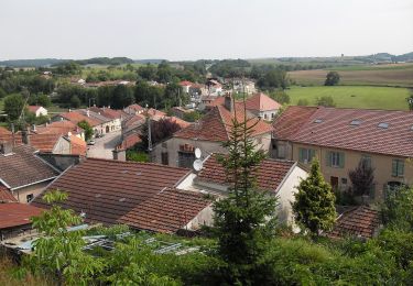
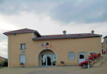
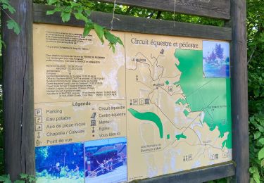
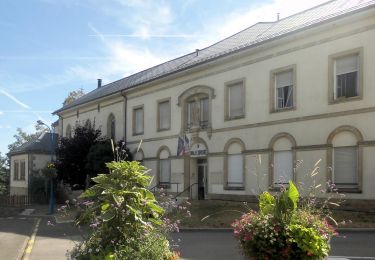
Circuit proposé par la communauté de communes de Mirecourt . C’est un itinéraire en boucle basé sur la composante paysagère il constitue un parcours pédagogique présentant la faune, la flore, la topographie et la géologie...... Cette présentation du patrimoine se fait par l’intermédiaire d’une série de panneaux didactiques répartis sur le parcours. Départ de l'église de Domvallier. Retrouvez les circuits de la communauté de communes de Mirecourt sur leur site.
Plaatsbepaling
Opmerkingen
Wandeltochten in de omgeving
![Tocht Te voet Mirecourt - Sentier des Écoliers - Photo](https://media.geolcdn.com/t/375/260/37a85499-65f3-411c-b514-fd76b1c94f58.jpeg&format=jpg&maxdim=2)
![Te voet Te voet](https://static1.geolcdn.com/sitytour/trail-icons/100.png)
Te voet
![](/images/other/stat-length.png)
![](https://static1.geolcdn.com/siteimages/upload/files/16400158638029165_repeat_loop_refresh_sync_direction_icon.png)
![Tocht Te voet Mazirot - Sentier des Trois Fontaines - Photo](https://media.geolcdn.com/t/375/260/3195c67f-6fc7-4a51-b3fc-afb10c20cd4c.jpeg&format=jpg&maxdim=2)
![Te voet Te voet](https://static1.geolcdn.com/sitytour/trail-icons/100.png)
Te voet
![](/images/other/stat-length.png)
![](https://static1.geolcdn.com/siteimages/upload/files/16400158638029165_repeat_loop_refresh_sync_direction_icon.png)
![Tocht Te voet Domvallier - Sentier Victor Hugo - Photo](https://media.geolcdn.com/t/375/260/847969bb-b882-4d7a-93e4-f8a52a5951e6.jpeg&format=jpg&maxdim=2)
![Te voet Te voet](https://static1.geolcdn.com/sitytour/trail-icons/100.png)
Te voet
![](/images/other/stat-length.png)
![](https://static1.geolcdn.com/siteimages/upload/files/16400158638029165_repeat_loop_refresh_sync_direction_icon.png)
![Tocht Te voet Mirecourt - Sentier des Luthiers et des Dentellières - Photo](https://media.geolcdn.com/t/375/260/224ec8ee-02f7-4835-910b-c43f2bba21e0.jpeg&format=jpg&maxdim=2)
![Te voet Te voet](https://static1.geolcdn.com/sitytour/trail-icons/100.png)
Te voet
![](/images/other/stat-length.png)
![](https://static1.geolcdn.com/siteimages/upload/files/16400158638029165_repeat_loop_refresh_sync_direction_icon.png)
![Tocht Te voet Puzieux - Sentier Sainte-Menne - Photo](https://media.geolcdn.com/t/375/260/d09aae78-2027-4ee8-af6c-352934fc41fe.jpeg&format=jpg&maxdim=2)
![Te voet Te voet](https://static1.geolcdn.com/sitytour/trail-icons/100.png)
Te voet
![](/images/other/stat-length.png)
![](https://static1.geolcdn.com/siteimages/upload/files/16400158638029165_repeat_loop_refresh_sync_direction_icon.png)
![Tocht Te voet Ambacourt - Jonction Ambacourt-Mazirot - Photo](https://media.geolcdn.com/t/375/260/a7a5f7aa-9c3b-49ab-a3ba-0cb86aa90645.jpeg&format=jpg&maxdim=2)
![Te voet Te voet](https://static1.geolcdn.com/sitytour/trail-icons/100.png)
Te voet
![](/images/other/stat-length.png)
![](https://static1.geolcdn.com/siteimages/upload/files/16400158638029165_repeat_loop_refresh_sync_direction_icon.png)
![Tocht Te voet Ambacourt - Jonction Ambacourt-Puzieux - Photo](https://media.geolcdn.com/t/375/260/a7a5f7aa-9c3b-49ab-a3ba-0cb86aa90645.jpeg&format=jpg&maxdim=2)
![Te voet Te voet](https://static1.geolcdn.com/sitytour/trail-icons/100.png)
Te voet
![](/images/other/stat-length.png)
![](https://static1.geolcdn.com/siteimages/upload/files/16400158638029165_repeat_loop_refresh_sync_direction_icon.png)
![Tocht sport Mazirot - Sentier des 3 fontaines - Photo](https://media.geolcdn.com/t/375/260/7a6b2516-fa41-4a74-82f6-03130015cbc5.jpg&format=jpg&maxdim=2)
sport
![](/images/other/stat-length.png)
![](https://static1.geolcdn.com/siteimages/upload/files/16400158638029165_repeat_loop_refresh_sync_direction_icon.png)
![Tocht Te voet Mattaincourt - Sentier du bois de Malaumont - Photo](https://media.geolcdn.com/t/375/260/881a2747-b482-491a-9e7a-bbf923a2a0ab.jpeg&format=jpg&maxdim=2)
![Te voet Te voet](https://static1.geolcdn.com/sitytour/trail-icons/100.png)
Te voet
![](/images/other/stat-length.png)
![](https://static1.geolcdn.com/siteimages/upload/files/16400158638029165_repeat_loop_refresh_sync_direction_icon.png)