![](/images/other/stat-length.png)
![Tocht Stappen Diemeringen - DiemeringenVoelerdingen - Photo](https://media.geolcdn.com/t/1900/400/ext.pjpeg?maxdim=2&url=https%3A%2F%2Fservices.sitytrail.com%2FGeolivesWS%2FDownloadMedia.ashx%3FTrailID%3D1126095%26Media%3Dfix__20190324154937.jpg)
DiemeringenVoelerdingen
helmut68
Gebruiker
![Lengte](/images/other/stat-length.png)
Lengte
10,5 km
![Max. hoogte](https://static1.geolcdn.com/siteimages/upload/files/1508320355ic_sort_altitude_max_24dp.png)
Max. hoogte
235 m
![Positief hoogteverschil](https://static1.geolcdn.com/siteimages/upload/files/1508320355ic_sort_den_pos_24dp.png)
Positief hoogteverschil
60 m
![Km-Effort](/images/other/stat-length.png)
Km-Effort
11,3 km
![Min. hoogte](https://static1.geolcdn.com/siteimages/upload/files/1508320355ic_sort_altitude_min_24dp.png)
Min. hoogte
217 m
![Negatief hoogteverschil](https://static1.geolcdn.com/siteimages/upload/files/1508320355ic_sort_den_neg_24dp.png)
Negatief hoogteverschil
59 m
![Boucle](https://static1.geolcdn.com/siteimages/upload/files/16400158638029165_repeat_loop_refresh_sync_direction_icon.png)
Boucle
Ja
Datum van aanmaak :
2019-05-06 23:12:55.637
Laatste wijziging :
2019-05-06 23:12:55.637
![Stappen](https://static1.geolcdn.com/sitytour/trail-icons/101.png)
2h15
Moeilijkheid : Gemakkelijk
![Scan deze QR-code om de tocht te openen in de SityTrail-applicatie](https://capi.geolives.com/qq0zvz2zws4bq2lad0pu/sitytour/trails/1126095/qr.png?size=200)
Gratisgps-wandelapplicatie
Over ons
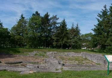
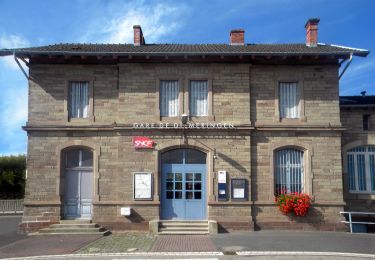
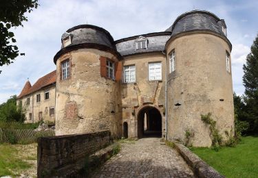
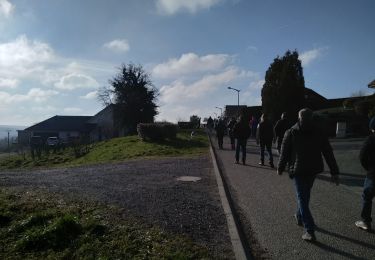
Tocht Stappen van 10,5 km beschikbaar op Grand Est, Bas-Rhin, Diemeringen. Deze tocht wordt voorgesteld door helmut68.
Beschrijving
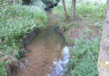
Départ cimetière de Diemeringen,longer l'Eichel jusqu'à Lorentzen puis emprunter la piste cyclable jusqu'à Voelerdingen.Retour par la même piste jusqu'à Diemeringen .
Parcours faisable toute l'année...
Plaatsbepaling
Land:
France
Regio :
Grand Est
Departement/Provincie :
Bas-Rhin
Gemeente :
Diemeringen
Locatie:
Unknown
Vertrek:(Dec)
Vertrek:(UTM)
367427 ; 5422851 (32U) N.
Opmerkingen
Wandeltochten in de omgeving
![Tocht Te voet Diemeringen - Mackwiller la romaine - Photo](https://media.geolcdn.com/t/375/260/6e42945c-7f24-4443-aff5-37264c5394f0.jpeg&format=jpg&maxdim=2)
![Te voet Te voet](https://static1.geolcdn.com/sitytour/trail-icons/100.png)
Mackwiller la romaine
Te voet
Gemakkelijk
Diemeringen,
Grand Est,
Bas-Rhin,
France
![](/images/other/stat-length.png)
4,6 km | 5,4 km-effort
1h 14min
![](https://static1.geolcdn.com/siteimages/upload/files/16400158638029165_repeat_loop_refresh_sync_direction_icon.png)
Ja
![Tocht Te voet Diemeringen - Croix bleue - Photo](https://media.geolcdn.com/t/375/260/038b5fbd-ad7d-4d8f-a6b9-4f60e8eebeb8.jpeg&format=jpg&maxdim=2)
![Te voet Te voet](https://static1.geolcdn.com/sitytour/trail-icons/100.png)
Croix bleue
Te voet
Gemakkelijk
Diemeringen,
Grand Est,
Bas-Rhin,
France
![](/images/other/stat-length.png)
12,3 km | 16,1 km-effort
3h 39min
![](https://static1.geolcdn.com/siteimages/upload/files/16400158638029165_repeat_loop_refresh_sync_direction_icon.png)
Neen
![Tocht Te voet Diemeringen - Triangle bleu - Photo](https://media.geolcdn.com/t/375/260/d4b9e7be-1430-47f3-af7c-96cdacf9298e.jpeg&format=jpg&maxdim=2)
![Te voet Te voet](https://static1.geolcdn.com/sitytour/trail-icons/100.png)
Triangle bleu
Te voet
Gemakkelijk
Diemeringen,
Grand Est,
Bas-Rhin,
France
![](/images/other/stat-length.png)
7,6 km | 9,6 km-effort
2h 10min
![](https://static1.geolcdn.com/siteimages/upload/files/16400158638029165_repeat_loop_refresh_sync_direction_icon.png)
Neen
![Tocht Te voet Diemeringen - Comtesse Sophie de Nassau - Photo](https://media.geolcdn.com/t/375/260/8c2b8556-e0a8-4065-811c-0a8a71e07fa2.jpeg&format=jpg&maxdim=2)
![Te voet Te voet](https://static1.geolcdn.com/sitytour/trail-icons/100.png)
Comtesse Sophie de Nassau
Te voet
Gemakkelijk
Diemeringen,
Grand Est,
Bas-Rhin,
France
![](/images/other/stat-length.png)
6,9 km | 8,1 km-effort
1h 50min
![](https://static1.geolcdn.com/siteimages/upload/files/16400158638029165_repeat_loop_refresh_sync_direction_icon.png)
Ja
![Tocht Te voet Diemeringen - Yellow triangle - Photo](https://media.geolcdn.com/t/375/260/d4b9e7be-1430-47f3-af7c-96cdacf9298e.jpeg&format=jpg&maxdim=2)
![Te voet Te voet](https://static1.geolcdn.com/sitytour/trail-icons/100.png)
Yellow triangle
Te voet
Medium
Diemeringen,
Grand Est,
Bas-Rhin,
France
![](/images/other/stat-length.png)
21 km | 27 km-effort
6h 11min
![](https://static1.geolcdn.com/siteimages/upload/files/16400158638029165_repeat_loop_refresh_sync_direction_icon.png)
Neen
![Tocht sport Butten - 2024-04-07 Les vergers de Butten - Photo](https://media.geolcdn.com/t/375/260/21e8b322-75c7-495e-aaf5-acea1f138e8c.jpg&format=jpg&maxdim=2)
2024-04-07 Les vergers de Butten
sport
Heel gemakkelijk
Butten,
Grand Est,
Bas-Rhin,
France
![](/images/other/stat-length.png)
4,3 km | 5,5 km-effort
Onbekend
![](https://static1.geolcdn.com/siteimages/upload/files/16400158638029165_repeat_loop_refresh_sync_direction_icon.png)
Ja
![Tocht Stappen Dehlingen - Speckfest Dehlingen 2023 - Photo](https://media.geolcdn.com/t/375/260/50343618-1039-4cc2-8cba-88bb57992e6e.jpg&format=jpg&maxdim=2)
![Stappen Stappen](https://static1.geolcdn.com/sitytour/trail-icons/101.png)
Speckfest Dehlingen 2023
Stappen
Gemakkelijk
Dehlingen,
Grand Est,
Bas-Rhin,
France
![](/images/other/stat-length.png)
4,8 km | 6,2 km-effort
1h 10min
![](https://static1.geolcdn.com/siteimages/upload/files/16400158638029165_repeat_loop_refresh_sync_direction_icon.png)
Ja
![Tocht Te voet Ratzwiller - Chevalet vert - Photo](https://media.geolcdn.com/t/375/260/e1ca6c5c-ec16-4e6c-a9bf-b3aef84f04a4.jpeg&format=jpg&maxdim=2)
![Te voet Te voet](https://static1.geolcdn.com/sitytour/trail-icons/100.png)
Chevalet vert
Te voet
Gemakkelijk
Ratzwiller,
Grand Est,
Bas-Rhin,
France
![](/images/other/stat-length.png)
6,1 km | 8,2 km-effort
1h 51min
![](https://static1.geolcdn.com/siteimages/upload/files/16400158638029165_repeat_loop_refresh_sync_direction_icon.png)
Neen
![Tocht Paardrijden Adamswiller - Boucle Adamswiller Kirschberg - Photo](https://media.geolcdn.com/t/375/260/2f0a407a-793d-4d42-a4b6-0a5db5e20562.jpg&format=jpg&maxdim=2)
![Paardrijden Paardrijden](https://static1.geolcdn.com/sitytour/trail-icons/301.png)
Boucle Adamswiller Kirschberg
Paardrijden
Medium
Adamswiller,
Grand Est,
Bas-Rhin,
France
![](/images/other/stat-length.png)
24 km | 30 km-effort
3h 53min
![](https://static1.geolcdn.com/siteimages/upload/files/16400158638029165_repeat_loop_refresh_sync_direction_icon.png)
Ja