![](/images/other/stat-length.png)
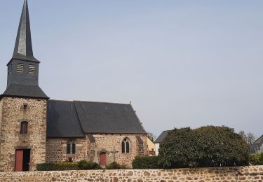
![Tocht Stappen Guipel - Sentier de la Barre - Guipel - Photo](https://media.geolcdn.com/t/1900/400/ext.pjpeg?maxdim=2&url=https%3A%2F%2Fservices.sitytrail.com%2FGeolivesWS%2FDownloadMedia.ashx%3FTrailID%3D112580%26Media%3D11016_2.jpg)
Sentier de la Barre - Guipel
tracegps
Gebruiker
![Lengte](/images/other/stat-length.png)
Lengte
6,5 km
![Max. hoogte](https://static1.geolcdn.com/siteimages/upload/files/1508320355ic_sort_altitude_max_24dp.png)
Max. hoogte
101 m
![Positief hoogteverschil](https://static1.geolcdn.com/siteimages/upload/files/1508320355ic_sort_den_pos_24dp.png)
Positief hoogteverschil
61 m
![Km-Effort](/images/other/stat-length.png)
Km-Effort
7,4 km
![Min. hoogte](https://static1.geolcdn.com/siteimages/upload/files/1508320355ic_sort_altitude_min_24dp.png)
Min. hoogte
70 m
![Negatief hoogteverschil](https://static1.geolcdn.com/siteimages/upload/files/1508320355ic_sort_den_neg_24dp.png)
Negatief hoogteverschil
61 m
![Boucle](https://static1.geolcdn.com/siteimages/upload/files/16400158638029165_repeat_loop_refresh_sync_direction_icon.png)
Boucle
Ja
Datum van aanmaak :
2014-12-10 00:00:00.0
Laatste wijziging :
2014-12-10 00:00:00.0
![Stappen](https://static1.geolcdn.com/sitytour/trail-icons/101.png)
1h40
Moeilijkheid : Gemakkelijk
![Scan deze QR-code om de tocht te openen in de SityTrail-applicatie](https://capi.geolives.com/qq0zvz2zws4bq2lad0pu/sitytour/trails/112580/qr.png?size=200)
Gratisgps-wandelapplicatie
Over ons
Tocht Stappen van 6,5 km beschikbaar op Bretagne, Ille-et-Vilaine, Guipel. Deze tocht wordt voorgesteld door tracegps.
Beschrijving
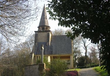
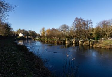
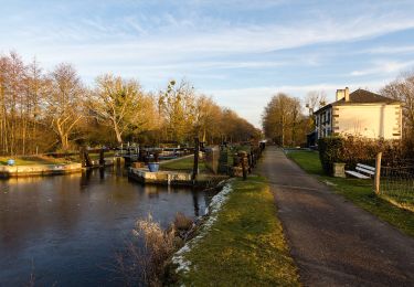
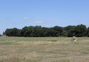
Circuit proposé par la Communauté de Communes du Val d’Ille. Départ de l'église de Guipel. Le parcours permet d’avoir un apercu du patrimoine naturel. Retrouvez la fiche du circuit sur le site de la communauté de communes du Val d’Ille.
Plaatsbepaling
Land:
France
Regio :
Bretagne
Departement/Provincie :
Ille-et-Vilaine
Gemeente :
Guipel
Locatie:
Unknown
Vertrek:(Dec)
Vertrek:(UTM)
594917 ; 5350234 (30U) N.
Opmerkingen
Wandeltochten in de omgeving
![Tocht Mountainbike Saint-Médard-sur-Ille - Sentier du Bois de Cranne - Saint-Médard-sur-Ille - Photo](https://media.geolcdn.com/t/375/260/ext.jpg?maxdim=2&url=https%3A%2F%2Fservices.sitytrail.com%2FGeolivesWS%2FDownloadMedia.ashx%3FTrailID%3D112570%26Media%3D10980_2.jpg)
![Mountainbike Mountainbike](https://static1.geolcdn.com/sitytour/trail-icons/202.png)
Sentier du Bois de Cranne - Saint-Médard-sur-Ille
Mountainbike
Gemakkelijk
(1)
Saint-Médard-sur-Ille,
Bretagne,
Ille-et-Vilaine,
France
![](/images/other/stat-length.png)
14,6 km | 16,9 km-effort
1h 19min
![](https://static1.geolcdn.com/siteimages/upload/files/16400158638029165_repeat_loop_refresh_sync_direction_icon.png)
Ja
![Tocht Te voet Saint-Médard-sur-Ille - Le Bois de Cranne - Photo](https://media.geolcdn.com/t/375/260/d1c048d2-ce9b-4bbc-8166-22a8dfba9cca.jpeg&format=jpg&maxdim=2)
![Te voet Te voet](https://static1.geolcdn.com/sitytour/trail-icons/100.png)
Le Bois de Cranne
Te voet
Gemakkelijk
Saint-Médard-sur-Ille,
Bretagne,
Ille-et-Vilaine,
France
![](/images/other/stat-length.png)
14,4 km | 16,6 km-effort
3h 45min
![](https://static1.geolcdn.com/siteimages/upload/files/16400158638029165_repeat_loop_refresh_sync_direction_icon.png)
Ja
![Tocht Te voet Saint-Médard-sur-Ille - Circuit de Saint-Médard - Photo](https://media.geolcdn.com/t/375/260/1db7e459-0d11-4a34-9758-09e2168028ed.jpeg&format=jpg&maxdim=2)
![Te voet Te voet](https://static1.geolcdn.com/sitytour/trail-icons/100.png)
Circuit de Saint-Médard
Te voet
Gemakkelijk
Saint-Médard-sur-Ille,
Bretagne,
Ille-et-Vilaine,
France
![](/images/other/stat-length.png)
10,2 km | 11,9 km-effort
2h 41min
![](https://static1.geolcdn.com/siteimages/upload/files/16400158638029165_repeat_loop_refresh_sync_direction_icon.png)
Ja
![Tocht Te voet Guipel - Circuit de la Plousière - Photo](https://media.geolcdn.com/t/375/260/a2e35f89-8d56-4bc1-a97a-058fc6f51e65.jpeg&format=jpg&maxdim=2)
![Te voet Te voet](https://static1.geolcdn.com/sitytour/trail-icons/100.png)
Circuit de la Plousière
Te voet
Gemakkelijk
Guipel,
Bretagne,
Ille-et-Vilaine,
France
![](/images/other/stat-length.png)
7 km | 7,7 km-effort
1h 44min
![](https://static1.geolcdn.com/siteimages/upload/files/16400158638029165_repeat_loop_refresh_sync_direction_icon.png)
Ja
![Tocht Te voet Guipel - Sentier de la Normandière - Photo](https://media.geolcdn.com/t/375/260/9517ac36-a7c5-49a5-915a-49060e792ae7.jpeg&format=jpg&maxdim=2)
![Te voet Te voet](https://static1.geolcdn.com/sitytour/trail-icons/100.png)
Sentier de la Normandière
Te voet
Gemakkelijk
Guipel,
Bretagne,
Ille-et-Vilaine,
France
![](/images/other/stat-length.png)
10,5 km | 11,5 km-effort
2h 36min
![](https://static1.geolcdn.com/siteimages/upload/files/16400158638029165_repeat_loop_refresh_sync_direction_icon.png)
Ja
![Tocht Stappen Montreuil-sur-Ille - GR_37_BE_32_Montreuil-Sur-Ille_St-Symphorien_20220319 - Photo](https://media.geolcdn.com/t/375/260/30d12f9b-026c-4f53-bd37-27552c6b3079.jpg&format=jpg&maxdim=2)
![Stappen Stappen](https://static1.geolcdn.com/sitytour/trail-icons/101.png)
GR_37_BE_32_Montreuil-Sur-Ille_St-Symphorien_20220319
Stappen
Gemakkelijk
Montreuil-sur-Ille,
Bretagne,
Ille-et-Vilaine,
France
![](/images/other/stat-length.png)
15 km | 17,4 km-effort
3h 25min
![](https://static1.geolcdn.com/siteimages/upload/files/16400158638029165_repeat_loop_refresh_sync_direction_icon.png)
Neen
![Tocht Te voet Hédé-Bazouges - Les 7 Moulins et les 11 Écluses - Photo](https://media.geolcdn.com/t/375/260/9517ac36-a7c5-49a5-915a-49060e792ae7.jpeg&format=jpg&maxdim=2)
![Te voet Te voet](https://static1.geolcdn.com/sitytour/trail-icons/100.png)
Les 7 Moulins et les 11 Écluses
Te voet
Gemakkelijk
Hédé-Bazouges,
Bretagne,
Ille-et-Vilaine,
France
![](/images/other/stat-length.png)
11,4 km | 13 km-effort
2h 57min
![](https://static1.geolcdn.com/siteimages/upload/files/16400158638029165_repeat_loop_refresh_sync_direction_icon.png)
Ja
![Tocht Te voet Guipel - Sentier des Guipellois - Photo](https://media.geolcdn.com/t/375/260/b87106f9-4162-4f98-a40f-dcdbc27fb374.jpeg&format=jpg&maxdim=2)
![Te voet Te voet](https://static1.geolcdn.com/sitytour/trail-icons/100.png)
Sentier des Guipellois
Te voet
Gemakkelijk
Guipel,
Bretagne,
Ille-et-Vilaine,
France
![](/images/other/stat-length.png)
5 km | 5,3 km-effort
1h 12min
![](https://static1.geolcdn.com/siteimages/upload/files/16400158638029165_repeat_loop_refresh_sync_direction_icon.png)
Neen
![Tocht Te voet Hédé-Bazouges - bazouges - Photo](https://media.geolcdn.com/t/375/260/c4367761-1bf0-492f-9f3a-e9ac4d9feb5d.jpg&format=jpg&maxdim=2)
![Te voet Te voet](https://static1.geolcdn.com/sitytour/trail-icons/100.png)
bazouges
Te voet
Moeilijk
Hédé-Bazouges,
Bretagne,
Ille-et-Vilaine,
France
![](/images/other/stat-length.png)
27 km | 30 km-effort
Onbekend
![](https://static1.geolcdn.com/siteimages/upload/files/16400158638029165_repeat_loop_refresh_sync_direction_icon.png)
Ja