


19,1 km | 23 km-effort


Gebruiker


Gratisgps-wandelapplicatie
 SityTrail
IGN / Geografische instituten
SityTrail World
De wereld gaat voor u open
Tocht Stappen van 14,1 km beschikbaar op Bretagne, Morbihan, Malestroit. Deze tocht wordt voorgesteld door tracegps.
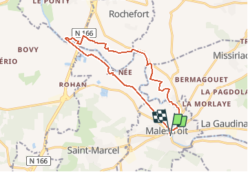
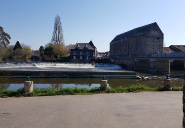
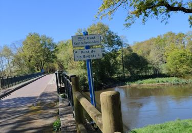
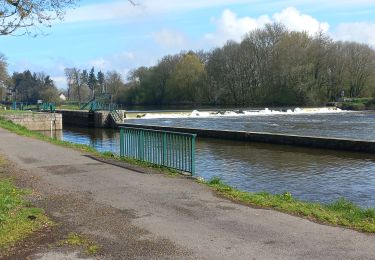
Point de départ : quai Roger Plisson à Malestroit - Coordonnées GPS : 02°22’51’’O / 47°48’30’’N - Distance : 15 km – 4 h 00 A voir en chemin: 1. Vestiges de la Chapelle de la Madeleine : c'est ici que fut signée le 19 janvier 1343, pendant la guerre de 100 ans, la trêve de Malestroit entre les représentants des Rois de France et d'Angleterre en présence des Cardinaux de Clermont et de Prenets. La trêve, signée grâce à la médiation de deux cardinaux, légats du Pape Clément VI, sera rompue après l'odieuse décapitation, par Philippe de Valois, de 14 seigneurs bretons dont Olivier de Clisson, Geoffroy et Jean de Malestroit, à Paris en novembre 1343. 2. la voie verte n°3 (Saint Malo – Rhuys) : itinéraire rêvé de balades, cette ancienne voie ferrée a été réhabilitée et aménagée pour les circulations non motorisées. Elle est le rendez-vous des marcheurs, des rollers, des cyclistes et autres skieurs à roulettes. 3. Le canal de Nantes à Brest : décidée en 1806 par Napoléon 1er pour permettre le ravitaillement de Brest et Lorient soumis au blocus maritime de la Grande-Bretagne, la construction de ce canal ne se réalisa vraiment qu'entre 1822 et 1840. Le trafic commercial, important entre 1880 et 1930, subit la concurrence implacable du chemin de fer puis de la route. Il prit fin le 7 décembre 1977 quand le "Mistral" déchargea à Saint-Congard sa dernière cargaison de sable. Mais très vite le tourisme fluvial assura la relève et donna au Canal une nouvelle jeunesse. Contact: Communauté de Communes du Val d’Oust et de Lanvaux - Tél : 02 97 75 01 02 – Email : ccvol (at) ccvol.com
Stappen
Noords wandelen
Fietstoerisme
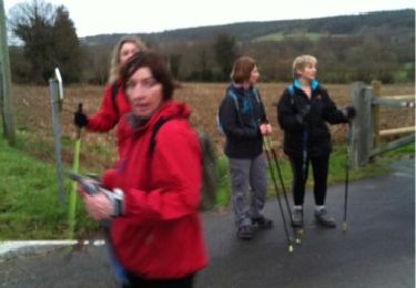
Noords wandelen
Stappen

Stappen
Stappen

Noords wandelen
Stappen