![](/images/other/stat-length.png)
![Tocht Mountainbike La Petite-Pierre - L'Étang du Donnenbach - La Petite Pierre - Photo](https://media.geolcdn.com/t/1900/400/ext.pjpeg?maxdim=2&url=https%3A%2F%2Fservices.sitytrail.com%2FGeolivesWS%2FDownloadMedia.ashx%3FTrailID%3D112469%26Media%3D10632_2.jpg)
L'Étang du Donnenbach - La Petite Pierre
tracegps
Gebruiker
![Lengte](/images/other/stat-length.png)
![Max. hoogte](https://static1.geolcdn.com/siteimages/upload/files/1508320355ic_sort_altitude_max_24dp.png)
![Positief hoogteverschil](https://static1.geolcdn.com/siteimages/upload/files/1508320355ic_sort_den_pos_24dp.png)
![Km-Effort](/images/other/stat-length.png)
![Min. hoogte](https://static1.geolcdn.com/siteimages/upload/files/1508320355ic_sort_altitude_min_24dp.png)
![Negatief hoogteverschil](https://static1.geolcdn.com/siteimages/upload/files/1508320355ic_sort_den_neg_24dp.png)
![Boucle](https://static1.geolcdn.com/siteimages/upload/files/16400158638029165_repeat_loop_refresh_sync_direction_icon.png)
![Mountainbike](https://static1.geolcdn.com/sitytour/trail-icons/202.png)
1h00
Moeilijkheid : Moeilijk
![Scan deze QR-code om de tocht te openen in de SityTrail-applicatie](https://capi.geolives.com/qq0zvz2zws4bq2lad0pu/sitytour/trails/112469/qr.png?size=200)
Gratisgps-wandelapplicatie
Over ons
Tocht Mountainbike van 13,8 km beschikbaar op Grand Est, Bas-Rhin, La Petite-Pierre. Deze tocht wordt voorgesteld door tracegps.
Beschrijving
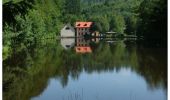
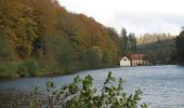
L’Étang du Donnenbach – La Petite Pierre Un circuit de la Base VTT du Pays de La Petite Pierre labellisée par la Fédération Française de Cyclotourisme. Départ du stade de la Petite Pierre. Créé au Moyen Age en vue d'une exploitation piscicole l'étang du Donnenbach a par la suite reçu une vocation hydraulique par l'installation d'une scierie et d'un moulin au XVlll's. La première habitation fut construite en 1730. Aujourd'hui, le site abrite une auberge et la Maison de l'Eau et de la Rivière qui est un centre d'initiation à la Nature et à l'Environnement. L'étang a inspiré le poète René Char entre 1939 et 1940 : « Lac de Donnenbach [...] la neige voluptueuse sur le sol des hordes fugitives de cerfs et de sangliers, était une fête aux étoiles »
Plaatsbepaling
Opmerkingen
Wandeltochten in de omgeving
![Tocht Te voet La Petite-Pierre - Triangle vert - Photo](https://media.geolcdn.com/t/375/260/038b5fbd-ad7d-4d8f-a6b9-4f60e8eebeb8.jpeg&format=jpg&maxdim=2)
![Te voet Te voet](https://static1.geolcdn.com/sitytour/trail-icons/100.png)
Te voet
![](/images/other/stat-length.png)
![](https://static1.geolcdn.com/siteimages/upload/files/16400158638029165_repeat_loop_refresh_sync_direction_icon.png)
![Tocht Te voet Hinsbourg - Anneau rouge - Photo](https://media.geolcdn.com/t/375/260/f76e09fc-e6e9-41fb-9f22-c2e60be7815f.jpeg&format=jpg&maxdim=2)
![Te voet Te voet](https://static1.geolcdn.com/sitytour/trail-icons/100.png)
Te voet
![](/images/other/stat-length.png)
![](https://static1.geolcdn.com/siteimages/upload/files/16400158638029165_repeat_loop_refresh_sync_direction_icon.png)
![Tocht Te voet Zittersheim - Anneau jaune - Photo](https://media.geolcdn.com/t/375/260/40af32f9-2f69-4f07-9a93-cacfd66f615c.jpeg&format=jpg&maxdim=2)
![Te voet Te voet](https://static1.geolcdn.com/sitytour/trail-icons/100.png)
Te voet
![](/images/other/stat-length.png)
![](https://static1.geolcdn.com/siteimages/upload/files/16400158638029165_repeat_loop_refresh_sync_direction_icon.png)
![Tocht Te voet La Petite-Pierre - Anneau bleu - Photo](https://media.geolcdn.com/t/375/260/35782fa9-c86a-4f9f-b3fb-0294497c25ab.jpeg&format=jpg&maxdim=2)
![Te voet Te voet](https://static1.geolcdn.com/sitytour/trail-icons/100.png)
Te voet
![](/images/other/stat-length.png)
![](https://static1.geolcdn.com/siteimages/upload/files/16400158638029165_repeat_loop_refresh_sync_direction_icon.png)
![Tocht Te voet Dossenheim-sur-Zinsel - Croix rouge - Photo](https://media.geolcdn.com/t/375/260/b7766ade-9612-4826-b6b4-3f8dbf585374.jpeg&format=jpg&maxdim=2)
![Te voet Te voet](https://static1.geolcdn.com/sitytour/trail-icons/100.png)
Te voet
![](/images/other/stat-length.png)
![](https://static1.geolcdn.com/siteimages/upload/files/16400158638029165_repeat_loop_refresh_sync_direction_icon.png)
![Tocht Te voet La Petite-Pierre - Triangle rouge - Photo](https://media.geolcdn.com/t/375/260/ac14cb89-5ba1-4ba9-9b9a-6e7178a855f4.jpeg&format=jpg&maxdim=2)
![Te voet Te voet](https://static1.geolcdn.com/sitytour/trail-icons/100.png)
Te voet
![](/images/other/stat-length.png)
![](https://static1.geolcdn.com/siteimages/upload/files/16400158638029165_repeat_loop_refresh_sync_direction_icon.png)
![Tocht Te voet La Petite-Pierre - Chevalet bleu - Photo](https://media.geolcdn.com/t/375/260/b7766ade-9612-4826-b6b4-3f8dbf585374.jpeg&format=jpg&maxdim=2)
![Te voet Te voet](https://static1.geolcdn.com/sitytour/trail-icons/100.png)
Te voet
![](/images/other/stat-length.png)
![](https://static1.geolcdn.com/siteimages/upload/files/16400158638029165_repeat_loop_refresh_sync_direction_icon.png)
![Tocht Te voet La Petite-Pierre - Rectangle jaune barré de blanc - Photo](https://media.geolcdn.com/t/375/260/e8786cd5-b21f-4723-bb2c-f0f19066f62a.jpeg&format=jpg&maxdim=2)
![Te voet Te voet](https://static1.geolcdn.com/sitytour/trail-icons/100.png)
Te voet
![](/images/other/stat-length.png)
![](https://static1.geolcdn.com/siteimages/upload/files/16400158638029165_repeat_loop_refresh_sync_direction_icon.png)
![Tocht Te voet La Petite-Pierre - Triangle bleu - Photo](https://media.geolcdn.com/t/375/260/33b3a588-f228-473c-8257-55ea2d8fff1e.jpeg&format=jpg&maxdim=2)
![Te voet Te voet](https://static1.geolcdn.com/sitytour/trail-icons/100.png)
Te voet
![](/images/other/stat-length.png)
![](https://static1.geolcdn.com/siteimages/upload/files/16400158638029165_repeat_loop_refresh_sync_direction_icon.png)