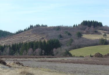
Tocht Paard Clergoux - Le grand tour de Sédières - Clergoux - Pays de Tulle  - Photo

Le grand tour de Sédières - Clergoux - Pays de Tulle

 tracegps
tracegps

Gebruiker

© OpenStreetMap contributors
Lengte
Lengte
14,2 km
Max. hoogte
Max. hoogte
629 m
Positief hoogteverschil
227 m
Km-Effort
Km-Effort  
17,2 km
Min. hoogte
Min. hoogte
553 m
Negatief hoogteverschil
222 m
Boucle
Boucle
Ja
Datum van aanmaak :
2014-12-10 00:00:00.0
Laatste wijziging :
2014-12-10 00:00:00.0

(1 Bericht)

Paard
Paard
2h30
Moeilijkheid : Medium

Scan deze QR-code om de tocht te openen in de SityTrail-applicatie

Gratisgps-wandelapplicatie

Logo SityTrail SityTrail

IGN / Geografische instituten

SityTrail uit de App Store downloaden SityTrail uit Google Play downloaden

Logo SityTrail SityTrail World

De wereld gaat voor u open

SityTrail uit de App Store downloaden SityTrail uit Google Play downloaden SityTrail op Huawei AppGallery downloaden

Over ons

Tocht Paard van 14,2 km beschikbaar op Nieuw-Aquitanië, Corrèze, Clergoux. Deze tocht wordt voorgesteld door tracegps.

Beschrijving

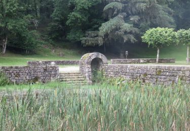
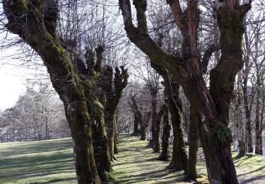
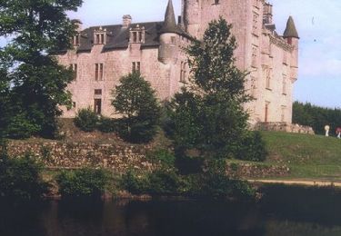
Le grand tour de Sédières - Clergoux - Pays de Tulle. Partant du château et passant sur cinq communes et quatre cantons, le "grand tour de Sédières " vous propose une randonnée sans difficulté dans la belle campagne corrézienne, à la découverte ici d'un étang, là d'un village, au détour de sentes chargées d'histoire, avec de magnifiques points de vues sur les Monédières. Téléchargez la fiche du circuit sur le site du Conseil Général de la Corrèze. Renseignements : Domaine de Sédières, Clergoux 05.55.27.76.40

Hoogteprofiel

Foto's

Plaatsbepaling

Land:
France
Regio :
Nieuw-Aquitanië
Departement/Provincie :
Corrèze
Gemeente :
Clergoux
Locatie:
Unknown
Vertrek:(Dec)
Vertrek:(UTM)
417779 ; 5016049 (31T) N.

Opmerkingen

Gelieve in te loggen om een commentaar of een beoordeling achter te laten


Wandeltochten in de omgeving

Tocht Stappen Eyrein - Etang de la chéze - Photo
Stappen
gerard1222

Stappen

Gemakkelijk
(1)
Eyrein, Nieuw-Aquitanië, Corrèze, France
4 km | 4,9 km-effort
1h 7min
Ja
Tocht Stappen Clergoux - 49 TraceGps issued - Photo
Stappen
houbart

Stappen

Moeilijk
Clergoux, Nieuw-Aquitanië, Corrèze, France
14,2 km | 17,2 km-effort
3h 53min
Ja
Tocht Stappen Clergoux - balade avec Claudette et Viviane  - Photo
Stappen
Nicole Cridel

Stappen

Heel gemakkelijk
Clergoux, Nieuw-Aquitanië, Corrèze, France
4,9 km | 6 km-effort
1h 41min
Ja
Tocht Mountainbike Clergoux - Le grand tour de Sédières - Clergoux - Pays de Tulle  - Photo
Mountainbike
tracegps

Mountainbike

Medium
Clergoux, Nieuw-Aquitanië, Corrèze, France
14,2 km | 17,2 km-effort
1h 10min
Ja
Tocht Stappen Clergoux - Le grand tour de Sédières - Clergoux - Pays de Tulle  - Photo
Stappen
tracegps

Stappen

Medium
Clergoux, Nieuw-Aquitanië, Corrèze, France
14,2 km | 17,2 km-effort
4h 0min
Ja
Tocht Fiets Clergoux - Massif des Monédières - le Suc au May - Photo
Fiets
tracegps

Fiets

Moeilijk
Clergoux, Nieuw-Aquitanië, Corrèze, France
70 km | 90 km-effort
3h 30min
Ja
Tocht Stappen Clergoux - Clergoux Les vieilles pierres - Photo
Stappen
grageot

Stappen

Medium
Clergoux, Nieuw-Aquitanië, Corrèze, France
8,6 km | 10,4 km-effort
2h 21min
Ja
Tocht Stappen Marcillac-la-Croisille - Marcillac Les 2 ponts du lac et Bos Redons - Photo
Stappen
grageot

Stappen

Gemakkelijk
(1)
Marcillac-la-Croisille, Nieuw-Aquitanië, Corrèze, France
16,2 km | 20 km-effort
4h 17min
Ja
Tocht Mountainbike Clergoux - circuit N6- Station VTT de Sédière - Photo
Mountainbike
chauffmarcel

Mountainbike

Gemakkelijk
(1)
Clergoux, Nieuw-Aquitanië, Corrèze, France
21 km | 25 km-effort
1h 20min
Ja


Sluiten
Mijn abonnementen