![](/images/other/stat-length.png)
![Tocht Stappen Plaine-et-Vallées - Circuit de Noizé - Photo](https://media.geolcdn.com/t/1900/400/ext.pjpeg?maxdim=2&url=https%3A%2F%2Fservices.sitytrail.com%2FGeolivesWS%2FDownloadMedia.ashx%3FTrailID%3D112253%26Media%3D10203_2.jpg)
Circuit de Noizé
tracegps
Gebruiker
![Lengte](/images/other/stat-length.png)
Lengte
6,3 km
![Max. hoogte](https://static1.geolcdn.com/siteimages/upload/files/1508320355ic_sort_altitude_max_24dp.png)
Max. hoogte
105 m
![Positief hoogteverschil](https://static1.geolcdn.com/siteimages/upload/files/1508320355ic_sort_den_pos_24dp.png)
Positief hoogteverschil
50 m
![Km-Effort](/images/other/stat-length.png)
Km-Effort
6,9 km
![Min. hoogte](https://static1.geolcdn.com/siteimages/upload/files/1508320355ic_sort_altitude_min_24dp.png)
Min. hoogte
80 m
![Negatief hoogteverschil](https://static1.geolcdn.com/siteimages/upload/files/1508320355ic_sort_den_neg_24dp.png)
Negatief hoogteverschil
51 m
![Boucle](https://static1.geolcdn.com/siteimages/upload/files/16400158638029165_repeat_loop_refresh_sync_direction_icon.png)
Boucle
Ja
Datum van aanmaak :
2014-12-10 00:00:00.0
Laatste wijziging :
2014-12-10 00:00:00.0
![Stappen](https://static1.geolcdn.com/sitytour/trail-icons/101.png)
1h34
Moeilijkheid : Gemakkelijk
![Scan deze QR-code om de tocht te openen in de SityTrail-applicatie](https://capi.geolives.com/qq0zvz2zws4bq2lad0pu/sitytour/trails/112253/qr.png?size=200)
Gratisgps-wandelapplicatie
Over ons
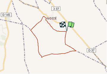
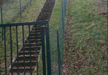
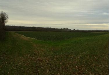
Tocht Stappen van 6,3 km beschikbaar op Nieuw-Aquitanië, Deux-Sèvres, Plaine-et-Vallées. Deze tocht wordt voorgesteld door tracegps.
Beschrijving
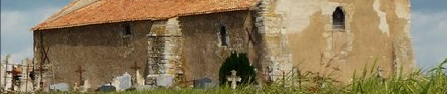
Circuit proposé par la mairie d’Oiron. Départ du cimetière de Noizé. Retrouvez le circuit sur le site de la mairie d’Oiron.
Plaatsbepaling
Land:
France
Regio :
Nieuw-Aquitanië
Departement/Provincie :
Deux-Sèvres
Gemeente :
Plaine-et-Vallées
Locatie:
Oiron
Vertrek:(Dec)
Vertrek:(UTM)
721560 ; 5198423 (30T) N.
Opmerkingen
Wandeltochten in de omgeving
![Tocht Stappen Plaine-et-Vallées - Circuit de Noizé - Photo](https://media.geolcdn.com/t/375/260/ext.jpg?maxdim=2&url=https%3A%2F%2Fstatic1.geolcdn.com%2Fsiteimages%2Fupload%2Ffiles%2F1553511878bg_sport_marche.png)
![Stappen Stappen](https://static1.geolcdn.com/sitytour/trail-icons/101.png)
Circuit de Noizé
Stappen
Heel gemakkelijk
(1)
Plaine-et-Vallées,
Nieuw-Aquitanië,
Deux-Sèvres,
France
![](/images/other/stat-length.png)
6,3 km | 6,9 km-effort
1h 33min
![](https://static1.geolcdn.com/siteimages/upload/files/16400158638029165_repeat_loop_refresh_sync_direction_icon.png)
Ja
![Tocht Stappen Plaine-et-Vallées - DEUX SEVRES / THOUARSAIS: LES MEGALITHES - Photo](https://media.geolcdn.com/t/375/260/766499a8-0dbd-46f3-aff0-644d9406b813.jpg&format=jpg&maxdim=2)
![Stappen Stappen](https://static1.geolcdn.com/sitytour/trail-icons/101.png)
DEUX SEVRES / THOUARSAIS: LES MEGALITHES
Stappen
Gemakkelijk
Plaine-et-Vallées,
Nieuw-Aquitanië,
Deux-Sèvres,
France
![](/images/other/stat-length.png)
11,7 km | 13,6 km-effort
3h 0min
![](https://static1.geolcdn.com/siteimages/upload/files/16400158638029165_repeat_loop_refresh_sync_direction_icon.png)
Ja
![Tocht Stappen Plaine-et-Vallées - .noize - Photo](https://media.geolcdn.com/t/375/260/ext.jpg?maxdim=2&url=https%3A%2F%2Fservices.sitytrail.com%2FGeolivesWS%2FDownloadMedia.ashx%3FTrailID%3D250348%26Media%3Dfix__20140217163921.jpg)
![Stappen Stappen](https://static1.geolcdn.com/sitytour/trail-icons/101.png)
.noize
Stappen
Heel gemakkelijk
Plaine-et-Vallées,
Nieuw-Aquitanië,
Deux-Sèvres,
France
![](/images/other/stat-length.png)
14,5 km | 15,9 km-effort
2h 25min
![](https://static1.geolcdn.com/siteimages/upload/files/16400158638029165_repeat_loop_refresh_sync_direction_icon.png)
Neen
![Tocht Stappen Plaine-et-Vallées - saint jouin coligny - Photo](https://media.geolcdn.com/t/375/260/ext.jpg?maxdim=2&url=https%3A%2F%2Fservices.sitytrail.com%2FGeolivesWS%2FDownloadMedia.ashx%3FTrailID%3D243369%26Media%3Dfix__20140118144108.jpg)
![Stappen Stappen](https://static1.geolcdn.com/sitytour/trail-icons/101.png)
saint jouin coligny
Stappen
Gemakkelijk
Plaine-et-Vallées,
Nieuw-Aquitanië,
Deux-Sèvres,
France
![](/images/other/stat-length.png)
11 km | 12,5 km-effort
2h 34min
![](https://static1.geolcdn.com/siteimages/upload/files/16400158638029165_repeat_loop_refresh_sync_direction_icon.png)
Ja
![Tocht Stappen Plaine-et-Vallées - saint jouin coligny - Photo](https://media.geolcdn.com/t/375/260/ext.jpg?maxdim=2&url=https%3A%2F%2Fservices.sitytrail.com%2FGeolivesWS%2FDownloadMedia.ashx%3FTrailID%3D243367%26Media%3Dfix__20140118162146.jpg)
![Stappen Stappen](https://static1.geolcdn.com/sitytour/trail-icons/101.png)
saint jouin coligny
Stappen
Gemakkelijk
Plaine-et-Vallées,
Nieuw-Aquitanië,
Deux-Sèvres,
France
![](/images/other/stat-length.png)
11 km | 12,5 km-effort
2h 34min
![](https://static1.geolcdn.com/siteimages/upload/files/16400158638029165_repeat_loop_refresh_sync_direction_icon.png)
Ja
![Tocht Wegfiets Plaine-et-Vallées - Entre Dive et thouet - Photo](https://media.geolcdn.com/t/375/260/ext.jpg?maxdim=2&url=https%3A%2F%2Fstatic1.geolcdn.com%2Fsiteimages%2Fupload%2Ffiles%2F1524743154velo.jpg)
![Wegfiets Wegfiets](https://static1.geolcdn.com/sitytour/trail-icons/201.png)
Entre Dive et thouet
Wegfiets
Moeilijk
Plaine-et-Vallées,
Nieuw-Aquitanië,
Deux-Sèvres,
France
![](/images/other/stat-length.png)
31 km | 34 km-effort
2h 4min
![](https://static1.geolcdn.com/siteimages/upload/files/16400158638029165_repeat_loop_refresh_sync_direction_icon.png)
Ja
![Tocht Fiets Saint-Généroux - circuit boucle saint generoux velo - Photo](https://media.geolcdn.com/t/375/260/ext.jpg?maxdim=2&url=https%3A%2F%2Fstatic1.geolcdn.com%2Fsiteimages%2Fupload%2Ffiles%2F1524743154velo.jpg)
![Fiets Fiets](https://static1.geolcdn.com/sitytour/trail-icons/200.png)
circuit boucle saint generoux velo
Fiets
Medium
Saint-Généroux,
Nieuw-Aquitanië,
Deux-Sèvres,
France
![](/images/other/stat-length.png)
36 km | 40 km-effort
Onbekend
![](https://static1.geolcdn.com/siteimages/upload/files/16400158638029165_repeat_loop_refresh_sync_direction_icon.png)
Ja
![Tocht Fietstoerisme Saint-Généroux - francette j7 St généroux parthenay - Photo](https://media.geolcdn.com/t/375/260/ext.jpg?maxdim=2&url=https%3A%2F%2Fstatic1.geolcdn.com%2Fsiteimages%2Fupload%2Ffiles%2F1524743154velo.jpg)
![Fietstoerisme Fietstoerisme](https://static1.geolcdn.com/sitytour/trail-icons/204.png)
francette j7 St généroux parthenay
Fietstoerisme
Moeilijk
Saint-Généroux,
Nieuw-Aquitanië,
Deux-Sèvres,
France
![](/images/other/stat-length.png)
56 km | 64 km-effort
8h 49min
![](https://static1.geolcdn.com/siteimages/upload/files/16400158638029165_repeat_loop_refresh_sync_direction_icon.png)
Neen
![Tocht Stappen Saint-Généroux - St Généroux - La croix des forges - Photo](https://media.geolcdn.com/t/375/260/ext.jpg?maxdim=2&url=https%3A%2F%2Fstatic1.geolcdn.com%2Fsiteimages%2Fupload%2Ffiles%2F1553511878bg_sport_marche.png)
![Stappen Stappen](https://static1.geolcdn.com/sitytour/trail-icons/101.png)
St Généroux - La croix des forges
Stappen
Moeilijk
Saint-Généroux,
Nieuw-Aquitanië,
Deux-Sèvres,
France
![](/images/other/stat-length.png)
10,8 km | 12,2 km-effort
2h 46min
![](https://static1.geolcdn.com/siteimages/upload/files/16400158638029165_repeat_loop_refresh_sync_direction_icon.png)
Ja
Aucun ombrage