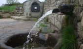
Tocht Mountainbike Alleyrat - Mystérieuses Fontaines 12 km - Alleyrat - Pays de Haute Corrèze  - Photo

Mystérieuses Fontaines 12 km - Alleyrat - Pays de Haute Corrèze

 tracegps
tracegps

Gebruiker

© OpenStreetMap contributors
Lengte
Lengte
12,1 km
Max. hoogte
Max. hoogte
789 m
Positief hoogteverschil
250 m
Km-Effort
Km-Effort  
15,4 km
Min. hoogte
Min. hoogte
676 m
Negatief hoogteverschil
247 m
Boucle
Boucle
Ja
Datum van aanmaak :
2014-12-10 00:00:00.0
Laatste wijziging :
2014-12-10 00:00:00.0

(0 Bericht)

Mountainbike
Mountainbike
1h19
Moeilijkheid : Medium

Scan deze QR-code om de tocht te openen in de SityTrail-applicatie

Gratisgps-wandelapplicatie

Logo SityTrail SityTrail

IGN / Geografische instituten

SityTrail uit de App Store downloaden SityTrail uit Google Play downloaden

Logo SityTrail SityTrail World

De wereld gaat voor u open

SityTrail uit de App Store downloaden SityTrail uit Google Play downloaden SityTrail op Huawei AppGallery downloaden

Over ons

Tocht Mountainbike van 12,1 km beschikbaar op Nieuw-Aquitanië, Corrèze, Alleyrat. Deze tocht wordt voorgesteld door tracegps.

Beschrijving

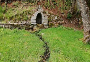
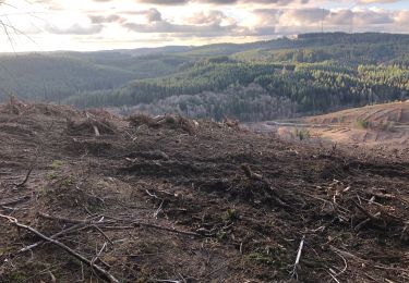
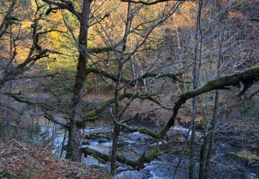
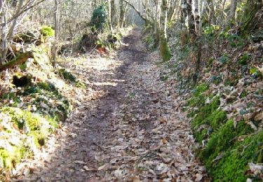
Mystérieuses Fontaines - Alleyrat 12 km - Pays de Haute Corrèze Quand votre oreille perçoit la douce mélodie de l’eau, approchez vous, écoutez-la vous conter ses secrets et laissez voguer votre imagination… Empruntez ce sentier à la découverte de ces mystérieuses sources et fontaines, des lavoirs, des puits et des moulins. Découvrez toutes ces architectures construites pour collecter et exploiter cet élément indispensable à la vie : l’eau ! Téléchargez la fiche du circuit sur le site du Conseil Général de la Corrèze. Renseignements : Office de Tourisme de Meymac ; 05.55.95.18.43

Hoogteprofiel

Foto's

Plaatsbepaling

Land:
France
Regio :
Nieuw-Aquitanië
Departement/Provincie :
Corrèze
Gemeente :
Alleyrat
Locatie:
Unknown
Vertrek:(Dec)
Vertrek:(UTM)
438812 ; 5047267 (31T) N.

Wandeltochten in de omgeving

Tocht Stappen Saint-Germain-Lavolps - Fred st Germain lavolps - Photo
Stappen
arnoultjf

Stappen

Moeilijk
Saint-Germain-Lavolps, Nieuw-Aquitanië, Corrèze, France
9,4 km | 12,7 km-effort
3h 35min
Ja
Tocht Stappen Meymac - Lestrade-La Vialle-Le Colomby - Photo
Stappen
viam19

Stappen

Gemakkelijk
Meymac, Nieuw-Aquitanië, Corrèze, France
13,2 km | 18,3 km-effort
5h 8min
Ja
Tocht sport Chaveroche - F 2024 Chaveroche - Photo
sport
hl44lv

sport

Heel gemakkelijk
Chaveroche, Nieuw-Aquitanië, Corrèze, France
11,4 km | 15,5 km-effort
Onbekend
Ja
Tocht Stappen Saint-Pardoux-le-Vieux - la gare de Saint-pardoux-le-vieux - Photo
Stappen
viam19

Stappen

Gemakkelijk
Saint-Pardoux-le-Vieux, Nieuw-Aquitanië, Corrèze, France
7,7 km | 9,6 km-effort
2h 45min
Ja
Tocht Stappen Meymac - Puy Baubière - Photo
Stappen
famille.scharf

Stappen

Medium
Meymac, Nieuw-Aquitanië, Corrèze, France
6,3 km | 9,2 km-effort
2h 15min
Ja
Tocht Stappen Chaveroche - Le Chassaing - Photo
Stappen
famille.scharf

Stappen

Chaveroche, Nieuw-Aquitanië, Corrèze, France
5,5 km | 7,1 km-effort
2h 1min
Ja
Tocht Stappen Alleyrat - Alleyrat Corrèze  - Photo
Stappen
zoe.vienne

Stappen

Medium
Alleyrat, Nieuw-Aquitanië, Corrèze, France
22 km | 29 km-effort
5h 0min
Ja
Tocht Stappen Saint-Pardoux-le-Vieux - Chemins de traverse 5km - Saint Pardoux le Vieux - Pays de Haute Corrèze  - Photo
Stappen
tracegps

Stappen

Gemakkelijk
Saint-Pardoux-le-Vieux, Nieuw-Aquitanië, Corrèze, France
7,2 km | 8,9 km-effort
1h 10min
Ja
Tocht Mountainbike Saint-Pardoux-le-Vieux - Chemins de traverse 10km - Saint Pardoux le Vieux - Pays de Haute Corrèze  - Photo
Mountainbike
tracegps

Mountainbike

Medium
Saint-Pardoux-le-Vieux, Nieuw-Aquitanië, Corrèze, France
10,2 km | 12,5 km-effort
45min
Ja


Sluiten
Mijn abonnementen