![](/images/other/stat-length.png)
![Tocht Stappen Bricqueville-sur-Mer - Le Havre de la Vanlée - Bricqueville sur Mer - Photo](https://media.geolcdn.com/t/1900/400/ext.pjpeg?maxdim=2&url=https%3A%2F%2Fservices.sitytrail.com%2FGeolivesWS%2FDownloadMedia.ashx%3FTrailID%3D111856%26Media%3D8632_1.jpg)
Le Havre de la Vanlée - Bricqueville sur Mer
tracegps
Gebruiker
![Lengte](/images/other/stat-length.png)
Lengte
10 km
![Max. hoogte](https://static1.geolcdn.com/siteimages/upload/files/1508320355ic_sort_altitude_max_24dp.png)
Max. hoogte
25 m
![Positief hoogteverschil](https://static1.geolcdn.com/siteimages/upload/files/1508320355ic_sort_den_pos_24dp.png)
Positief hoogteverschil
44 m
![Km-Effort](/images/other/stat-length.png)
Km-Effort
10,6 km
![Min. hoogte](https://static1.geolcdn.com/siteimages/upload/files/1508320355ic_sort_altitude_min_24dp.png)
Min. hoogte
3 m
![Negatief hoogteverschil](https://static1.geolcdn.com/siteimages/upload/files/1508320355ic_sort_den_neg_24dp.png)
Negatief hoogteverschil
45 m
![Boucle](https://static1.geolcdn.com/siteimages/upload/files/16400158638029165_repeat_loop_refresh_sync_direction_icon.png)
Boucle
Ja
Datum van aanmaak :
2014-12-10 00:00:00.0
Laatste wijziging :
2014-12-10 00:00:00.0
![Stappen](https://static1.geolcdn.com/sitytour/trail-icons/101.png)
2h00
Moeilijkheid : Medium
![Scan deze QR-code om de tocht te openen in de SityTrail-applicatie](https://capi.geolives.com/qq0zvz2zws4bq2lad0pu/sitytour/trails/111856/qr.png?size=200)
Gratisgps-wandelapplicatie
Over ons
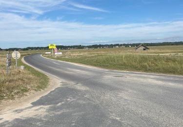
Tocht Stappen van 10 km beschikbaar op Normandië, Manche, Bricqueville-sur-Mer. Deze tocht wordt voorgesteld door tracegps.
Beschrijving
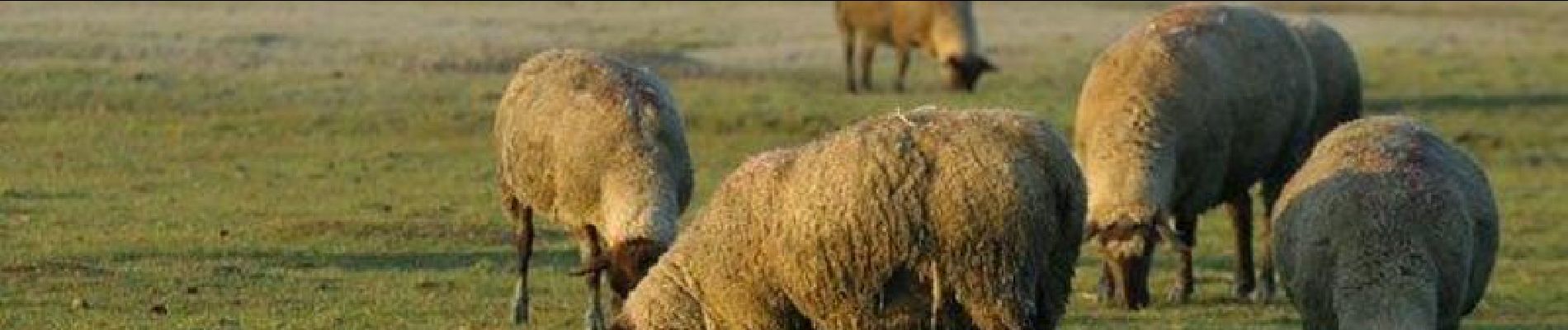
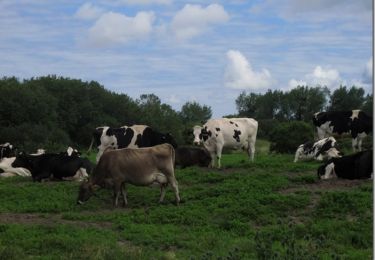
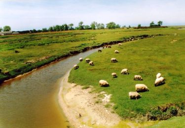
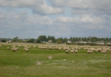
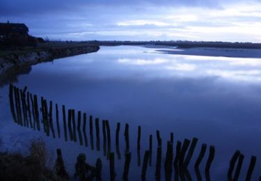
Balade de Bricqueville par la havre de la Vanlée, bras de mer dans lequel on trouve un paysage d’herbus et de moutons de prés salés. Ce site protégé est très fragile mais magnifique par tous les temps.
Plaatsbepaling
Land:
France
Regio :
Normandië
Departement/Provincie :
Manche
Gemeente :
Bricqueville-sur-Mer
Locatie:
Unknown
Vertrek:(Dec)
Vertrek:(UTM)
605209 ; 5418915 (30U) N.
Opmerkingen
Wandeltochten in de omgeving
![Tocht Stappen Bréville-sur-Mer - Balade à Breville sur Mer - Photo](https://media.geolcdn.com/t/375/260/ext.jpg?maxdim=2&url=https%3A%2F%2Fservices.sitytrail.com%2FGeolivesWS%2FDownloadMedia.ashx%3FTrailID%3D172624%26Media%3D13990_6.jpg)
![Stappen Stappen](https://static1.geolcdn.com/sitytour/trail-icons/101.png)
Balade à Breville sur Mer
Stappen
Medium
Bréville-sur-Mer,
Normandië,
Manche,
France
![](/images/other/stat-length.png)
14,2 km | 15,4 km-effort
3h 0min
![](https://static1.geolcdn.com/siteimages/upload/files/16400158638029165_repeat_loop_refresh_sync_direction_icon.png)
Ja
![Tocht Mountainbike Bréhal - brehal 1 - Photo](https://media.geolcdn.com/t/375/260/ext.jpg?maxdim=2&url=https%3A%2F%2Fservices.sitytrail.com%2FGeolivesWS%2FDownloadMedia.ashx%3FTrailID%3D141198%26Media%3D20120725112747.jpg)
![Mountainbike Mountainbike](https://static1.geolcdn.com/sitytour/trail-icons/202.png)
brehal 1
Mountainbike
Heel gemakkelijk
Bréhal,
Normandië,
Manche,
France
![](/images/other/stat-length.png)
30 km | 35 km-effort
2h 45min
![](https://static1.geolcdn.com/siteimages/upload/files/16400158638029165_repeat_loop_refresh_sync_direction_icon.png)
Ja
![Tocht Paardrijden Lingreville - Balade Sarah samedi - Photo](https://media.geolcdn.com/t/375/260/1ff22927-12ef-4acd-8c7d-2098b1cdad3c.jpg&format=jpg&maxdim=2)
![Paardrijden Paardrijden](https://static1.geolcdn.com/sitytour/trail-icons/301.png)
Balade Sarah samedi
Paardrijden
Medium
Lingreville,
Normandië,
Manche,
France
![](/images/other/stat-length.png)
19,7 km | 21 km-effort
45min
![](https://static1.geolcdn.com/siteimages/upload/files/16400158638029165_repeat_loop_refresh_sync_direction_icon.png)
Ja
![Tocht Stappen Bréhal - Les Villages - St Martin Le Vieux - Bréhal - Photo](https://media.geolcdn.com/t/375/260/ext.jpg?maxdim=2&url=https%3A%2F%2Fservices.sitytrail.com%2FGeolivesWS%2FDownloadMedia.ashx%3FTrailID%3D111765%26Media%3D8250_1.jpg)
![Stappen Stappen](https://static1.geolcdn.com/sitytour/trail-icons/101.png)
Les Villages - St Martin Le Vieux - Bréhal
Stappen
Medium
Bréhal,
Normandië,
Manche,
France
![](/images/other/stat-length.png)
6,7 km | 7,3 km-effort
1h 45min
![](https://static1.geolcdn.com/siteimages/upload/files/16400158638029165_repeat_loop_refresh_sync_direction_icon.png)
Ja
![Tocht Stappen Bréhal - Les Marais - Saint Martin de Bréhal - Photo](https://media.geolcdn.com/t/375/260/ext.jpg?maxdim=2&url=https%3A%2F%2Fservices.sitytrail.com%2FGeolivesWS%2FDownloadMedia.ashx%3FTrailID%3D111764%26Media%3D8248_1.jpg)
![Stappen Stappen](https://static1.geolcdn.com/sitytour/trail-icons/101.png)
Les Marais - Saint Martin de Bréhal
Stappen
Medium
(1)
Bréhal,
Normandië,
Manche,
France
![](/images/other/stat-length.png)
10 km | 10,5 km-effort
2h 30min
![](https://static1.geolcdn.com/siteimages/upload/files/16400158638029165_repeat_loop_refresh_sync_direction_icon.png)
Ja
![Tocht Stappen Bréhal - Le Chemin du Bois - Bréhal - Photo](https://media.geolcdn.com/t/375/260/ext.jpg?maxdim=2&url=https%3A%2F%2Fservices.sitytrail.com%2FGeolivesWS%2FDownloadMedia.ashx%3FTrailID%3D111762%26Media%3D8245_1.jpg)
![Stappen Stappen](https://static1.geolcdn.com/sitytour/trail-icons/101.png)
Le Chemin du Bois - Bréhal
Stappen
Medium
Bréhal,
Normandië,
Manche,
France
![](/images/other/stat-length.png)
5,8 km | 6,6 km-effort
1h 45min
![](https://static1.geolcdn.com/siteimages/upload/files/16400158638029165_repeat_loop_refresh_sync_direction_icon.png)
Ja
![Tocht Stappen Lingreville - pont l eveque - Photo](https://media.geolcdn.com/t/375/260/ext.jpg?maxdim=2&url=https%3A%2F%2Fstatic1.geolcdn.com%2Fsiteimages%2Fupload%2Ffiles%2F1553511878bg_sport_marche.png)
![Stappen Stappen](https://static1.geolcdn.com/sitytour/trail-icons/101.png)
pont l eveque
Stappen
Zeer moeilijk
Lingreville,
Normandië,
Manche,
France
![](/images/other/stat-length.png)
154 km | 183 km-effort
6h 2min
![](https://static1.geolcdn.com/siteimages/upload/files/16400158638029165_repeat_loop_refresh_sync_direction_icon.png)
Neen
![Tocht Paardrijden Lingreville - Balade Sarah 2 eme jour - Photo](https://media.geolcdn.com/t/375/260/ae4bd52d-1bc8-4773-bc0f-6bc00a6c954a.jpg&format=jpg&maxdim=2)
![Paardrijden Paardrijden](https://static1.geolcdn.com/sitytour/trail-icons/301.png)
Balade Sarah 2 eme jour
Paardrijden
Medium
Lingreville,
Normandië,
Manche,
France
![](/images/other/stat-length.png)
25 km | 27 km-effort
54min
![](https://static1.geolcdn.com/siteimages/upload/files/16400158638029165_repeat_loop_refresh_sync_direction_icon.png)
Ja
![Tocht Fiets Lingreville - 20070628Bernesq - Photo](https://media.geolcdn.com/t/375/260/ext.jpg?maxdim=2&url=https%3A%2F%2Fstatic1.geolcdn.com%2Fsiteimages%2Fupload%2Ffiles%2F1524743154velo.jpg)
![Fiets Fiets](https://static1.geolcdn.com/sitytour/trail-icons/200.png)
20070628Bernesq
Fiets
Heel gemakkelijk
Lingreville,
Normandië,
Manche,
France
![](/images/other/stat-length.png)
75 km | 85 km-effort
Onbekend
![](https://static1.geolcdn.com/siteimages/upload/files/16400158638029165_repeat_loop_refresh_sync_direction_icon.png)
Neen