


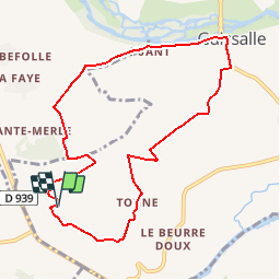

7,1 km | 8,9 km-effort


Gebruiker


Gratisgps-wandelapplicatie
 SityTrail
IGN / Geografische instituten
SityTrail World
De wereld gaat voor u open
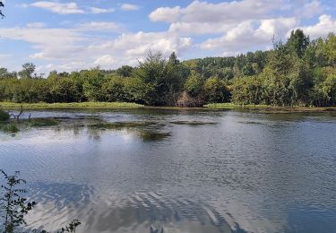
Tocht Stappen van 9,3 km beschikbaar op Nieuw-Aquitanië, Charente, Vindelle. Deze tocht wordt voorgesteld door tracegps.
Circuit proposé par la communauté de communes Braconne et Charente et le Pays d’Entre Touvre & Charente. Départ du hameau de Tonne à Vindelle. Retrouvez le circuit sur le site de la communauté de communes Braconne et Charente.
Stappen
Stappen
Stappen
Stappen

Noords wandelen
Noords wandelen

Stappen
Noords wandelen
Noords wandelen